

Measuring, monitoring and visualising from the skies, using cutting-edge drone technology. Training in partnership with @consortiq.
Cardiff, UK, sky, as required
Joined August 2015
- Tweets635
- Following149
- Followers117
- Likes35


A great company to work with....

Join Our Team! 👷♀️👷
We are currently recruiting for a Planner, initially based on-site in Port Talbot. If you are looking for your next career move and want to join a dynamic team, we want to hear from you! 👇
andrewscott.co.uk/planner-va…
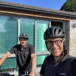
Standing, and cycling, in solidarity with our great friends at @AndrewScottLtd on #cycletoworkday !

Tomorrow is #cycletoworkday and we're encouraging our workforce to ditch the car and try cycling to work instead. Having sponsored & taken part in the Carten100 in May this year, Team Andrew Scott are now looking forward to their next challenge, the Jiffy Cancer 50 bike ride🚴
Leaping Wing celebrates an amazing ten years this month. To mark the occasion we surprised Michael with cake in the office.
Here's to many more years of happy flying!
Happy Birthday Leaping Wing 🎂 🎉
bit.ly/3NMM6QS


We’re harnessing the power of drones to revolutionise stockpile management.
By capturing aerial imagery, we can create accurate 3D models that provide precise measurements for stockpile calculations.
📞 +44 (29) 21690344
💻 bit.ly/3NMM6QS
📩 [email protected]
‘And then they were - GONE’. As we say in Wales...
Using drone-based LiDAR we are able to penetrate crops, vegetation and sparse trees to produce accurate topographical surveys of large land areas.
📞 +44 (29) 21690344
💻 bit.ly/3NMM6QS
📩 [email protected]
Today's trivia question - for which movie did we survey this site two years ago?
🚂🚂🚂 We frequently work in the TV & film sectors helping to gather survey data for visual effects and set construction.

Whether it's monitoring construction, inspecting installations, or ensuring site safety, we're here to support your project's success from start to finish.
Contact us.
📞 +44 (29) 21690344
💻 bit.ly/3VYZLXx
📩 [email protected]

Conventional drone survey is notoriously bad at capturing fine details such as powerlines. Our LiDAR setup, however, is proving itself more than capable of extracting measurable data.
Contact us 📞
📞 +44 (29) 21690344
💻 bit.ly/4fjTMF6
📩 [email protected]
We’re working with @ProjectSeagrass to certify team members to fly the Wingtra VTOL drone for their fantastic conservation work.
We provide #dronetraining. Get in touch for a quote.
📞 +44 (29) 21690344
💻 bit.ly/3IvD9Zy
📩 [email protected]
We hope to never see what’s in the yellow box...
But, if we do, that means that our heavy-lift drone has failed in mid-air and the ballistic parachute system is about to protect the safety of anyone below.
📞 +44 (29) 21690344
💻bit.ly/4fjTMF6
📩 [email protected]

Early morning site visit capturing stunning aerial stills for our client 🛩️✨
There’s something magical about the early morning light that brings landscapes to life.
Need some imagery for your project?
📞 +44 (29) 21690344
💻 bit.ly/3xC1eb1
📩 [email protected]

Ever wondered what LiDAR is all about?
Check out our latest blog post where we dive deeper into LiDAR technology and its amazing applications.
👉 bit.ly/3Ajpcg6
Share your thoughts 👇
📞 +44 (29) 21690344
💻 leapingwing.co.uk/lidar-surv…
📩 [email protected]

Whether it's monitoring construction, inspecting installations, or ensuring site safety, we're here to support your project's success from start to finish.
Contact us for a drone survey today.
📞 +44 (29) 21690344
💻 bit.ly/3KL9Sdj
📩 [email protected]

On site for a topographical survey.
Our team is hard at work capturing the intricate details of the landscape.
Ever wondered how we map out the land?
Drop your questions in the comments below 👇
📞 +44 (29) 21690344
💻 bit.ly/3YYljUm
📩 [email protected]

We love hearing from our amazing clients. Here's some feedback from a recent drone trainee.
More about out #dronetraining courses here bit.ly/3IvD9Zy

Surveyor Apurva has been busy fitting our new parachute recovery system to the DJI M300 airframe. This system will deploy a parachute and also cut the motors in the event of failure.
📞 +44 (29) 21690344
💻 bit.ly/3YYljUm
📩 [email protected]

Join industry leaders like the BBC Natural History Unit in mastering 3D landscape modelling with drone technology, schedule your #dronetraining with us today.
📞 +44 (29) 21690344
💻 bit.ly/3IvD9Zy
📩 [email protected]

Another day, another quarry.
We use these models to help our clients visualise their projects, and also to extract measurable data for engineering works.
We can help with your project! Call us today.
📞 +44 (29) 21690344
💻 bit.ly/3S85qc8
📩 [email protected]
Are you looking to enhance your project accuracy and efficiency? At Leaping Wing, our expertise in #LiDAR technology is a game-changer for the construction industry.
Contact us today:
📞 +44 (29) 21690344
💻 bit.ly/3YYljUm
📩 [email protected]

Trees - GONE!
#LiDAR enables us to strip the survey area quickly & accurately to produce accurate elevation models for onward processing in our topographical survey workflow.
Book your #topographicsurvey
💻 bit.ly/3YYljUm
📩 [email protected]