

Weather, environment and critter reporter for USA Today Florida. Certificate in Weather Forecasting, Penn State. Surfer, dog walker. University of Arizona.
- Tweets11.9K
- Following1.2K
- Followers4.1K
- Likes4.3K









ALT Key Messages: 1. Isaias is expected to strengthen and be a strong hurricane when it approaches the northern Gulf Coast on Friday. There is an increasing risk of life-threatening storm surge along portions of the northern Gulf Coast, and a Storm Surge Watch is in effect from The Mouth of the Mississippi River to Yankeetown, Florida. Residents in the watch area should follow advice given by local officials and evacuate if told to do so. 2. The risk of damaging hurricane-force winds is increasing over portions of the Florida Panhandle, southern Alabama, and southern Mississippi. A Hurricane Watch has been issued from Bay St. Louis, Mississippi, to Indian Pass, Florida. Residents in these areas should prepare for the possibility of long-duration power outages. 3. Isaias will bring areas of heavy rainfall to the central U. S. Gulf Coast and much of the Southeast Friday into the weekend. Flash and urban flooding, along with isolated river flooding, will be possible.
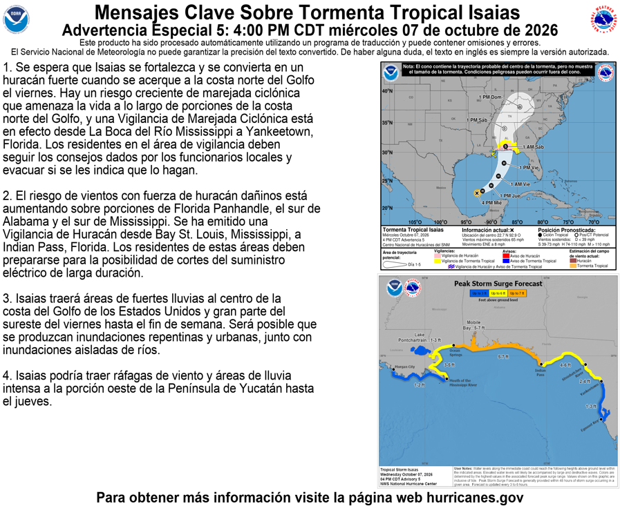
ALT Mensajes clave: 1. Se espera que Isaias se fortalezca y se convierta en un huracán fuerte cuando se acerque a la costa norte del Golfo el viernes. Hay un riesgo creciente de marejada ciclónica que amenaza la vida a lo largo de porciones de la costa norte del Golfo, y una Vigilancia de Marejada Ciclónica está en efecto desde La Boca del Río Mississippi a Yankeetown, Florida. Los residentes en el área de vigilancia deben seguir los consejos dados por los funcionarios locales y evacuar si se les indica que lo hagan. 2. El riesgo de vientos con fuerza de huracán dañinos está aumentando sobre porciones de Florida Panhandle, el sur de Alabama y el sur de Mississippi. Se ha emitido una Vigilancia de Huracán desde Bay St. Louis, Mississippi, a Indian Pass, Florida. Los residentes de estas áreas deben prepararse para la posibilidad de cortes del suministro eléctrico de larga duración.





