

KATV Chief Meteorologist
Little Rock, AR
Joined June 2009
- Tweets31.5K
- Following682
- Followers27.9K
- Likes16.2K


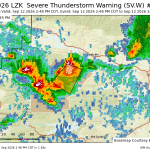
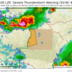
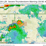


Mid afternoon radar showing more showers developing around AR. Not everywhere, but at least it’s something. #arwx
Crazy

At 11:30 pm on October 7th, Isaias was upgraded to a hurricane, becoming the first of the 2026 Atlantic hurricane season. This is the latest date the Atlantic has seen its first hurricane since the satellite era began in 1966, shattering the previous record by nearly a month! The upgrade also ends a hurricane-free streak of nearly 242 days, falling just three weeks short of the longest on record.


A quick passing shower with wind gusting to about 25 mph at our tailgate at Sylvan Hills high school. Shouldn’t last very long. Might want to consider a light jacket if you’re going to high school football early this evening. #arwx
Sometimes it feels BETTER than the actual temperature. In Arkansas, we get used to a Heat Index that's higher than the actual temperature, but today, the heat index is MUCH LOWER than the temperature. In LR, it's 89 at 1PM with a "feels like" of 86! Love it. Humidity and rain chances return later this week. #ARWX


LZK issues Severe Thunderstorm Warning [wind: 60 MPH (RADAR INDICATED), hail: 1.00 IN (RADAR INDICATED)] for Garland, Perry, Saline [AR] till 4:30 PM CDT mesonet.agron.iastate.edu/vt…

LZK issues Severe Thunderstorm Warning [wind: 60 MPH (RADAR INDICATED), hail: 1.00 IN (RADAR INDICATED)] for Lawrence [AR] till 11:00 PM CDT mesonet.agron.iastate.edu/vt…

LZK issues Severe Thunderstorm Warning [wind: 60 MPH (RADAR INDICATED), hail: 0.88 IN (RADAR INDICATED)] for Lawrence [AR] till 10:30 PM CDT mesonet.agron.iastate.edu/vt…

LZK issues Severe Thunderstorm Warning [wind: 60 MPH (RADAR INDICATED), hail: 0.75 IN (RADAR INDICATED)] for Boone, Johnson, Newton, Pope, Searcy [AR] till 3:30 PM CDT mesonet.agron.iastate.edu/vt…

LZK issues Severe Thunderstorm Warning [wind: 60 MPH (RADAR INDICATED), hail: 1.00 IN (RADAR INDICATED)] for Yell [AR] till 3:15 PM CDT mesonet.agron.iastate.edu/vt…

LZK issues Severe Thunderstorm Warning [wind: 60 MPH (RADAR INDICATED), hail: 0.75 IN (RADAR INDICATED)] for Newton [AR] till 2:45 PM CDT mesonet.agron.iastate.edu/vt…

LZK issues Severe Thunderstorm Warning [wind: 60 MPH (RADAR INDICATED), hail: 1.00 IN (RADAR INDICATED)] for Newton, Pope, Searcy [AR] till 1:15 PM CDT mesonet.agron.iastate.edu/vt…

Scattered showers and storms, like this one near Pinnacle Mountain, are occurring now in Arkansas. Hopefully you get a cooling shower this evening or tomorrow! #arwx

At 10 AM, it is 3° hotter (87°) in Little Rock than this time yesterday… and more humid. And we got to 100° yesterday. Ugh!


LZK issues Severe Thunderstorm Warning [wind: 60 MPH (RADAR INDICATED), hail: 1.00 IN (RADAR INDICATED)] for Cleburne, Independence, Stone [AR] till 3:30 PM CDT mesonet.agron.iastate.edu/vt…

Merciful storms with heat relief from Central into Northern Arkansas! Let’s see some pictures of rain. It will help us who don’t have rain to feel a little better 😆 #ARWX
Barry Brandt retweeted

Drought impacts are starting to show and unfortunately, are expected to worsen with time as very little rain is expected over the next week or so. #arwx

ALT Drought impacts are starting to show and unfortunately, are expected to worsen with time as very little rain is expected over the next week or so.
*LABOR DAY WEEKEND OUTLOOK*
No big changes ahead in our forecast, but I have increased daily high temperatures a little, back to the triple digits. Our rain chances will continue to be poor with only isolated afternoon showers possible. Sunday afternoon showers could be a little more numerous, but you would still have to be lucky to get rain relief. Hang on folks, we'll get through this.
#arwx

