
Keenan retweeted

📸COMING SOON: Recon Studio.
We're pleased to announce our new IRL streaming service- Cloud Streaming for Storm Chasers. This powerful cloud engine accepts your in-car or on-person live stream and keeps you live on your favorite platforms even when you have no signal.
Dropping signal and losing your stream and viewers in the middle of a storm is frustrating. The ways around it typically involved expensive OBS cloud services or having a stable internet and computer at home with static IP. Now, you can get that protection for $35 per month, with re-streaming included, so you can DROP your ReStream or similar monthly charges.
Send your stream to the studio in any way you can imagine. Whether it's via OBS, LiveU, RTMP, SRT, HLS, WHIP, SRTLA, or using our streaming companion app for iOS and Android to bond cellular and wifi together for a stronger connection.
Our service also provides you with ready-made stream widgets, such as radar that follows your position, nearby weather data, warnings and alerts, as well as customizable text and tickers at no extra cost and no extra set-up.
Be sure to follow @reconwx for updates on the release data and tours of all features.

Keenan retweeted

Isaias is now expected to become a major hurricane tomorrow, with peak sustained winds of 115 mph. It is still forecast to weaken to a Category 2 on landfall.

sonde.projectweathereye.org/…
About to do a radiosonde launch from Oxford, MS! youtube.com/watch?v=RvqF0qw3… Follow along wxeye.org #MSWX #WinterStormFern @VinceWaelti @stsweathereye


@VinceWaelti @stsweathereye about to do a Launch from Oxford, MS! youtube.com/watch?v=RvqF0qw3… Follow along wxeye.org #MSWX #WinterStormFern

1
2
506
Keenan retweeted
Just hit about 20,000 feet on our sounding. Data still streaming in. WxEye.org @stsweathereye

Another successful launch for @stsweathereye Follow the data live!! sonde.projectweathereye.org/… #wiwx @NWSMilwaukee @VinceWaelti
wxeye.org

1
5
68



Keenan retweeted

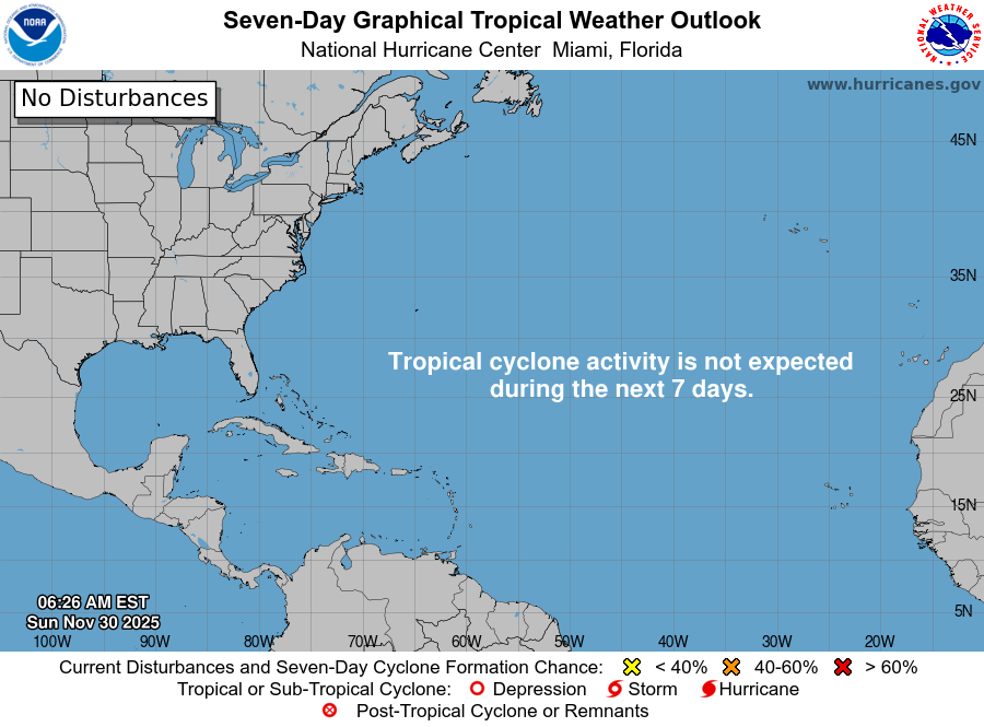
11/30: Today is the last day of the 2025 hurricane season. The month of November has proven to be very quiet this year, with no named storms during the month. There weren't even any disturbances mentioned in the Tropical Weather Outlook the entire month.
See hurricanes.gov
Keenan retweeted

Sacramento, California hasn't been above 47°F in over 110 hours.
Brutal stretch of Tule Fog continues.


Keenan retweeted
BREAKING: A significant Eruption has occured in Ethiopia, either at Ali Bagu (Amaytole) or possibly Erta Ale itself. Early information suggests the eruption may be located between Amaytole and Hayli Gubi.


Keenan retweeted
CRUDE sounding near Sikeston, Missouri from the launch hours earlier. I can't access our custom sounding viewer/plotter from the field due to it being in beta, so this is a very simple HTML plot just to mark our first in-field sounding. This is the data set we need to calibrate the algorithms and will be used to tune the viewer. You can still see the 'easy mode' data:
sonde.projectweathereye.org/…
@RadarOmega

Keenan retweeted

Another dropsonde in the eye of the storm shows that subsidence in the center has become extreme, with substantial drying and warming penetrating closer and closer to the surface. No surprise that water vapor temperatures are as dry as they've ever been in a TC.


A new dropsonde in #Melissa reveals that winds in the lowest 150 meters of the column have increased even further, to a ridiculous 185 kt. Per the standard reduction ratio to convert this to a surface wind, this is supportive of an intensity of 150-155kt. Incredible storm.
