

We’ve moved! Follow @NOAASatellites and visit https://xitter.cf/t.co/51mGteiRU9 for future JPSS updates.
- Tweets5.4K
- Following91
- Followers21.6K
- Likes2.5K




ALT A view of a section of the JPSS-4 satellite, featuring the integrated Libera instrument. The spacecraft and its components are heavily covered in bright golden-orange thermal insulation. Several protruding parts are wrapped in white protective covers, one of which features bold red text reading \"Remove before flight.\" Bundles of blue and white cables hang loosely beneath the satellite body. The background shows a softly blurred cleanroom setting with work chairs, tables, and a black-and-yellow caution tape.

ALT Satellite image of a lake (within a red circle) in a desert with the NOAA logo in the bottom left-hand corner.

ALT Global satellite view of Earth from April 21, 2026, centered on North and South America, with swirling white clouds against a dark background. A NOAA logo can be seen in the bottom right corner.

ALT Satellite image of a lake (within a red circle) amid snow-covered mountains with the NOAA logo in the bottom left-hand corner.


ALT Map showing how nighttime light on Earth changed from 2014 to 2022. Gold areas indicate brighter nighttime lights. Purple areas indicate dimmer nighttime lights. White areas indicate a mix of brightening and dimming. The United States has gold areas on the west and more purple and white on the east. Europe is mostly purple. China, India, the Middle East, and Central America are mostly gold. There is a bright gold chain of lights stretching across the South Pacific toward Australia.

ALT A satellite image of an island with a red circle around it in the middle of a lake with the NOAA logo in the bottom left hand corner.

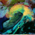
ALT Satellite image of a large storm system stretching across central North America observed on April 8, 2026, with a swirl centered over the western United States and broad cloud bands extending into the Plains, Great Lakes, and southern Canada. The enhanced-color day cloud phase view shows cloud patterns in shades of blue, yellow, orange, and red. NOAA and CIRA logos appear in the lower-right corner.

ALT A satellite image shows a blue lake (within a red circle) next to snow-covered mountains.


ALT Weekly recap graphic for #NOAASatelliteShowdown on a dark blue gradient background. Text reads “16 of 16 posted” above sixteen orange progress dots. Four rectangular image strips, labeled Thunderstorm, Smoke Plume, Lake-Effect, and Nor’easter, show preview slices of the four satellite images shared this past week. A NOAA logo is featured in the bottom right corner.

ALT Aerial view of a frozen river choked with ice floes, passing under a bridge near a small town and forested hills. NOAA and NWS logos in corners.