

The largest online Iowa weather network. Bringing you the best weather coverage devoted only to online viewers. #iawx
Iowa
Joined April 2010
- Tweets11.5K
- Following2.7K
- Followers24.9K
- Likes5.9K





Temperatures will climb well into the 70s through Friday, with a few spots potentially reaching 80°! However, changes are on the way as gusty winds develop Friday, followed by increasing rain chances this weekend. 🌧️ A cold front will bring cooler, more seasonable temperatures by Sunday and Monday.
We've broken down what to expect, including when rain could arrive in your area! #iawx #iowa #weather
iowaweather.com/iowa-weather…

Winds have started out on the gusty side for some this morning. We will likely see additional wind gusts throughout the day today. Wind gusts out of the south around 20 to 30 mph will be possible through early evening.

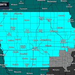
A cold start to the weekend is on the way! The National Weather Service has issued Freeze Warnings, Freeze Watches, and Frost Advisories for every county in Iowa as temperatures are expected to drop into the upper 20s and lower 30s late tonight into Saturday morning.
Freeze Warnings: Much of central, northern, and eastern Iowa will see temperatures fall below freezing, with lows ranging from 26° to 31°. These conditions could bring a killing freeze to sensitive vegetation.
Freeze Watches: Portions of western Iowa, including Sioux City, Council Bluffs, and surrounding communities, could see temperatures fall as low as 29° to 32°.
Frost Advisories: Portions of far southeastern Iowa, including Burlington, Mount Pleasant, Fort Madison, and Bloomfield, could see widespread frost as temperatures fall into the lower 30s.
Bring sensitive potted plants indoors, cover vulnerable outdoor vegetation, and protect any exposed plumbing from freezing temperatures. Frost and freezing conditions could damage or kill plants left unprotected.
For many communities, this could be one of the coldest mornings of the fall season so far. Be sure to prepare before heading to bed tonight!
#iawx #iowa #frost #freeze #weather

Hold onto your hats! A strong fall weather system will bring gusty northwest winds and much cooler temperatures to Iowa overnight tonight and through Friday.
Widespread wind gusts of 35-45 MPH are expected across much of the state, with the potential for gusts of 45-55 MPH, especially across northern and northwestern Iowa. The strongest winds are expected during the overnight hours into Friday morning before gradually decreasing through the afternoon.
In addition to the strong winds, Friday will feel more like late fall, with afternoon highs only reaching the upper 40s to mid-50s. Wind chills Friday morning will make it feel like temperatures are in the 30s!
Be sure to secure any loose outdoor objects before the winds increase tonight!
#iawx #iowa #weather #wind
The National Weather Service has issued a Freeze Watch for a large portion of Iowa from late Friday night through Saturday morning as some of the coldest temperatures of the season are expected to move into the region.
Temperatures could fall into the upper 20s to around 30 degrees across much of the state, with some locations in northeast Iowa potentially dropping as low as 27 degrees.
These temperatures could bring a widespread freeze, potentially damaging or killing sensitive vegetation and any remaining crops that have not been harvested. If you still have outdoor plants or flowers you want to keep around, now is the time to make plans to bring them indoors or provide protection. Unprotected outdoor plumbing could also be at risk.
A Freeze Watch means conditions are favorable for temperatures to fall below freezing, but the exact extent and severity of the freeze are still uncertain. The watch may be upgraded to a Freeze Warning as confidence increases.
We'll continue to monitor the forecast and provide updates as we get closer to Friday night!

Another round of thunderstorms is expected to develop across portions of Iowa tonight, with a few storms potentially becoming strong to severe. The greatest concern will be across southern Iowa, particularly along and south of Interstate 80, where conditions will be more favorable for stronger thunderstorms.
The primary threat with any stronger storms will be large hail, although isolated damaging wind gusts, frequent lightning, and pockets of heavy rainfall will also be possible.
The greatest potential for strong to severe storms will be between approximately 9 PM tonight and 4 AM Wednesday. Some thunderstorms could develop earlier in the evening, with additional showers and storms lingering into Wednesday morning.
The Storm Prediction Center has placed portions of Iowa under a Level 1 out of 5 (Marginal Risk) for severe weather. While widespread severe weather is not expected, a few storms could become intense enough to produce severe hail or strong wind gusts.
There remains some uncertainty regarding how widespread thunderstorms will become, as the greatest instability and overall severe weather potential are expected to remain south of Iowa. Recent forecast trends have also shifted the higher storm chances farther south.

Saturday looks to be one of the warmest days of the week. We're talking widespread highs in the 80s across Iowa, which is roughly 15 to 20 degrees warmer than what we'd typically expect for this time of year in some locations.
But Saturday's bigger weather story may actually be the wind.
Southerly winds will increase considerably, with gusts of 30 to 40 miles per hour possible across portions of the state. Some areas of northwestern Iowa could experience even stronger gusts.
#iawx #iowa #weather

🚨 FLOOD GATES CLOSED AT DES MOINES WATER WORKS FOR FIRST TIME SINCE 2019
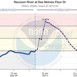
Des Moines Water Works has closed the flood gates at its Fleur Drive Treatment Plant as a precaution ahead of rising water levels on the Raccoon River. This marks the first time the gates have been closed due to flooding since 2019.
The National Weather Service is currently forecasting the Raccoon River to crest at 17.4 feet. Once the river approaches 17 feet, floodwaters can begin reaching the treatment plant's flood gates. Crews closed the gates Wednesday afternoon while conditions still allowed them to do so safely.
The flood gates are part of a larger flood protection system installed following the historic 1993 flood. Additional safeguards include a higher, reinforced levee and stormwater pumping capabilities designed to protect the treatment plant.


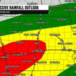
The Weather Prediction Center has upgraded portions of central, west-central and southwest Iowa to a Moderate Risk (Level 3 of 4) for excessive rainfall Wednesday into Wednesday night.
A strengthening storm system will pull unusually rich moisture northward into the region, helping produce rounds of showers and thunderstorms. The greatest rainfall totals are expected along and north of a frontal boundary, which could place portions of Iowa in a corridor of repeated heavy rainfall.
The WPC notes that rainfall amounts across this corridor are high enough that additional portions of the region may eventually need to be upgraded to a Moderate Risk, although questions remain about whether rainfall rates will be high enough for more widespread flash flooding.
The main concern will be multiple rounds of heavy rain falling over the same areas Wednesday into Wednesday night, potentially resulting in localized flash flooding and areas of standing water.
We'll continue to monitor exactly where this corridor sets up as newer data comes in.
#iawx #iowa #flood

Some additional counties have been added to the flood watch that is in effect from tonight through Thursday evening. A widespread 2" to 4" of rainfall with localized higher amounts will be possible within this watch area.

Rain will continue to increase throughout the day today, and will continue through Thursday. By all said and done, still looking at a widespread 2" to 4" of rainfall with some localized higher amounts certainly possible. #iawx #iowa #flood #weatherforecast

A large portion of Iowa is now under a Flood Watch as another prolonged period of heavy rain takes aim at the state.
Flood Watches have been issued beginning Tuesday evening and continuing through Thursday evening or late Thursday night.
Widespread rainfall totals of 2–4 inches are expected, with locally higher amounts possible. Some locations in western Iowa could see totals exceeding 5 inches.
The biggest concern is that this rain will fall on already saturated ground. Additional heavy rainfall could quickly lead to excessive runoff, flash flooding, rising rivers and streams, and flooding of low-lying, poor-drainage and urban areas.
We’ll continue tracking the rainfall and flooding threat closely over the next several days. Stay with the Iowa Storm Chasing Network for updates.
#iawx #iowa #flood

A multi-day rainfall event is expected to impact Iowa beginning Tuesday and continuing through Wednesday and Thursday.
Widespread rainfall totals of 1–2 inches are looking increasingly likely, with portions of Iowa potentially receiving 2–4 inches or more. Western and central Iowa currently have some of the strongest signals for the heaviest rainfall, but significant rain is possible across much of the state.
The biggest concern with this system is not severe weather — it’s flooding. Multiple rounds of showers and embedded thunderstorms could move across the same areas, producing locally heavy rainfall. Flash flooding, urban flooding and additional rises on rivers and streams will all need to be monitored, especially where the heaviest bands repeatedly develop.
Rain should begin spreading into western Iowa Tuesday before becoming more widespread Tuesday night and Wednesday. Wednesday currently looks like one of the wettest periods of the week for much of Iowa, with additional rainfall potentially continuing into Thursday.
There is still uncertainty regarding exactly where the corridor of heaviest rain will set up, and that could shift as we get closer. This is a forecast we’ll be watching closely over the next couple of days.
#iawx #iowa #flooding #rainfall

Rain chances will continue across Iowa today through Saturday, with another round of rain expected to move into the state Tuesday into Wednesday of next week.
The National Blend of Models (NBM), which combines data from multiple weather models, is currently showing widespread rainfall totals of 2 to 4 inches across Iowa through next Thursday. The highest amounts are currently projected across southwest Iowa, where some areas could see more than 4 inches of rain.
Keep in mind that these are forecast rainfall totals, and the exact amounts and locations of the heaviest rainfall will likely change as we get closer to each round of precipitation.
We'll continue monitoring the latest forecast guidance and provide updates as the next several rounds of rain approach Iowa!
#iawx #iowa #rain

After several days of cloudy, dreary, and wet weather, Wednesday will finally bring a much-needed break across Iowa! Expect dry conditions with increasing sunshine as clouds gradually clear from east to west. Temperatures will remain on the cool side, with afternoon highs generally in the 60s.
Unfortunately, the break won't last long! Showers and a few thunderstorms will begin moving into western Iowa early Thursday morning, with rain chances gradually spreading eastward Thursday into Friday. Periods of rain will continue into Saturday before drier conditions return Sunday.
The graphic below shows the Weather Prediction Center's forecast rainfall totals from today (Tuesday) through 7 PM Sunday. While severe weather is not expected, some of the showers and thunderstorms could produce locally heavy rainfall. With soils already saturated from recent rainfall, additional precipitation could lead to localized flooding and ponding of water in low-lying areas.
The good news? Sunday is looking much drier, with the potential for some sunshine and warmer temperatures as we wrap up the weekend!
#iawx #iowa #rain #weather

Another round of rain will spread across Iowa this evening and continue through Monday as a slow-moving weather system moves across the state. Rain will become more widespread across northern and central Iowa tonight, with periods of steady rainfall and a few thunderstorms possible. Scattered showers will continue across much of the state on Monday before gradually diminishing from west to east Monday night into Tuesday morning.
The highest rainfall amounts are expected across northwest Iowa, where an additional 0.50” to 1.50” is possible. Central and northern Iowa can generally expect 0.20” to 0.50”, while eastern and southern Iowa should see lighter amounts. Although widespread heavy rainfall is no longer expected, some creeks and streams in eastern Iowa are still experiencing flooding from previous rainfall.

Another round of heavy thunderstorms is expected to impact portions of southern Iowa tonight, bringing the potential for significant rainfall and flash flooding. Multiple rounds of thunderstorms are expected to develop and move across the region through the early overnight hours, with rainfall rates potentially exceeding 2 inches per hour in the heaviest storms.
Widespread rainfall totals of 2 to 4 inches are possible across the region, with locally higher amounts where thunderstorms repeatedly move over the same areas. With portions of Iowa already experiencing heavy rainfall over the past several days, additional rainfall could quickly overwhelm drainage systems and lead to flash flooding, particularly in low-lying and flood-prone areas.
Flash flooding is likely in areas that experience the most persistent thunderstorms through approximately 2 AM. If you encounter a flooded roadway, turn around and find an alternate route. Never attempt to drive through floodwaters, especially at night when water depth can be difficult to determine.
Stay weather aware tonight, especially across southern Iowa, and make sure you have a reliable way to receive weather alerts while you sleep.
#iawx #iowa #flooding

Portions of eastern Iowa are under a moderate risk (Level 3 of 4) for excessive rainfall Saturday. Multiple rounds of heavy rain and thunderstorms are expected, first late tonight into Saturday morning and again Saturday evening into Saturday night.
Rainfall totals of 1–3 inches are likely, with localized amounts of 3–4 inches possible where storms repeatedly track over the same areas. With parts of eastern Iowa already receiving heavy rain over the past several days, flash flooding, rapid rises on small creeks and streams, and flooding of low-lying areas will be possible.
#iawx #iowa #flood

A Flood Watch is in effect for a large portion of north-central and northeast Iowa as rounds of heavy rain and thunderstorms move through the region tonight into Saturday.
The main concern will be repeated rounds of storms moving over the same areas, which could produce rainfall faster than it can drain and lead to flash flooding. Many areas could receive 1 to 3 inches of rain, with locally higher amounts possible. Some thunderstorms may produce rainfall rates of 1 to 2 inches per hour.
For much of north-central and northeast Iowa, the watch begins this evening and continues through Saturday afternoon, while portions of eastern Iowa remain under the watch through Saturday evening.
We’ll continue to monitor the heavy rain and flooding potential throughout tonight and Saturday. Stay weather aware!
