
We turn geo-spatial data into decision making info. 1st project - Foresight Crops, provides arable farmers with advanced info on the risk of insect infestation.
Joined December 2016
- Tweets248
- Following124
- Followers40
- Likes295






GGIS retweeted

#Copernicus for #wildfires monitoring
#Chile🇨🇱 continues to be affected by some of the worst #fires in recent history, and evacuations are underway
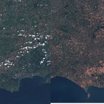
Multiple plumes of smoke continue to be visible in this #Sentinel3🇪🇺🛰 image acquired on 7 February
#EMSR647 @CopernicusEMS

GGIS retweeted

Heard the phrase "Polar Vortex" thrown about lately and wanted to know more about what it actually is (and isn't)? This is the article for you!
climate.gov/news-features/un…
@NOAAClimate @NOAA

ALT infographic of understanding the polar vortex. Image shows two globes. A light blue band indicates the jet stream. Left globe has a straight jet stream. The other is wavy. Above the Arctic is a 3-d vortex of blue indicating the polar vortex. On the left globe, the vortex is stable and strong. On the right globe, the vortex is weaker and split showing a disrupted vortex.
GGIS retweeted

—Job Alert—
Map Cataloguer
British Library, London
Deadline: 20 November 2022
The British Library is looking to recruit a full-time Map Cataloguer with specialist interest in antiquarian and modern cartographic materials.
bit.ly/3E0p1FJ

GGIS retweeted

Drone technology can be applied in different fields during planning & problem solving, #drones are used in emergency response in case of disasters, surveillance and security in infrastructure. #tech #DataScience #opensource #innovation #OpenStreetMap #Digital #dronephotography

GGIS retweeted

WA recently became the 1st state in the country to mandate that newly constructed buildings be outfitted with all-electric space heating and hot water systems. About 10% of U.S. carbon emissions now come from burning fossil fuels for heating and cooking.
bit.ly/3smoPdu
GGIS retweeted

🇿🇦South Africa – Tender
@DMRE_ZA postpones commercial close timelines for large-scale renewable energy projects selected in the 5th round of the REIPPPP.
➡️pv-magazine.com/2022/05/05/s…
#africasolar #solarenergy #solar #solarpower #SDG7

GGIS retweeted
@osmuganda is planning to get over 10,000 teachers equipped with #openmapping skills as they begin their digital journey through the OSM in Schools initiative. #schools #Training #OpenStreetMap #Opensource #community #EducationForAll #DataScience #GoogleEDU #hplaptops


GGIS retweeted

Listen to a quick preview of our conversation with Adina Gillespie from GHGsat, the first company in the world to monitor greenhouse gases from space.
Get the full podcast episode on our website: ow.ly/jzVx50Gnh1Y
GGIS retweeted

Latest processed image of #LaSoufriere volcano done by Dr Adam Stinton of the @mvoms taken from the Sentinel-1 satellite. Data credit: @esa #svg #volcano #redalert #stilldangerous #uwi @NEMOSVG @mvoms

GGIS retweeted
As the PM of St. Vincent and the Grenadines has ordered an evacuation for the communities in the Red Zone, we share these maps produced under the Volcano Ready Communities Project for reference. Follow @nemosvg20 for more info. #svg #lasoufrière #volcano #uwi

GGIS retweeted

We've got a thing that's called #InSAR love, a technique that can be used in a plethora of applications, including solutions to the #food, #energy & #environment industries. Check out our perspective on this👇
parsec-accelerator.eu/insigh…
#tech #deformation #rawmaterials #water
GGIS retweeted

The Indian Ocean island of Mauritius has declared an environmental emergency after a Japanese-owned ship that ran aground offshore days ago began spilling tons of fuel. apne.ws/PURZFKb
GGIS retweeted

The Department for International Trade (DIT) has launched a COVID-19 webinar series to help UK SMEs - starting this week. These webinars will feature info on; how to manage distrupted supply chains, risk management, and routes to market. Find out more: ow.ly/jbLY30qEYRX


GGIS retweeted
Hurricane #Dorian is producing hurricane force winds in eastern North Carolina. Here are the 5 am EDT Key Messages.

GGIS retweeted

Growers beware: the first UK reports of a major tomato virus have been reported. @FarmingUK provide a rundown of the symptoms to watch out for. farminguk.com/news/major-tom…
GGIS retweeted

🚫No bees 🐝🐝🐝
⬇️
🚫No pollination 🌻
⬇️
🚫No plants 🌱
⬇️
🚫No food 🍎
⬇️
🚫No life 🌍
#FutureofFood #Savethebees #ZeroHunger
GGIS retweeted

Digital agriculture: #Innovation and inclusion of #technology is helping #smallholders’ access to farm inputs and increase yields. Read more via @SciDevNet bit.ly/2Giu1HI #MUIIS #D4Ag @mhailu @tordeben @WorldBankKenya @PressACP @FAOeagriculture @farmingfirst @europeaid
GGIS retweeted
#Indonesia's latest tsunami raises global questions over disaster preparedness reut.rs/2Tk50Qi xitter.cf/Reuters/status/1079337…

GGIS retweeted

Climate change may increase the emergence of vector borne diseases so we should prepare adequately to prevent epidemics.
#ClimateChangeResilient
#FightClimateChange
#PPCRJamaica
#ClimateChangeJamaica
#SmartandSteady
#GetClimateReady
#PPCRClimateDataProject
