齋藤 仁/Saito Hitoshi retweeted
A sharper view of our changing planet is coming. 🛰️🌎
Meet LandIS, the Landsat Instrument Suite that will fly aboard Landsat 10, the next satellite in the Landsat series.
With 26 spectral bands spanning visible light to thermal infrared, LandIS will collect more than twice as many bands as Landsat 8 and Landsat 9. These additional bands will help users better distinguish features on Earth’s surface and monitor water quality, agriculture, vegetation health, snow and ice, soil conditions, and other environmental parameters.
LandIS will also capture finer spatial detail, with resolutions of 10 to 20 meters for visible, near-infrared, and shortwave-infrared observations. That means a clearer view of smaller features, including streams, streamside habitats, woodlots, and individual agricultural fields.
Together, more spectral bands and finer spatial resolution will help users detect, distinguish, and track environmental change with greater detail and precision.
Expected to begin operations in the early 2030s, LandIS will also continue Landsat’s coverage of sunlit land and near-shore waters, along with select nighttime observations. It will also uphold the program’s high standards for data accuracy, extending a record of Earth observations that spans more than 54 years.
Learn more about Landsat 10 and its planned capabilities: ow.ly/X4gK50ZW4EE
📷: A visual comparison of spatial resolution showing the 30-meter pixels of Landsat 8 and 9 (left) alongside the finer, more detailed 10-meter pixels planned for Landsat 10 (right). Credit: NASA
齋藤 仁/Saito Hitoshi retweeted
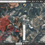
DEMからMPI赤色立体地図を作成できるQGISプラグインを作成しました!「PngTile2Dem」で取得したDEMをそのまま処理できます。そのほかのDEMも可能。
アナグリフ/ステレオペア画像の生成にも対応。
QGISのプラグインリポジトリから入手できます。
🔗 使い方:
github.com/yiwasa/Stereo-MPI…
齋藤 仁/Saito Hitoshi retweeted
#不動産情報ライブラリ 災害履歴を新規追加!
過去に発生した災害について、災害種別や発生時期・分布状況を取りまとめた #災害履歴 のうち、
・水害🌊
・土砂災害🪨
・地震災害⚠️
のデータを地図・APIに新規追加!
是非ご確認ください。
reinfolib.mlit.go.jp
#ハザード #防災 #国土調査
齋藤 仁/Saito Hitoshi retweeted
9月9日~11月24日
伊勢湾台風・東海豪雨25年企画展
「地図は悪夢を知っていた~濃尾平野水害地形分類図からわかること~」を開催。
過去に名古屋市や東海地方に甚大な被害をもたらした風水害と地形とのつながりを、地形図やハザードマップから読み解きましょう。
minato-bousai.jp/
齋藤 仁/Saito Hitoshi retweeted
1923年9月1日に発生した #関東大震災 から今日でちょうど102年となります。
現在、この関東大震災に関する自然災害伝承碑163基を #地理院地図 で公開しています。
この機会に自然災害伝承碑を #地理院地図 で確認し、災害に備えましょう。
<地理院地図でみる>
maps.gsi.go.jp/#13/35.683096…
齋藤 仁/Saito Hitoshi retweeted
UAV-LiDAR(レーザードローン)で測量した全国22の森林の詳細な樹冠情報や地形情報をまとめたデータペーパーを発表しました。過去3年間の努力の1つの集大成です。共同研究者や多くの関係者にお世話になりました。データはDIASからダウンロードできます。
doi.org/10.1111/1440-1703.12…
齋藤 仁/Saito Hitoshi retweeted
國島 大河・高田 賢人 氏らの日本産淡水蟹種複合体の遺伝的集団構造解析に関する@SciReports #OA #論文
Genetic population structure of Japanese freshwater crab, Geothelphusa dehaani species complex using genome wide SNPs
nature.com/articles/s41598-0…
#オープンアクセス
@WMNH @univkyoto

ALT Fig. 1 Map showing the geographical distribution of the analyzed samples. Symbol shapes represent species and data sources; circles, the Geothelphusa dehaani species complex; squares, outgroups; triangles: reference data of G. dehaani sensu lato from the literature. Symbol colors represent body coloration types; sky blue, BL type; brown, DA type; red, RE type; blue, amakusa type: orange, OC type; white, unidentified specimens due to small individuals; and black, unknown.
全国のサワガニ、実は5集団 地理的境界も判明 6年がかりで論文に
mainichi.jp/articles/2025082…
サワガニは日本固有種で、北海道から鹿児島県のトカラ列島まで広く生息する淡水性の生物。サワガニの集団は地理的にはっきりした境界を持ち、体色タイプの分布も明らかになりました。
齋藤 仁/Saito Hitoshi retweeted
斜面崩壊・土石流・堆積分布図「八代西」「八代東」を新たに公開しました。これは #令和7年8月6日からの大雨 によって生じたと考えられる #熊本県 八代市、宇城市等の斜面崩壊等を判読したものです。
斜面崩壊・土石流・堆積分布図等
gsi.go.jp/BOUSAI/R7_0806_hea…
齋藤 仁/Saito Hitoshi retweeted
斜面崩壊・土石流・堆積分布図「天草上島」を公開しました。これは #令和7年8月6日からの大雨 によって生じたと考えられる #天草諸島 の #上島 の斜面崩壊等を判読したものです。
斜面崩壊・土石流・堆積分布図
www1.gsi.go.jp/geowww/saigai…
令和7年8月6日からの大雨に関する情報gsi.go.jp/BOUSAI/R7_0806_hea…
齋藤 仁/Saito Hitoshi retweeted
新着記事を登載しました。E-journal GEO
[ タイトル ] 地形・植生・人の見えないつながりを見える化する――高精細地理情報を用いた流域内コネクティビティの研究――
[ 著者 ] 早川 裕弌,齋藤 仁
doi.org/10.4157/ejgeo.20.25
齋藤 仁/Saito Hitoshi retweeted
What is left of #Blatten this morning at 10:35 am! 😭
The lake has grown since yesterday, with only the roofs of the lowest buildings still visible! 🌊
📷 @ABettmeralp
齋藤 仁/Saito Hitoshi retweeted
Devastating image after massive Glacier Collapse in Blatten of Valais, Switzerland 🇨🇭 (28.05.2025)
齋藤 仁/Saito Hitoshi retweeted
2025年3月28日(UTC)にミャンマーで発生したM7.7(USGS)の地震に伴う地殻変動を検出。JAXAのだいち2号(ALOS-2)のデータを国土地理院が解析。詳しくは地理地殻活動研究センター地殻変動研究室のサイトへ。
gsi.go.jp/cais/topic20250328…
齋藤 仁/Saito Hitoshi retweeted
【 #地図で見る過去の災害 ①】
明日(9月26日)は #伊勢湾台風 上陸から65年目になります。伊勢湾台風は死者・行方不明者5千人以上という甚大な被害が発生しました。当時、地理調査所(現:国土地理院)がまとめた伊勢湾北部沿岸の洪水・被害状況では、当時の洪水範囲等が記録されています。
齋藤 仁/Saito Hitoshi retweeted
石川県輪島市内の「推定浸水域」を公開しました。
SNSにおける写真から、参考地点における浸水の深さを仮定して、周辺地域内の浸水状況を推定したものです。
xview.bosai.go.jp/view/index…
#風水害 #大雨特別警報 #防災科研 #bosaiXview
齋藤 仁/Saito Hitoshi retweeted
【研究成果】全国規模の土壌調査データを活用して日本の山地・丘陵地における土壌深度(土層厚)を確率で示すマップを作成しました。これは森林の水源涵養機能、二酸化炭素の土壌への貯留機能、山地の斜面災害ハザードマップ等の精度の大幅な改善につながる重要な成果です🗾ffpri.affrc.go.jp/research/s…