

Geospatial...Map Therapy on Demand
Denver USA
Joined June 2014
- Tweets1.8K
- Following1.2K
- Followers438
- Likes914





#Intermap generates Global #Geospatial datasets for a better and safer tomorrow!!!


Intermap and Twinn by Royal HaskoningDHV Transform Climate Change Insurance - intermap.com/pressreleases/2…
Location based results & Precise elevation data plus your own risk scoring results place you in control!!! #Intermap & #InsitePro
Intermap's InsitePro Clients Post Excellent Underwriting Results After Tropical Storm Hilary hubs.ly/Q022HmH30

Bill Raymor retweeted

Intermap's InsitePro Clients Post Excellent Underwriting Results After Tropical Storm Hilary hubs.ly/Q022HmH30
Intermap Announces Positive Cash Flow in the First Half and Private Placement - intermap.com/pressreleases/2…
#Intermap working hard for the best #Geospatial solutions for the entire planet! Congratulations!
A global 6M dataset built specifically for the UAS/UAV/UTM/BVLOS industry for the growth of your organization!
EASA Certified. Fully certified to relevant industry standards and regulation for integration with flight safety systems.
intermap.com/aviation-surfac…

New partnership milestone! We hosted a delegation from @HitachiVantara , who collected their Volanti aircraft. 🚀 Signing the MOU sealed our strategic partnership and commitment to our shared key values: reducing environmental impact and enabling cost-effective data acquisition.

Patrick A. Blott, #Intermap Chairman and CEO. “Our elevation data provides accurate, location-specific details to increase the level of confidence for accurate property valuation and help investors make smarter decisions.”
Bill Raymor retweeted
Intermap Partners with CAPE Analytics for Property Intelligence Analytics
hubs.ly/Q01YGBH_0


A global 6M dataset built specifically for the UAS/UAV/UTM/BVLOS industry for the growth of your organization!
EASA Certified. Fully certified to relevant industry standards and regulation for integration with flight safety systems.
intermap.com/aviation-surfac…
We are super pumped about Australia's @CASABriefing announcing the launch of a new beyond visual line-of-sight (BVLOS) outside of controlled airspace (OCTA) exam for remote pilots.
Want to know more?
Read our opinion piece here: ow.ly/CunO50P01oH
A global 6M dataset built specifically for the UAS/UAV/UTM/BVLOS industry for the growth of your organization!
EASA Certified. Fully certified to relevant industry standards and regulation for integration with flight safety systems.
intermap.com/aviation-surfac…

Better elevation data creates an address specific risk score. Plus we customize your risk scoring analytic for your particular organization that incorporates into your work flow! Good work #Intermap

We have global, uniform data for the #BVLOS and aviation industry #Intermap intermap.com/aviation-surfac…

eVTOL developer @Lilium has become the first to receive Certification Basis from both the EASA and FAA
aerotime.aero/articles/liliu…

Cool Beans!!! #Intermap 'The platform has tens of millions of active users who will benefit from NEXTMap’s detailed terrain data.'

Bill Raymor retweeted
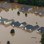
#Intermap provides Location Based flood analytics globally. This is in Europe... Not a Cat model, but address specific

#Intermap provides Location Based flood analytics globally. This is in Europe... Not a Cat model, but address specific
'Leveraging Intermap’s consistently reliable and high-quality data'
Good work #Intermap and #GeoSolutions
A global 6M dataset built specifically for the UAS/UAV/UTM/BVLOS industry for the growth of your organization!
EASA Certified. Fully certified to relevant industry standards and regulation for integration with flight safety systems.
intermap.com/aviation-surfac…

Autonomous flight company Merlin opens new operations centre in New Zealand urbanairmobilitynews.com/air…

A global 6M dataset built specifically for the UAS/UAV/UTM/BVLOS industry for the growth of your organization!
EASA Certified. Fully certified to relevant industry standards and regulation for integration with flight safety systems.
intermap.com/aviation-surfac…

Multipupose drone payloads with automated replacement make aerial operations more efficient!
Airobotics’ drones perform a wide range of tasks such as inspection, mapping, surveying, delivery and more.
Video source: @AiroboticsUAV
#drones #tech #engineering #innovation