

Providing simplified, high-precision flood hazard maps across Africa. https://xitter.cf/t.co/WdqDWtOOeh
Nigeria
Joined September 2020
- Tweets1.1K
- Following191
- Followers1.1K
- Likes758



Pinned Tweet
#ClimateEmergency compels us to convert our shared concerns into direct, data-guided action.
Join our flood risk reporting initiative, and contribute to proactive strategies built on real data from real incidents.
Visit arcg.is/1rSqv1
#FloodRiskManagement #ArcGIS

The first version of that model scored 0.999 because we had leaked the answer into it, with permanent water sitting in the training labels, and once we found it we cut it and wrote down why, since models scoring too well are usually cheating.

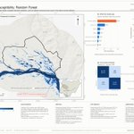
Our flood susceptibility model scores 0.998 AUC, and the useful figure is the ablation beneath it, since removing absolute elevation drops it to 0.982 and terrain shape alone gives 0.886, so a headline score explains very little.

This #IDDRR2026, GRMI is taking action in Ibaji, Kogi State, one of Nigeria’s most flood-affected areas.
We’re conducting household early-action training and distributing Flood Action Cards to help families prepare, respond early, and reduce flood risk.
#ResilienceStartsAtHome

A hazard map allows a uniform handout to become a targeted one, because intersecting it with the cooperative's plot register ranks farmers by measured exposure at no cost, so the seed ends up where the exposure actually is

The purpose of 200 kg of seed lies in multiplication, since it works as a seed nucleus whose value accumulates over the seasons the cooperative replants, and that is the claim worth monitoring, so we built it into the M&E.

Some 4,109 hectares of Katcha's cropland sit in the top two flood hazard classes, and the 200 kg we distributed plants 3.3 of them, which is 0.08%, and we say so plainly so that nobody infers a coverage we did not deliver.

Settlements in Katcha sit on high ground, with built-up flooding rising from 1 ha at a 2 m stage to only 14 ha at 10 m, so the village chose its site correctly generations ago, while the farmland was never afforded that choice.

Sixty-nine per cent of Katcha's cropland floods at a 2 m rise and 86% at 10 m, so the curve flattens early and a 10 m headline scenario adds little to a 3 m one, leaving the real decisions between 0.5 m and 3 m.

We audited our own report and found seven defects, four of them serious, the most important being a ward area denominator wrong by 19%, which means the headline "65% rice" should read 53%, and we published the correction.

Cropland and wetland cover 53% of Katcha Ward, amounting to 5,736 hectares, and when we measured that against ESA WorldCover it landed within 1% of the field report's own figure, confirming the absolute area.

Geohazard Risk Mapping Initiative retweeted

What if resilience to heat, droughts, floods and other climate hazards could come from something as small as a bee?
As traditional farming and livestock keeping are put under pressure, beekeeping is proving to be a practical, nature-based alternative.
🔗 zcralliance.org/blogs/a-swee…

Register to join us: bit.ly/iddrr26


To mark IDDRR 2026, we are hosting a webinar focused on household and community resilience and exploring practical approaches to strengthening disaster preparedness and disaster risk reduction in Nigeria Register to join us: bit.ly/iddrr26
@UNDRR
@AYAB_DRR
#IDDRR2026

Geohazard Risk Mapping Initiative retweeted
To mark IDDRR 2026, we are hosting a webinar focused on household and community resilience and exploring practical approaches to strengthening disaster preparedness and disaster risk reduction in Nigeria Register to join us: bit.ly/iddrr26
@UNDRR
@AYAB_DRR
#IDDRR2026
JRC Global Surface Water maps 1,415 ha of the ward as water-affected, and our Sentinel-1 work gave 1,257 to 1,374 ha, so two satellites covering two decades agree to within 10%, which is what corroboration looks like.

We mapped where the water actually goes using Sentinel-1 radar, which sees through cloud during a Nigerian rainy season, and we then checked the result against 37 years of Landsat observations from an entirely separate sensor.

To mark IDDRR 2026, we are hosting a webinar focused on household and community resilience and exploring practical approaches to strengthening disaster preparedness and disaster risk reduction in Nigeria Register to join us: bit.ly/iddrr26
@UNDRR
@AYAB_DRR
#IDDRR2026
To mark IDDRR 2026, we are hosting a webinar focused on household and community resilience and exploring practical approaches to strengthening disaster preparedness and disaster risk reduction in Nigeria
Register to join us: bit.ly/iddrr26
@UNDRR
@AYAB_DRR
#IDDRR2026

Farmers told us what trial data does not capture, describing how FARO 44 yields well in the rains and poorly in the dry season because Harmattan cold arrives at flowering, which is textbook rice physiology observed unprompted.
Geohazard Risk Mapping Initiative retweeted

📢 Early warnings only work when they are received, understood, & acted upon.
#EarlyWarningsForAll ➡️ ow.ly/W5nK50Xxsas

