

GEOGLAM Rangelands and Pasture Productivity monitors the world’s rangelands and pasture lands, and their capacity to sustainably produce animal protein
Joined December 2015
- Tweets53
- Following25
- Followers286
- Likes3





Report: Monitoring groundcover: an online tool for Australian regions
doi.org/10.25919/5bf84026e55…
pdf: publications.csiro.au/rpr/do…
Vegetation cover data for July 2018 updated in our RaPP Map. Australia's southeast suffering the effects of the drought.
Check it in map.geo-rapp.org/#share=s-60…
powered by @TerriaJS @Data61news @NCInews

Neil Sims from @CSIROnews presenting on Sustainable Development Goals during our @GeoglamRAPP workshop.

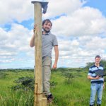
Francesco Fava and Anton Vrieling checking their phenocams which track vegetation phenology in @ILRI's Kapiti research station

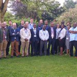
@GeoglamRAPP workshop participants out of the room and to the field! Visiting @ILRI's Kapiti Research station. Learning about Kenya's livestock/wildlife rangeland systems

GEOGLAM RAPP retweeted

Catherine Nakalembe presents on @EOFSAC today @GeoglamRAPP workshop in Nairobi to discuss Earth observations data applications for rangeland food security and #SDGs followed this week by an African regional workshop for regional Data Cube users.


GEOGLAM RAPP retweeted
Juan Guerschman of @CSIROnews kicks off the 6th @GeoglamRAPP workshop in Nairobi, which focuses on Sustainable Development Goals #SDGs and the Open Data Cube Initiative (ODC).

First day of the @GeoglamRAPP workshop, kindly hosted by @ILRI in their Nairobi campus.

GEOGLAM RAPP retweeted
Thank you from @G20_GEOGLAM to everyone who joined the #GEOGLAM Executive Committee meeting at the Joint Research Centre in Ispra, Italy for your support and guidance of our critical program work!

We are conducting a survey to better understand how earth observations are used for rangeland and pasture monitoring: goo.gl/forms/0D2lABnsphtt6MS…
Thank you for your help!

RAPP Newsletter #8: RAPP Map, Kenya workshop (with #SDGs and @OpenDataCube), recent publications, updates and more...
geo-rapp.org/about/news-2/ra…
Dustwatch - reducing soil erosion in Australia, uses data and services produced by GEOGLAM RAPP to monitor ground cover levels across the rangelands. Project leader John Leys explains in this video.
youtu.be/vbL1IxOX8Qo
New paper describing GSio, a software system for serving geospatial raster or gridded Big Earth Data at scale. Gsio plays a big role in our RAPP Map (hosted by @NCInews) and in #DigitalEarthAU xitter.cf/prl9000/status/9362206…
November Newsletter geo-rapp.org/about/news-2/ra…
Including RAPP Map, activities with communal farmers in Namibia’s rangelands, new partnerships, UN Sustainable Development Goals, and more.
.@NCInews provides the behind the scenes power to run our rangeland monitoring tool. Featured in annual report, page 40 xitter.cf/NCInews/status/9229967…

Our 2016-17 Annual Report is out! Featuring our highlights from the year and great research stories. #HPC #bigdata nci.org.au/about-nci/annual-…


.@NCInews holding lots of the data and tools which support our "RAPP Map"
map.geo-rapp.org/ xitter.cf/NCInews/status/8649876…
Check out this great map of global rangelands and pastures! The map is supported by IT resources at @NCINews. #environment #agriculture xitter.cf/ESA_EO/status/86480846…
Thanks @ESA_EO for hosting us in Frascati. Great workshop! xitter.cf/ESA_EO/status/86481528…

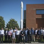
Group pic of the 5th @GeoglamRAPP (#Rangeland & #PastureProductivity) Workshop at #ESRIN, 16-17 May: geo-rapp.org #RemoteSensing

GEOGLAM RAPP retweeted

Why monitor RAPP? #Rangelands cover 70% of Earth’s surface & 18% of global population depend on #PastureProductivity map.geo-rapp.org/

