Gulf Coast Storm Center (@GCSCWX) profile picture

Official X account for Gulf Coast Storm Center | Providing weather updates, news and analysis for the Gulf Coast region | Posts by @calebweather.

Gulf Breeze, FL
Joined May 2014
Photo by Gulf Coast Storm Center (@GCSCWX)Photo by Gulf Coast Storm Center (@GCSCWX)Photo by Gulf Coast Storm Center (@GCSCWX)Photo by Gulf Coast Storm Center (@GCSCWX)Photo by Gulf Coast Storm Center (@GCSCWX)Photo by Gulf Coast Storm Center (@GCSCWX)Photo by Gulf Coast Storm Center (@GCSCWX)Photo by Gulf Coast Storm Center (@GCSCWX)Photo by Gulf Coast Storm Center (@GCSCWX)Photo by Gulf Coast Storm Center (@GCSCWX)
Gulf Coast Storm Center retweeted
The City of Naples has issued an emergency citywide curfew to protect and safeguard the health, safety, and welfare of City of Naples residents, visitors, and first responders. The curfew is effective immediately until further notice.
72
780
103
1,858
Gulf Coast Storm Center retweeted
Currently in Fort Myers, Florida. Video by Loni Architects #flwx #Ian #hurricane
848
7,434
1,563
22,497
Gulf Coast Storm Center retweeted
An extreme wind warning is in effect for Englewood FL, Rotonda FL, Grove City FL until 2:00 PM EDT for extremely dangerous hurricane winds. Treat these imminent extreme winds as if a tornado was approaching and move immediately to an interior room or shelter NOW!. – at Rotonda, FL
14
443
40
916
Gulf Coast Storm Center retweeted
11AM SEPT 28th: The latest impact levels of Hurricane Ian in South Florida. For more information: nhc.noaa.gov & weather.gov/srh/tropical?off…
2
37
3
69
Gulf Coast Storm Center retweeted
Surge is coming in crazy fast in #Naples #FLwx. A rate of a little more than a foot per 10 minutes. Don't think this is over just because winds are lessening as the eye moves to your north! #Ian
6
100
7
309
Gulf Coast Storm Center retweeted
New plane has penetrated Hurricane #Ian, and is finding evidence that the secondary wind max observed earlier is intensifying, and evolving into an outer eyewall that now has stronger winds than the inner eyewall, at least in the SE quadrant. Eyewall replacement cycle underway.
32
229
34
888
Gulf Coast Storm Center retweeted
Winds at Key West just gusted to 71 mph in this outer band of extremely dangerous hurricane #Ian #flwx
3
38
6
176
Gulf Coast Storm Center retweeted
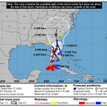
Following Ian deviating right of the forecast track this morning, NHC nudged the forecast south/east. Since then, Ian continued to deviate even further to the right of NHC's forecast track - if this persists, it may make landfall earlier, stronger & farther south than forecast.
15
65
4
210
Gulf Coast Storm Center retweeted
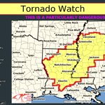
A tornado watch has been issued for parts of Florida until 5 PM EDT – at Florida, USA
21
195
55
318
Gulf Coast Storm Center retweeted
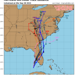
⚠️ This is a concerning shift in the 18z ECMWF-EPS guidance to a more easterly track for Ian. Not only do most members support a landfall south of Tampa & near Sarasota, but more than a handful show the storm moving out into the Atlantic and re-strengthening. @ECMWFbot
18
74
15
275
Gulf Coast Storm Center retweeted
Life-threatening storm surge - one of many expected hazards with Hurricane #Ian - along the west coast of Florida has prompted evacuation orders for some communities. I urge those residents to heed directions from officials! Your safety is at the heart of these tough decisions.
20
414
29
779
Gulf Coast Storm Center retweeted
This 12z run of ECMWF HiRes drops Ian by 20 mb after reaching Gulf of Mexico with sub-950 mb storm minimum. The stalling track offshore hopefully will keep area of 20"-40" away from Florida.
4
13
52
Gulf Coast Storm Center retweeted
Latest guidance holding strong with the idea that #Ian will be slowing down as it approaches western #FLwx which may cut down on the highest-end winds, but will dramatically worsen surge and rain impacts. The time to prep for high water in #Tampa is NOW
11
84
11
287
Gulf Coast Storm Center retweeted
The shift west is very noticeable on the 6z EPS members compared to the 00z ones #Ian
11
9
1
63
Gulf Coast Storm Center retweeted
NHC will initiate advisories on Tropical Storm Earl, located east of the Leeward Islands, at 1100 PM AST (0300 UTC).
28
285
98
656
Gulf Coast Storm Center retweeted
Aug 19th 1055 AM EDT: A special Tropical Weather Outlook has been issued, raising the probability of tropical cyclone formation to 60% within the next two days for the disturbance in the southwestern Gulf of Mexico. More info: hurricanes.gov #99L
20
218
50
534
Gulf Coast Storm Center retweeted
A trough of low pressure slowly drifting northward in the Gulf of Mexico is forecast to produce substantial rainfall along the Gulf Coast this week, with as much as 10" of rain (locally exceeding 15") possible along the immediate SE Louisiana coastline & lesser amounts inland. 🌧️
1
42
13
123
Gulf Coast Storm Center retweeted
Perhaps slipping a little under the radar is an old frontal boundary that will propagate over the Gulf of Mexico during the next few days in a low shear environment. Starting to see some more consistent hints for cyclogenesis next week. Worth monitoring given proximity to land.
17
68
17
292
Gulf Coast Storm Center retweeted
The new ECMWF Atlantic seasonal #hurricane forecast calls for an extremely active season, with ~19 named storms and ~11 hurricanes predicted for July-November.
10
94
10
241
Gulf Coast Storm Center retweeted
Potential T.C. One is expected to bring heavy rainfall across portions of Central and South Florida through tomorrow. A Moderate Risk of Excessive Rainfall has been issued for today and tonight and rainfall totals of 4-8" with localized amounts up to 12" are possible.
2
95
13
198