

This page is no longer being updated. Please visit our website or connect with us on our active social media channels.
- Tweets4.4K
- Following405
- Followers2.7K
- Likes566










ALT Sunday’s Weather Forecast

ALT This graphic displays a severe thunderstorm warning plotted on a map. The warning is in effect until 10:45 PM CDT. The warning includes Garden City KS and Holcomb KS. This warning is for Southwestern Finney County in southwestern Kansas. The threats associated with this warning are wind gusts up to 60 MPH and quarter sized hail. There are 36,646 people in the warning along with 21 schools and 1 hospital.

ALT Este gráfico muestra la localización en el mapa de un Vigilancia de Tormenta Severa número 617. El aviso estará en efecto hasta las 3:00 AM CDT.Las amenazas asociadas a este aviso son. Varios tornados posibles. Granizo disperso de hasta limon posible. Ráfagas Dispersas de Hasta 85 MPH Posibles. Hay 1,085,328 personas bajo este aviso incluyendo 652 escuelas y 80 hospitales.

ALT This graphic displays Severe Thunderstorm watch number 609 plotted on a map. The watch is in effect until 10:00 PM CDT. The watch includes parts of Colorado and Kansas. The threats associated with this watch are no tornadoes expected, scattered hail up to tennis ball size possible and scattered gusts up to 70 mph possible. There are 117,972 people in the watch along with 132 schools and 19 hospitals.


ALT This graphic displays Severe Thunderstorm watch number 586 plotted on a map. The watch is in effect until 3:00 AM CDT. The watch includes parts of Kansas, Nebraska, Oklahoma and Texas. The threats associated with this watch are a couple tornadoes possible, scattered hail up to two inch size possible and scattered gusts up to 75 mph possible. There are 253,108 people in the watch along with 251 schools and 38 hospitals.

ALT Another complex of thunderstorms is expected to arrive from Colorado Sunday evening, and track across southwest Kansas through tonight. Some storms will produce strong to severe wind gusts of 50-70 mph. Widespread rainfall amounts of 1/2 to 1 inch are expected.

ALT This graphic displays Severe Thunderstorm watch number 582 plotted on a map. The watch is in effect until 4:00 AM CDT. The watch includes parts of Iowa, Kansas and Nebraska. The threats associated with this watch are a couple tornadoes possible, scattered hail up to two inch size possible and scattered gusts up to 80 mph likely. There are 1,896,394 people in the watch along with 937 schools and 107 hospitals.

ALT This graphic displays a severe thunderstorm warning plotted on a map. The warning is in effect until 8:00 PM CDT. The warning includes Garden City KS, Holcomb KS and Deerfield KS. This warning is for Northeastern Kearny County in southwestern Kansas, Northwestern Finney County in southwestern Kansas and Southwestern Scott County in west central Kansas. The threats associated with this warning are wind gusts up to 70 MPH and half dollar sized hail. There are 30,598 people in the warning along with 19 schools and 0 hospitals.


ALT This graphic displays Severe Thunderstorm watch number 502 plotted on a map. The watch is in effect until 10:00 PM CDT. The watch includes parts of Colorado, Kansas and Nebraska. The threats associated with this watch are no tornadoes expected, scattered hail up to two inch size possible and scattered gusts up to 75 mph likely. There are 2,709,384 people in the watch along with 1223 schools and 108 hospitals.


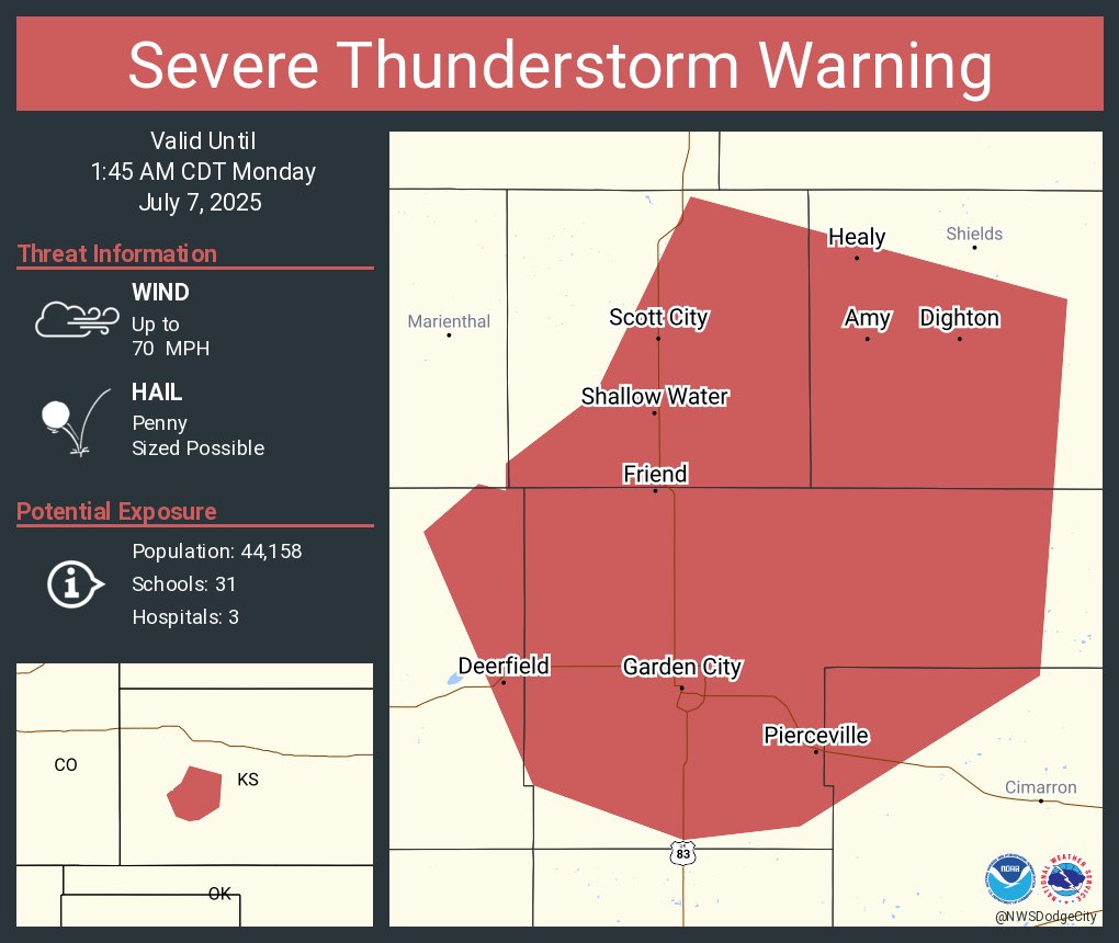
ALT This graphic displays a severe thunderstorm warning plotted on a map. The warning is in effect until 1:45 AM CDT. The warning includes Garden City KS, Scott City KS and Holcomb KS. This warning is for Northeastern Kearny County in southwestern Kansas, Finney County in southwestern Kansas, Scott County in west central Kansas, Lane County in west central Kansas and Northwestern Gray County in southwestern Kansas. The threats associated with this warning are wind gusts up to 70 MPH and penny sized hail. There are 44,158 people in the warning along with 31 schools and 3 hospitals.