

Official European branch of Force Thirteen, covering weather news across the continent.
Europe
Joined March 2021
- Tweets879
- Following6
- Followers1.8K
- Likes66




Force Thirteen Europe retweeted

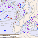
Likely subtropical cyclone off the coast of Libya in the Mediterranean Sea with winds near 50mph at this time. Storm expected to weaken a little before reaching land to the southeast by tomorrow.
Force Thirteen Europe retweeted
Tropical Weather Outlook 13:00 UTC March 17
Tropical Storm Narelle intensifying quickly as it enters the Coral Sea, and is likely to impact northern Queensland as a major cyclone.
New Mediterranean storm likely to make landfall in Libya tomorrow.


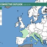
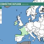
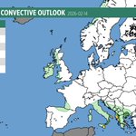
⛈️ CONVECTIVE OUTLOOK: Feb 15 ⛈️
SLIGHT RISK in place for:
🔸 Northern France & South UK Coast
🔸 NE Greece, S Bulgaria & NW Turkey
Primary Hazards:
💨 Damaging winds (100-120 km/h)
🌪️ Waterspouts & brief tornadoes
🧊 Prolific graupel/small hail
#StormOriana #Weather #Europe


Planning our schedule! 🗓️ Which is more helpful: a convective outlook posted the evening before, or a fresh update on the morning of? Let us know below! 👇 #Weather #Forecasting
48%Eve prior to forecast day
52%Morning of forecast day
21 votes • Final results

🚨 Severe Weather Outlook: Isolated thunderstorms across southern Europe today, with a small risk of a tornado / waterspout.
The main threat area is Portugal & Spain, where storms may produce damaging winds.
#SevereWeather #Thunderstorms #Tornado #Portugal #Spain


🚨Convective Outlook - #Italy Weather Alert: #StormNils likely to bring hurricane-force gusts, hail & tornadoes to #Sicily #Sardinia & #Corsica with further severe storms in Turkey, Greece, France and Iberia. Stay safe! #Meteo #Weather #StormWarning

Powerful winds are expected tomorrow into Thursday across France and Spain. Be ready! Scattered heavy thunderstorms are also possible.


A strong windstorm / winter storm is set to impact Scandinavia and much of Eastern Europe this weekend into early next week. Expect snow, strong winds, and possible blizzard conditions, especially in Norway and along the Baltic Sea. High impact weather likely. #EUwx


An atmospheric river is setting up over northern Scandinavia, with Norway taking the brunt. Persistent moisture will bring round after round of heavy rain and snow, leading to significant accumulations, potentially exceeding 200 mm in some areas. High risk of disruption. #EUwx


Snow lovers 👀❄️ Big changes ahead as we head into the New Year. Snowy lows diving SE from Scandinavia + possible North Sea sea-effect snow as a high pressure ridge is locked in in NW Europe. Colder air spreading into E Europe. Stay tuned! #EUwx
