

Advancing geospatial capabilities of individuals, teams, and organizations is our mission and our passion.
Joined August 2009
- Tweets13.2K
- Following1K
- Followers35.7K
- Likes2.7K





Pinned Tweet
GIS is more than static maps! It is a way to visualize data, convey information, and tell stories. 🌎📖
Learn the latest ArcGIS tools that power deeper communication in our brand-new MOOC. Register: bit.ly/4zcXqLh
🌟The free course opens on Oct. 21.

🌟 New to spatial analysis? Start your journey with our free 6-week MOOC! 🌍📊
Registration is now open: link.esri.com/701UU00000gR50…
Learn essential spatial analysis skills and see how GIS can transform your data analysis work.

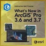
🚨New release! Discover what's new in ArcGIS Pro 3.6 & 3.7! ✨💻
Our course walks through key updates to mapping, analysis, labeling, and sharing so you can apply the latest capabilities right away.
Sign up: link.esri.com/701UU00000c63K…

This learning plan covers creating and managing 3D data, scene styling, and performing analytic workflows. 📊
You'll gain experience with 3D workflows to solve real-world problems in planning, utilities, and environmental management. Enroll today: link.esri.com/701UU00000bvQb…

Just one week away! 🌎 Our free MOOC opens on October 21.
Save your spot: link.esri.com/701UU00000ZXAv…
You'll learn design principles, cartographic techniques, and storytelling strategies that turn spatial data into clear, compelling messages.

Make your analysis pop!💥
Learn spatial statistical techniques and how to uncover patterns in data using ArcGIS with an Esri Expert.
Sign up 🡢 bit.ly/4s10SpH

#ArcGIS allows us to turn geographic data into information that helps us understand our world and make smart decisions. 🌐
Explore the six categories of spatial analysis and how to solve spatial problems in this free web course: bit.ly/4yE85P6

Learn about advanced, symbology, 3D scenes, voxel layers and more! 🤩🌏
Sign up for our new MOOC opening on October 21.
Register: bit.ly/47646Pc

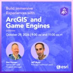
Save the date: Live Training Seminar on October 29! 🌎🎃
Learn from experts, view demos, and ask questions about ArcGIS, 3D GIS, and game engines.
Register today: bit.ly/4rRywy5

Don't miss out! The Spatial Data Science MOOC registration closes tonight at 11:59 PM PT.
Sign up before it's too late ➡️ bit.ly/4elaJ3Y

Ready to make every pixel count? 📷➡️🗺️
Our course teaches you how to analyze imagery, run classifications, detect change, and deliver clear, actionable products. Register: link.esri.com/701UU00000c63K…

Esri Training retweeted

An easy way to celebrate #GISDay2026 is to take free GIS and ArcGIS training on Esri Academy! 🌏🤓
🌟Check out the course catalog today: bit.ly/4ymzvsv
@EsriTraining #GIS #ArcGIS #FreeTraining

Looking for a place to get started with 3D GIS? This learning plan is for you!
Empower your 3D content creation, management, and sharing with ArcGIS.
🌏Start learning: bit.ly/3VqMISz

Don't miss your opportunity to register for our no-cost Spatial Data Science MOOC.
➡️ Registration closes on October 7. Join today: link.esri.com/701UU00000ZXAv…
📊 Explore how to uncover patterns, build models, and turn analysis into clear, compelling stories with ArcGIS.

Keep your spatial data accurate and reliable 🗂️
Learn how to:
🔹 Use topology to identify and prevent errors
🔹 Apply attribute rules to improve data quality
🔹 Enforce consistency with domains and subtypes
Start the web course: link.esri.com/701UU00000bvQb…

Start this ArcGIS Lab to learn how to build interactive, media-rich stories that engage your audience and showcase spatial insights.
📖 Get practice storytelling with purpose: bit.ly/4iZqp0c

Level up your 3D GIS game 🧊🌎
Join our next live training seminar on Oct. 29 to learn what's possible when you combine ArcGIS Maps SDKs for Game Engines, GIS data, and gaming technology.
Register: bit.ly/47e9X5b

Week 2 in the Spatial Data Science MOOC is here!
🌟 Get started: bit.ly/4hwdgJs
Register by October 7 to learn how to extract deeper insights and uncover hidden patterns from spatial data.
(ArcGIS software is provided for the duration of the course at no-cost!!)

AI assistants in ArcGIS help users streamline workflows and save time! 🤩
Learn about + get practice with 4 different assistants in this 4-hour course.
Sign up: bit.ly/46L0wdd

Using CAD and BIM data in your GIS workflows enables you to map and analyze data related to structures and systems. 🏢🌍
Whether you are just getting started or want a refresher on the basics, take this web course: bit.ly/4rwC5tq
#ArcGIS #CAD #BIM #ArcGIS

ArcGIS Utility Network users! 💡💧
If you have 2-4 years of experience, check out our updated certification exam: bit.ly/4ycx5g8
Level up your career and become one of the first to reach this achievement 🌎
