
Connect to EUMeTrain and get informed on case studies, training modules, upcoming courses and interesting weather.
Austria
Joined August 2010
- Tweets452
- Following15
- Followers585
- Likes15






⚡️ The recording of last week's NWC SAF MTG-I Lightning Imager Prototype Products Workshop is now available on the EUMeTrain web page: eumetrain.org/resources/nwc-…
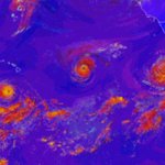
The structure of the hurricane is clearly seen, with the calm eye in the middle. The high-level thick clouds are visible in white, and the warm, ozone-poor tropical air mass is in green. The red areas show drier air flowing into the core, eventually weakening the hurricane. 2/2
GOES East Airmass RGB - 9 October 2026, 09UTC
First hurricane of the 2026 Atlantic hurricane season, Hurricane Isaias, reached peak intensity on the 9th of October. It was the latest first hurricane of the season recorded since 1905, when the hurricane season timing was set. 1/2

One week until the Tropical Meteorology Event Week!
Save the dates and register here: forms.gle/Nqj7zZ7P7JPTWeUA9
Check out the agenda here: resources.eumetrain.org/even…

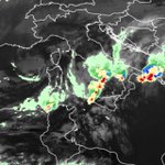
Together, these products provide complementary information on estimated rainfall intensity and electrically active thunderstorms within the cloud systems, supporting convection monitoring over both land and sea. 3/3
The FCI 10.5 µm infrared image shows their extensive cloud cover. The precipitation rate product, combining FCI infrared observations with microwave measurements, highlights precipitation areas, while the Lightning Imager (LI) Accumulated Flash Area shows lightning activity. 2/3
FCI HRFI IR10.5 μm, Precipitation rate at ground by blended FCI IR / LEO MW precipitation and LI Accumulated Flash Area – 9 October, 08:10 UTC - Several convective systems are visible over southern Italy and the southern Adriatic. 1/3

☀️ The EUMeTrain Consortium met in Lisbon from 29 September to 2 October to work on mini-modules and plan new training materials on satellite meteorology.
Four days of teamwork and plenty of discussions to bring you more useful learning resources and events. Stay tuned!

The recording of the September weather briefing, presented by Ângela Lourenço and Bruno Café from IPMA, is now available online:
youtube.com/watch?v=tfAtKWgB…
🌦️ Registration is now open for the EUMeTrain Event Week on Tropical Meteorology!
Check out the agenda here: resources.eumetrain.org/even…
Save the dates between 20- 22 October 2026 and register here:
forms.gle/oV9udecEKdPTNgxg9
Orange is for water, blue is for ice and brown is for the mixed phase. The product's version is GEO v2025, which uses FCI data, making it more precise than its predecessor. All the products of the software package NWC/GEO v2025 can be found here: shorturl.at/2doih 2/2

🌧️EUMeTrain Event Week on Tropical Meteorology
Join us online from 20 to 22 October and deepen your understanding of tropical weather phenomena and their impacts on populations, infrastructure, and socio-economic activities.
The registration form and the agenda are coming soon.

In the Convection RGB, strong convection and small ice particles are shown in yellow, indicating that the most intense convection is located within hurricane eyewalls. 3/3
On 2 September, Hurricane Lowell reached Category 5, while Karina Category 4, both achieving their maximum intensity. Higher-than-average convective activity is expected in this area due to warm sea-surface temperatures and atmospheric instability associated with El Niño. 2/3
GOES-W Convection RGB - 3 September, 21:00 UTC - A tropical cyclone outbreak happened in the eastern Pacific, with three hurricanes, Lowell, Karina and Marie, developing between Hawaii and western Mexico. 1/3

The water vapour channels show the structure of the weakening typhoon. The eye in the middle is disappearing and the rainbands are becoming weaker and sparser. The storm is still expected to bring heavy rain and strong winds to Taiwan and Eastern China over the weekend. 2/2
Himawari-8 Full disk AHI WV 6.2 + 7.3 - Wednesday 26th of August, 21 UTC - Typhoon Saudel is moving toward Southeastern China as a Category 1 tropical storm. According to forecasts, it will weaken to a tropical storm before making landfall. 1/2

⚡️NWC SAF MTG-I LI Prototype Products Workshop⚡️
On 15 October 2026, join this online event to learn about the upcoming NWC SAF GEO-LI software package and the new generation of products based on MTG LI data.
Check out the agenda and register here: shorturl.at/w1Gz6

The recording of the August weather briefing, presented by Zsófia Kocsis and Alajos Kiss from HungaroMet, is now available online:
youtu.be/SGEpy05sK18