

OU Alum | OU Nightly Alum | Former @WYMT Meteorologist |
Hazard, KY
Joined January 2022
- Tweets270
- Following97
- Followers229
- Likes197


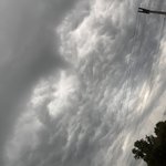
Snow continuing to fall in Northern Perry County about a quarter inch of accumulation in the highest areas. @SSmithWeather @Kentuckyweather @JimWKYT @WYMT
I’m excited to announce I’ll be joining 40/29 News in Rogers, Arkansas this December as a Weekend Morning Meteorologist and Reporter. I’m excited to get to serve the people of Northwest Arkansas and the River Valley over the next few years.

Very small Graupel mixing in with the rain in Northern Perry County. #kywx @brobwx @SSmithWeather @TheErikDean

Northern Lights in Perry County. Not yet visible with the naked eye. @TheErikDean @SSmithWeather @brobwx

Drake Foley retweeted

Leatherwood, KY, iPhone 15 Pro Max, 3 second exposure. #northernlights @Kentuckyweather @JimWKYT @nwsjacksonky @TheErikDean @DrakeFoleyWX @WYMT


Drake Foley retweeted
Went from doing nothing to absolutely pouring in London in the last five or six minutes. @Kentuckyweather @TheErikDean @DrakeFoleyWX @JimWKYT @nwsjacksonky #kywx
Drake Foley retweeted
Pretty dark looking storm rolling in to London . #kywx @Kentuckyweather @JimWKYT @BenWKYT @DrakeFoleyWX @TheErikDean


Drake Foley retweeted

FIRST ALERT: Severe Storms Possible This Afternoon
wymt.com/2024/07/05/first-al…
I’ll have more information for you at 6 and 11 tonight!
A couple strong thunderstorms are passing through Eastern Kentucky bringing heavy rain, lightning, and gusty winds. Keep an eye on your WYMT First Alert Weather App as these storms continue to pass through Eastern Kentucky! #kywx

Drake Foley retweeted

A special weather statement has been issued for Hazard KY, Diablock KY and Hyden KY until 2:30 PM EDT

ALT This graphic displays a special weather statement plotted on a map. The statement is in effect until 2:30 PM EDT. The statement includes Hazard KY, Diablock KY and Hyden KY. A STRONG THUNDERSTORM WILL IMPACT SOUTHEASTERN OWSLEY, NORTHERN LESLIE, NORTHWESTERN PERRY and SOUTHWESTERN BREATHITT AND NORTHEASTERN CLAY COUNTIES THROUGH 230 PM EDT. The threats associated with this storm are wind gusts up to 40 MPH and pea sized hail. Seek shelter in a sturdy structure until the storm passes.
It’s gonna be very warm in the United States in July. Especially above average in Eastern Kentucky. #kywx


Drake Foley retweeted
YOUR FIRST ALERT: How hot will we get?
wymt.com/2024/06/12/your-fir…
We are tracking possible heat indices reaching the triple digit mark. Read more here:
YOUR FIRST ALERT: Keeping an eye on heat this weekend wymt.com/2024/06/11/your-fir…

Drake Foley retweeted
KSP investigating Letcher Co. death
wymt.com/2024/06/10/ksp-inve…
Plentiful sunshine from Friday into Saturday before showers return. wymt.com/2024/06/07/plentifu…