

This is Donegal's first and top weather channel for all your weather forecast and weather updates we cover all of Donegal, and Ireland and cover Northern lights
Donegal, Ireland
Joined January 2012
- Tweets24.3K
- Following1.6K
- Followers12.2K
- Likes2.2K






Check out this Brocken spectre I captured on my Drone this morning. 🌈
A Brocken spectre captured via a drone occurs when the flying drone casts its shadow onto low-lying clouds, fog, or mist opposite the position of the sun, creating a magnified shadow surrounded by a circular, rainbow-like halo known as a glory or anticorona.
Kenneth from the Donegal Weather Channel
#weather #ireland #drone #cold #Brockenspectre – at Leitrim, Ireland


🌀 UPDATE ON THE POTENTIAL STORM LATER NEXT WEEK
Good morning folks the outlook for Thursday is a rather wet and windy one at present with 4 of the weather models attached showing a deep area of low pressure passing close to the south of Ireland.
Models outputs differ with some showing exceptionally heavy rain that would lead to flooding for some with and damaging gusts also for some. At this point it's hard to pin point until earlier next week as I said in the past few updates I have provided. Once the higher resolution models come into range it will give a better guidance.
The outlook highlights below based on Sunday mornings model outputs:
▪️ Deep Atlantic low pressure approaching Ireland.
▪️ Heavy rain and flooding risk, especially where rain persists.
▪️ Strong winds, particularly along Atlantic coasts and exposed areas.
▪️ Difficult travel conditions from surface water, spray and gusty winds.
▪️ Rough seas and large waves, with possible wave overtopping in exposed coastal locations.
The four models show a notably deep area of low pressure near Ireland and the UK, although its exact track, intensity and timing differ. This is a model-based outlook, not a confirmed weather warning; the forecast may change as newer runs become available and looking at the current trend over the past 2 days this low pressure system seems to be moving southwards on each run. Based on the trend of this low moving southwards ever so slightly on each run there is a possible chance this stays just far enough to be south of Ireland that it misses with less impact which would be great. Put just to state it needed to be carefully watched.
Kenneth from the Donegal Weather Channel
#weather #ireland #fblifestyle #storm #wind #rain #flooding – at Leitrim, Ireland

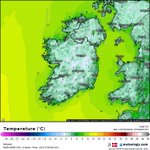
🥶 TEMPERATURES DOWN TO -1C AGAIN TONIGHT
It will be another cold night with temperatures falling to 0C to -1C in places with frost developing by dawn, some mist and fog patches also.
#cold #temperatures #fog #frost #mist – at Leitrim, Ireland

Good morning folks the Ecmwf model continues to show storm depressions later next week Thursday into Friday and then Sunday into Monday during the bank holiday.
The attached charts is from the Ecmwf model for Sunday into bank holiday Monday.
As mentioned yesterday it would really be early next week before we start to get a idea, especially for Thursday and Friday next week.
Each model over the coming days will continue to show different scenarios and tracks of these storm depressions.
I will continue to keep you updated.
#weather #ireland #storm #europe #wind – at Leitrim, Ireland


🌀 2 STRONG STORMS POSSIBLE AT THE END OF NEXT WEEK AND OVER THE BANK HOLIDAY WEEKEND
Weather models continue to show a increasing risk of very unsettled weather later next week and over the bank holiday weekend. Some weather models has including the ECMWF , GFS and GEM models have a deep area of low pressure moving close to Ireland on Friday with very strong winds and heavy rainfall.
As we head towards the end of the bank holiday weekend Sunday and Monday there is some signs there could be a 2nd storm that develops and moves close to Ireland hot on the heels of the 1st storm.
There is wlao potential it could also be windy in the west and northwest on Tuesday night into Wednesday morning.
Details should start to become more clear early next week what Friday and the end of the week might bring.
#weather #ireland #fblifestyle #rain #storm #wind #autumn #October – at Leitrim, Ireland

POTENTIALLY STORMY LATER NEXT WEEK
Following on from my update a few days back when I advised on a potential stormy period later next week and over the bank holiday weekend weather models are still suggesting the possibility of a strong storm developing later next week or next weekend over the bank holiday.
High pressure will build today and into the weekend before breaking down again on Tuesday. From Wednesday onwards it looks set to become wet and very unsettled with the Ecmwf mode very bullish on this. This has been a few days in a row now that it's showing potentially a low pressure system later next week and another one over the bank holiday weekend bringing wet and windy weather.
I will continue to keep a eye on this over the coming days as things should become a little more clear.
Kenneth from the Donegal Weather Channel
☕You can also support my updates by buying me a coffee. By buying a coffee you are helping secure the future of the page which helps in the maintenance and running costs 👉 buymeacoffee.com/donegalweat…
#weather #ireland #wind #storm #stormy #rain #highpressure

Some flooding around this morning with heavy bursts of rain in the south and east, rain has cleared the west, northwest, north and midlands with plenty of dry weather there with bright and sunny spells developing this morning. Rain will clear the south and east by the afternoon with brighter spell also developing.
Some scattered showers will be possible this evening and tonight mainly in the northwest but over all there will be alot of dry and clear weather for many.
Friday to Tuesday then looks dry with bright and sunny spells so make the most of it as there are some signs it could turn very unsettled at some stage in the 2nd half of October.
#weather #ireland #rain #sunshine #sunny #clear – at Sligo, Ireland

Check out this low pressure system to the south of Iceland today which will being strong winds, Snow and Blizzard conditions to the country.
This is also what is bringing windy conditions today across the northwest and the our band of the low pressure system is now approaching Ireland and will bring heavy rainfall this evening, Tonight and into Thursday morning. Some Localised flooding will be possible in the northwest.
View the latest warnings here 👉 donegalweatherchannel.ie/wea…
☕You can also support my updates by buying me a coffee buymeacoffee.com/donegalweat…
#weather #ireland #snow #iceland #storm – at Leitrim, Ireland

Good morning folks another period of heavy rainfall moving into the northwest this morning with thunderstorm activity in southwest Donegal with a large cell.
Anyone with any reports or images of this?
Track thunderstorms here 👉 donegalweatherchannel.ie/liv…

HIGH PRESSURE BUILDING THIS WEEKEND WITH A PROLONGED DRY SPELL LOOKING MORE LIKELY ☀️ 🥶 🌁
Based on the majority of weather models including the Ecmwf, Gfs, UKMO and GEM there are signs of a potentially prolonged spell of settled weather developing across Ireland. If this pattern verifies, high pressure could dominate much of the remainder of October, bringing a change towards drier, calmer conditions after what has been a more unsettled period.
The main feature is a strong area of high pressure centred over or close to the Ireland and the UK, with pressure around 1035–1036 hPa on the charts. This would tend to suppress Atlantic weather fronts and reduce the frequency of rain-bearing systems reaching Ireland and the UK .
However, settled does not necessarily mean sunny or warm at this time of year. The balance between sunshine, cloud, fog and overnight temperatures will depend on the wind direction, moisture levels and how quickly the ground cools overnight.
☀️ Sunshine and cloud
Expect a mixture of bright, sunny spells and periods of cloud. Eastern and inland areas could see some of the best sunshine if the high settles overhead. Western coastal areas may be more prone to low cloud, mist and occasional drizzle from Atlantic moisture.
🌧️ Rainfall
Rainfall could be significantly reduced compared with an unsettled Atlantic pattern. Many areas may experience several dry days in succession, with rain largely restricted to isolated showers, drizzle or occasional weak fronts. The northwest and Atlantic coasts could still see some rain but amount will also be low here.
🌫️ Fog and mist
This could become one of the main features of the pattern. With light winds and clear skies overnight, moisture near the ground may produce fog patches, locally dense fog and mist during the early mornings. Some areas could remain cloudy for much of the day if fog and low cloud are slow to clear. This would bring the highest risk of weather warnings due hazardous conditions fog can create.
❄️ Frost potential
Frost becomes possible on clear, calm nights, especially inland, in sheltered valleys and across higher parts of Donegal and the Midlands. Ground frost may develop before widespread air frost becomes likely. Any cloudier and breezy nights would reduce the frost risk.
🌡️ Temperatures
As an indicative estimate rather than a direct model forecast, daytime temperatures could generally reach around 11–15°C. Nights may fall to approximately 0–7°C, with lower temperatures possible in sheltered inland locations under clear skies. Persistent fog or low cloud could keep daytime temperatures lower.
Why is this high-pressure pattern developing?
The charts show a substantial ridge of high pressure extending across Ireland and the UK, while deeper low pressure is positioned farther north over the North Atlantic and Arctic region.
This arrangement can encourage a blocking pattern, slowing the passage of Atlantic weather systems and allowing more stable air to dominate.
- Less frequent weather fronts: reduced opportunities for widespread rain.
- Lighter winds: especially near the centre of the high.
- Longer dry intervals: although occasional weak fronts can still get through.
- Greater overnight cooling: particularly where skies clear and winds become light
16–25 October
A more settled, drier period looks plausible, with high pressure becoming the dominant feature.
26–31 October
Lower confidence
High pressure may persist, but Atlantic fronts could return if the blocking pattern weakens or shifts position. Fog and chilly nights would remain possible.
I will continue to keep you updated as promised. Since my last update a few days ago confidence in the higher pressure building has really increased.
Kenneth from the Donegal Weather Channel
☕You can also support my page by clicking here buymeacoffee.com/donegalweat…
#weather #ireland #uk #fog #sunshine #frost #temperature #uk – at Leitrim, Ireland

Heavy rainfall is forecast across the northwest and west in Wednesday evening, night and into Thursday morning that could bring some Localised flooding. Rainfall amounts of up to 40mm to 50 could fall across parts of Donegal, Mayo & Galway with between 20mm to 30mm possible in parts of Sligo and Leitrim. Donegal Weather Channel has issued a early weather warning for this earlier.
Wednesday morning and afternoon is also set to be windy especially across Donegal, Mayo and Galway with strong southwest winds. Winds in these counties will be strongest along exposed coastal areas. Winds will be strongest around the late morning hours and early afternoon hours. A wind warning has also been issued for Donegal, Galway and Mayo.
#weather #ireland #rain #wind #Donegal #sligo #leitrim #mayo #galway #Forecast – at Leitrim, Ireland


🟡 Status Yellow - Wind warning for Donegal, Galway, Mayo
Warning valid from Wednesday morning until Wednesday evening
🟡 Status Yellow - Rain warning for Donegal, Galway , Leitrim, Mayo, Sligo
Warning valid from Wednesday afternoon until Thursday Thursday morning
View all warnings here 👉 donegalweatherchannel.ie/wea…
#warning #ireland #rainfall #weatherwarning #wind #Donegal #sligo #leitrim #mayo #galway – at Leitrim, Ireland


🟡 Status Yellow - Rain warning for Donegal, Galway , Leitrim, Mayo, Sligo
Warning in place from Wednesday afternoon until Thursday morning.
Some adjustment could be made closer Wednesday.
View the latest warnings here 👉 donegalweatherchannel.ie/wea…
#warning #ireland #rain #flooding #Donegal, #galway #sligo #leitrim #mayo – at Donegal, Ireland

Public sector strike and rainfall warning for Wednesday
The forecast for Wednesday for all those taken part in the public sector strike action looks ok at least until the later afternoon.
Wednesday morning looks set to start of dry but it will become mostly overcast and cloudy. During the afternoon some outbreaks of rain look set it arrive into parts of Donegal, Mayo, Sligo, Leitrim and Galway. Rain will turn heavier through the evening hours and will slowly spread southeastwards overnight into Thursday morning.
Latest model guidance suggests potential rainfall warnings for northwestern counties with up to 40mm to 50mm possible there in places. Some spot and localised flooding wlll be possible through Wednesday night and Thursday morning.
There day will also be windy with moderate southwest winds strong along Atlantic coastal counties especially in the northwest.
Temperatures will range between 13C to 17C.
#ireland #weather #rain #rainfall # – at Leitrim, Ireland

Another strong solar flare and CME on the sun
Potential chance of the Aurora again next week. View here for more 👉 donegalweatherchannel.ie/liv…
#aurora #auroraborealis #astronomy #ireland #space #spaceweather #northernlights – at Leitrim, Ireland

⚠️ WARNING UPDATE⚠️
Status Yellow - Rain warning for Donegal, Galway, Leitrim, Mayo, Sligo
Warning currently in effect and will be until early Friday morning 4am.
View the latest warnings here 👉 donegalweatherchannel.ie/wea…
☕You can also support my updates by buying me a coffee. By buying a coffee you are helping secure the future of the page which helps in the maintenance and running costs 👉 buymeacoffee.com/donegalweat…
Kenneth from the Donegal Weather Channel
#weather #ireland #rain #flooding

🟡 Status Yellow - Rainfall warning for, Donegal
Warning in place from midday Thursday until Friday morning
View the latest warnings here 👉 donegalweatherchannel.ie/wea…
☕You can also support my updates by buying me a coffee. By buying a coffee you are helping secure the future of the page which helps in the maintenance and running costs 👉 buymeacoffee.com/donegalweat…
Kenneth from the Donegal Weather Channel – at Leitrim, Ireland
