

Emergency Operations Support Planning Coordinator @VDEM | AP Award Winning Meteorologist | Communications Expert | @Millersvilleu Alum
- Tweets17.5K
- Following3.2K
- Followers2.1K
- Likes34.9K





ALT Forecast graphic showing increasing probabilities for minor impacts from snow across the central Appalachians and the interior Northeast later this week into the weekend.

ALT WHAT WE KNOW: A wave of low pressure is likely to develop across the Ohio Valley late Wednesday and then track eastward to off the Mid-Atlantic coast Friday while strengthening. This low pressure will cause expanding precipitation, with rain and high elevation snowfall possible. Much cooler than normal temperatures will accompany this system Friday and through next weekend. WHAT WE DON’T KNOW: The exact placement of the storm — small shifts in the track will greatly change impacts. The amount of snow that may occur, and whether lower elevations will receive any accumulation. The impacts to coastal regions due to gusty winds and onshore flow. BOTTOM LINE: Confidence in storm development is higher than confidence in specific impacts. Forecast details will change over the next several days. Keep up to date with the latest at weather.gov




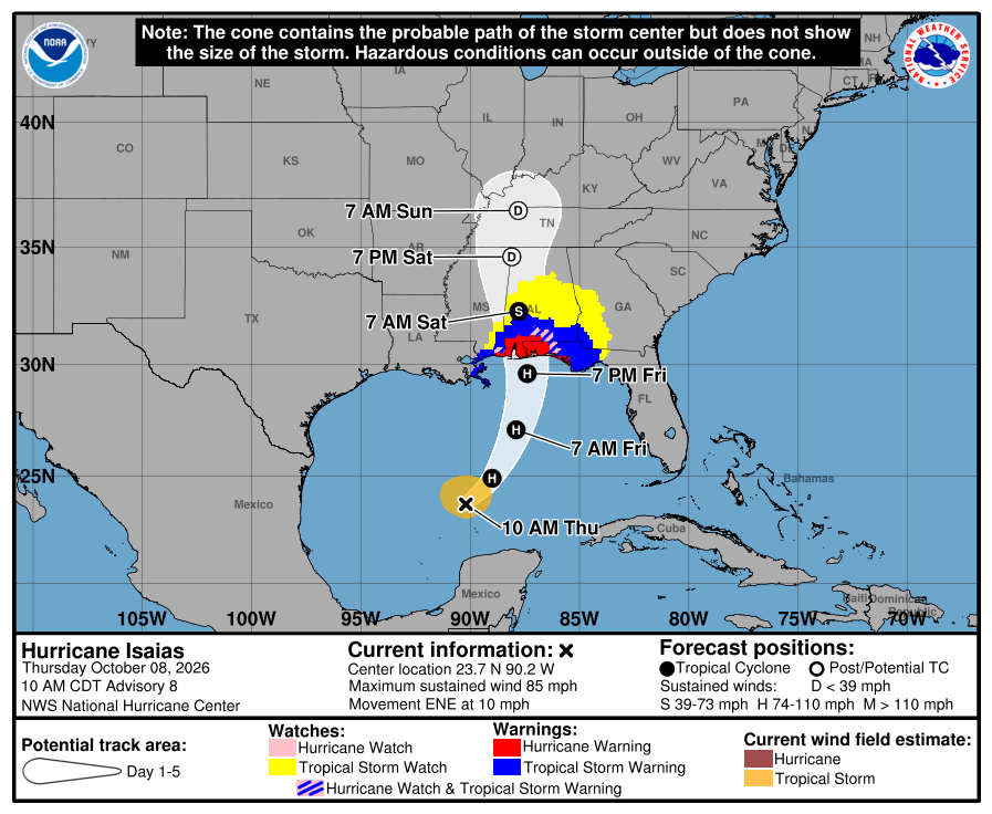
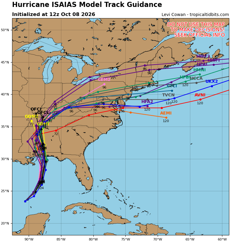
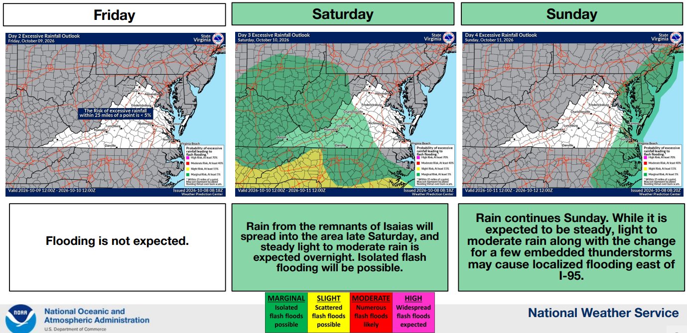


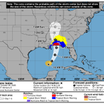
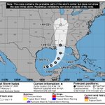
ALT NWS National Hurricane Center forecast track graphic for Tropical Storm Isaias, issued Wednesday, October 07, 2026, at 5 PM EDT (Advisory 5). At 5 PM EDT, the center of Tropical Storm Isaias was located near latitude 22.7 North, longitude 92.9 West. Isaias is moving toward the east-northeast near 8 mph. A continued east-northeastward motion is expected today, followed by a turn toward the northeast and north on Thursday and Friday. On the forecast track, Isaias is expected to pass to the north of the Yucatan Peninsula on Thursday and make landfall along the U.S. northern Gulf Coast late Friday or early Saturday.


ALT Key Messages: 1. There is an increasing risk of dangerous wind and storm surge impacts along portions of the northern Gulf Coast, and watches could be required on Wednesday. Residents from Louisiana to the Florida Panhandle should closely monitor the latest forecast updates and ensure they have their hurricane plan in place. 2. The system will bring areas of heavy rainfall to the central U. S. Gulf coast Friday into the weekend. Flash and urban flooding, along with isolated river flooding, will be possible. 3. Yucatan Peninsula of Mexico: The depression is expected to strengthen and could bring gusty winds and areas of heavy rain to the western portion of the Yucatan Peninsula in a couple of days.
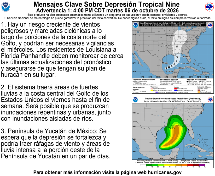
ALT Mensajes clave: 1. Hay un riesgo creciente de vientos peligrosos y marejadas ciclónicas a lo largo de porciones de la costa norte del Golfo, y podrían ser necesarias vigilancias el miércoles. Los residentes de Louisiana a Florida Panhandle deben monitorear de cerca las últimas actualizaciones del pronóstico y asegurarse de que tengan su plan de huracán en su lugar. 2. El sistema traerá áreas de fuertes lluvias a la costa central del Golfo de los Estados Unidos el viernes hasta el fin de semana. Será posible que se produzcan inundaciones repentinas y urbanas, junto con inundaciones aisladas de ríos. 3. Península de Yucatán de México: Se espera que la depresión se fortalezca y podría traer ráfagas de viento y áreas de lluvia intensa a la porción oeste de la Península de Yucatán en un par de días.


ALT Major tidal flooding is expected for the Northern Neck, northern Middle Peninsula, along the lower York River, through the James River, and for Norfolk down to Corolla. Moderate flooding is expected for Dorchester and Somerset Counties in MD, the upper York River, southern coastal Mathews, Gloucester, Poquoson, Hampton, Suffolk, Portsmouth, Northampton, and Accomack Counties. Moderate to major flooding is possible for Cambridge, with minor at Ocean City.

ALT Upper Bay flood hydrographs. Lewisetta high tide early mid-day today and again early morning Friday, reaching major flood stage. Windmill Point high tide later this morning and again late this evening, reaching major flood stage. Crisfield high tide later this morning and again overnight tonight, reaching minor to moderate flood stage.

ALT Lower Bay hydrographs. Sewells Point high tide this morning and again this evening . Lynnhaven high tide into major flood stage this morning and again this evening. Kiptopeake high tide into major flood stage later this morning and again late this evening.


ALT Major tidal flooding is expected for the Northern Neck, northern Middle Peninsula, along the lower York River, through the James River, and for Norfolk down to Corolla. Moderate flooding is expected for Dorchester and Somerset Counties in MD, the upper York and Rappahannock Rivers, coastal Mathews, Gloucester, Poquoson, Hampton, Suffolk, Portsmouth, Northampton, and Accomack Counties. Minor flooding is possible for Cambridge and Ocean City.