

Emergency Management Twitter Account California State University, San Bernardino (CSUSB) 909-537-7477 ~Not Continually Monitored~
- Tweets224
- Following88
- Followers31
- Likes1.2K
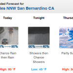




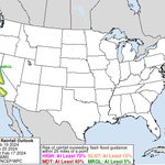


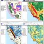



ALT A cold storm system will move over the area Thursday through Sunday. expect light rain or drizzle on Thursday, with more significant rain overspreading the area on Friday. There will likely be periods of moderate rain, with 6-18 inches of snow above around 7000 feet. Snow levels will lower to 3500 to 4500 feet Saturday night into Sunday, with potential for impacts on and below Tejon Pass. Expect chain restrictions and possible closures above 5500 feet. Be alert for mud and rockslides on canyon roads, and below steep slopes.


ALT Gusty westerly winds are expected over the mountains into the deserts Monday into Tuesday. Wind gusts 40 to 50 mph are expected Monday night into Tuesday. Winds will be strongest below passes such as I-10 in San Gorgonio Pass and I-8 in San Diego County near Imperial County line.

ALT Best chance of rain is Monday night into early Tuesday morning. Forecast Rainfall Totals: Coast: 0.05-0.10 inches; Valleys: 0.05-0.15 inches; Mountains: 0.10-0.25 inches; Deserts: none

ALT Light snow accumulations expected 6500 ft and above. Most likely amounts are a trace to an inch.


ALT A screenshot from the linked video briefing, featuring an NWS Meteorologist providing an update on storm total rainfall amounts.

ALT Forecast rain totals through Wednesday. Orange County/western Inland Empire: 1.5-2 inches, Eastern Inland Empire: 1-1.5 inches, San Diego County coasts/valleys: 0.6-1.3 inches, highest north, San Bernardino Mountains: 1.5-3 inches, locally 5 inches or more, Riverside/San Diego Mountains: 0.7-1.8 inches, High desert: 0.25-0.6 inch, Low deserts: 0.05-0.2 inch

ALT A strong storm Sunday through Tuesday will likely bring periods of heavy rain (2-5 inches of rain), mountain snow (several feet at high elevations), strong winds, flooding, and possible power outages. Stay safe: avoid low-lying areas and large waves at the coast, be prepared for disruptions, and be sure to monitor the latest weather forecast.


ALT A vigorous inside slider will bring another round of strong and damaging winds to portions of the area, rain chances and mountain snow Wednesday into Thursday. The strongest winds will likely be in the mountains, foothills, and Southwest Santa Barbara County where gusts of 50-70 mph are expected, with local gusts up to 80 mph possible. Snow levels will be 4000-4500 feet, lowering to around 3000 feet by early Thursday. A winter storm warning is in effect, with 2-5 inches of snow in the mountains, including the I-5 near Tejon Pass, cold wind chills due to strong winds, and low visibility in blowing snow. Significant travel delays are likely. Hide Caption


