Ronald Martinez (@CAStormLover) header
Ronald Martinez (@CAStormLover) profile picture

21 y/o | Weather Enthusiast🌪 | Catholic ✝️ | John 3:16 🙏🏼 | Nationalist | Aviation Worker ✈️ | Central Valley Photographer 📸 🇺🇸

Stockton, CA
Joined April 2017
Photo by Ronald Martinez (@CAStormLover)Photo by Ronald Martinez (@CAStormLover)Photo by Ronald Martinez (@CAStormLover)Photo by Ronald Martinez (@CAStormLover)Photo by Ronald Martinez (@CAStormLover)Photo by Ronald Martinez (@CAStormLover)Photo by Ronald Martinez (@CAStormLover)Photo by Ronald Martinez (@CAStormLover)Photo by Ronald Martinez (@CAStormLover)Photo by Ronald Martinez (@CAStormLover)
Henry Doorly Zoo and Aquarium with @samromshek in Omaha, Nebraska 📍 #nature #photography #animals #naturephotography #Omaha #Nebraska #Zoo – at Omaha, NE
3
24
Ronald Martinez retweeted
Tropical Storm Rachel will bring copious amounts of rain to Southern California starting Sunday. The exact track remains uncertain but a landfall anywhere from San Diego to Ensenada is LIKELY. Regardless of where it makes landfall it is historic in nature. High winds along the coastlines are possible. Tropical Storm Watches have been issued for San Diego County & the far north coasts of Baja California. Rachel is forecasted to strengthen a little before landfall from baroclinic forces and trough interaction at play. Hard to not sugar coat this but we are living through historic times folks and this goes far beyond #RACHEL. A raging Super El Niño unlike we've ever seen before in modern history and a historic winter is likely on our doorstep here in California and across the country. I will talk more about it in the coming weeks but I am close to coming to a general consensus for Winter 2026-2027 and will be posting my Winter forecast by November. Stay tuned. #CAwx #WxTwitter
1
3
243
Ronald Martinez retweeted
Wanted to share my thoughts on El Niño this winter in California. This year's winter forecast for the state is the most extreme we've seen this far out, probably in modern history. The C3S model blends 9 of the world's top seasonal models into one, with over 450 member models. It's showing the highest forecast confidence we've ever seen for a wetter-than-normal winter in California: a nearly 100% chance of an above-normal winter and a well-over-70% chance of a top-third wet winter. To see this from a model this large is, in a word that's used too often, unprecedented. Many of you remember the same hype around the last Super El Niño in 2015-16. That year didn't deliver, and it didn't pull California out of its worst drought in state history. But here's where it gets interesting. The ECMWF SEAS5 model, the gold standard of seasonal models, did not predict a blockbuster wet winter for 2015-16 despite the super El Niño. In reforecasts for 1982-83 and 1997-98, two other super El Niño years, it did predict very wet winters. Those years look much more like this one, because they were strong and east-based. For this winter, SEAS5's wettest 20% of members show 250 to 300% of normal precipitation from the Bay Area to SoCal, and a mean of 150 to 200% of normal statewide. Several members show coastal California having its wettest winter on record, with the highest odds from the Bay Area down to SoCal. The guaranteed impact from El Niño this winter on the state is major coastal flooding and erosion. San Francisco is expected to see about 30 king tide days this year, and it would take just a moderate storm at peak king tide, to break the high water mark record. Much of the Bay Area's infrastructure and homes sit only a few feet above sea level, so a new record could have severe impacts. King tides are expected Nov 24 to 26, Dec 22 to 25 and Jan 20 to 23, windows when large winter storms are quite possible. El Niño will add 12 to 15 inches to sea level on top of long-term sea level rise. In a worst-case scenario, a strong storm landing on a king tide, with the moon's gravitational pull nearing a 19-year high, could push water 3 to 5 feet above high tide. That could cause major flooding along Highway 101, SFO, the Embarcadero, Highway 80 and many bayside and coastal communities. We've already seen El Niño's impacts in SoCal: severe coastal damage from elevated sea levels, combined with dangerous surf from Hurricane Marie, part of an El Niño-fueled record burst of hurricane activity in the eastern Pacific. Stay tuned.
94
224
28
2,022
187,962
Ronald Martinez retweeted
Just did some number crunching using latest (Oct 1) ECMWF seasonal data, and I must say that I've never seen such high predictive confidence in a very wet California winter. This is a truly extraordinary forecast amid a record-strength El Niño event. [Thread: please read to end.]
31
224
33
1,134
80,003
Ronald Martinez retweeted
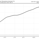
The brand new ECMWF El Niño forecast has just arrived, and it's quite something. It shows the El Niño peaking around or just above 4°C in December. But what's most notable is the duration of record-breaking conditions, with with many members remaining above 3°C into April!
22
199
26
735
77,570
Hurricane Polo has strengthened into a Historic Category 5 Hurricane with a pressure of 889.7mb with sustained winds of 180 MPH. This is the second lowest pressure ever recorded in the Eastern Pacific Basin behind Hurricane Patricia. Residents in Baja California should monitor this storm closely for potential impacts. More updates to follow on this historic storm fueled by Super El Niño. #WxTwitter #Polo
1
3
406
Ronald Martinez retweeted
Category 5 Hurricane Polo has achieved a new peak intensity of 165 MPH and 920 MBAR. He is now forecast by the NHC to reach further sustained winds of 180 MPH, with gusts up to 220 MPH. Polo may be on the verge of becoming one of the strongest Pacific Hurricanes of all-time.
20
199
16
1,118
66,285
Good Morning/Afternoon! It is September 1st, the first day of Meteorological Fall. Welcome back everyone and I hope you have enjoyed summer! We have lots to talk about over the next couple of months as we prepare for the strongest El Niño in modern history and its impacts across California that will be strongly felt this winter. I am writing this on August 25th so numbers may be slightly outdated but as of now the El Niño is currently at +2.6°C and is expected to continue to strengthen throughout September and beyond. We will continue to monitor this as the months progress into the Winter Season. Speaking of which my Winter Forecast will be released sometime in Late October. Let me update you on the latest. We have recently seen a surge of tropical activity across the Eastern & Central Pacific which is pretty typical for a Super El Niño year. I will monitor this to see if there is any rain chances for the state. ENSO updates will continue throughout September and I will be watching this closely. Stay tuned for more updates in the meantime! #CAwx #WxTwitter
1
12
505
Important statement regarding Invest 95E. #CAwx #WxTwitter
1
11
867
Ronald Martinez retweeted
Happy 250th Birthday, America 🇺🇸
1,031
14,545
380
89,764
1,121,706
Happy Independence Day! There’s a story from the end of the Revolutionary War I want to tell as we celebrate America’s 250th Birthday, and it’s one everyone in the world can learn from. George Washington, at that moment, after commanding the American forces to victory, was the most powerful man in the new country. Many people talked about making him King of America. Across the ocean, King George was sitting with an American painter, and asked what he thought Washington would do now that the war was ending. The painter said he believed he would go back to his farm. The King said, “If he does that, he will be the greatest man in the world.” As the war officially ended, Washington came to speak to Congress and said, “Having now finished the work assigned me, I retire from the great theater of Action.” He returned his commission they’d given him in 1775 - after more than 8 years of leading the Americans to victory without pay, and he was home at Mount Vernon for Christmas. Of course, he was elected as our first President a few years later, and after two terms, showed the same selflessness again when he willingly gave up his power and went back to Mount Vernon again. That’s true greatness. He had all the power in the world. But power, alone, does not make you great. Washington’s greatness came from being a true servant - to a cause much bigger than himself. His greatness was his complete lack of selfishness. The whole story of American Independence is a story of selflessness. It’s a story of people who set their self-interest aside and worked for each other. We’ve all heard the line about “We must all hang together, or, most assuredly, we shall all hang separately.” Apparently, Ben Franklin might have actually never said that. But that’s fine, because the same mentality is right there in the last line of the Declaration of Independence, published on this day 250 years ago: “And for the support of this Declaration, with a firm reliance on the protection of divine Providence, we mutually pledge to each other our Lives, our Fortunes and our sacred Honor.” We mutually pledge to each other. No one was in this alone. No one was in it for themselves. This was a group of people with different backgrounds who were in it for each other. Today is a reminder: greatness comes from what we do for each other, never what we do for ourselves. That’s a lesson that applies no matter what country you call home. It’s a lesson that doesn’t require any law passed by a politician, because, let’s be honest, if you’re waiting for selfless politicians, I really hope you are not holding your breath. All of us have the power to be there for the people around us. For our families and friends. For our neighbors. For everyone. All of us can reach for greatness. It’s as simple as looking beyond yourself, seeing past the mirror, picking your eyes up from your phone, and pledging to be there for each other. Happy Fourth. May you all find your own version of greatness today by lifting each other up. Lift up your neighborhood. Lift up America. Lift up the World.
857
4,711
184
43,367
650,309
3 Tornadoes were confirmed yesterday in Central California. High end EF-1 110 MPH W of Atwater, CA at 3:30 PM EF-1 95 MPH NE of Clovis, CA at 5:09 PM EF-0 70 MPH near Biola, CA at 2:10 PM This marks the most significant single day tornadic event in the state since February 2019. #CAwx #WxTwitter
HNX issues Damage Survey PNS (Max: EF1) at Apr 22, 12:19 PM PDT ...NWS Damage Survey for Monday April 21st, 2026 Tornado Event... mesonet.agron.iastate.edu/p.…
1
3
15
1,687
Ronald Martinez retweeted
Tornado Warning including Old Fig Garden CA, Biola CA and Rolling Hills CA until 2:45 PM PDT
16
42
21
117
28,424
Happy Easter to everyone! Have a blessed day! #EasterSunday John 3:16 🐣🙏🏼✝️
1
249
Blood Moon fully visible in many parts of California. 3:20 AM 3/3/26 #LunarEclipse2026 #LunarEclipse #CAwx #WxTwitter
9
941
Models continue to uptrend on rainfall & snowfall amounts with the newest surge of precipitation forecasted for week 4 of February. Temperatures will be several degrees below average for weeks. The pattern is still developing, a very wet February is now likely. #CAwx #WxTwitter
3
9
2
149
9,102
The most aggressive Winter Storm Watch this season has been issued for Northern & Central California, it covers foothill elevations due to the possibility of a significant amount of snow at 3,000 feet. Along I-80 the Winter Storm Watch starts just before Auburn at Newcastle, for Hwy 50 it starts at Cameron Park. While accumulating snow at 1,000 feet is unlikely at the moment these are precautionary measures that it cannot be ruled out. The Euro model properly supports this possibility as it’s been trending colder in recent model runs. #CAwx #WxTwitter
A Winter Storm Watch has been issued for the foothills and mountains from Sunday evening through Wednesday evening. Expect major travel impacts from heavy snow, and mountain travel is highly discouraged during this time! #CAwx
1
7
1,228
It’s a miracle! A welcome sight after a month of inactivity, a major pattern change will take shape across all of California starting tonight lasting well into mid February where several inches of rain (2-4”) and several feet of mountain snow (5-10 feet+) is expected to fall throughout the state. Low elevation snow is expected with snow accumulation a little under 3,500-4,000 feet possible with some systems. More updates later, stay tuned! 🌧️❄️ 1/3 #CAwx #WxTwitter
2
2
19
687
Places like South Lake Tahoe, Carson City and Reno have the chance to see the most snowfall they’ve seen all season with multiple feet of snow possible in the city of South Lake Tahoe and several inches of snow for Reno and Carson City. 2/3 ☃️ #CAwx #NVwx #WxTwitter
1
1
8
667
A HIGH risk for heavy rain and snow has been issued for portions of California, flooding threats will be evaluated in the coming week as individual systems come into frame. 3/3 #CAwx #WxTwitter
4
459