

We are a local government agency, dedicated to helping our citizens, first responders, and officials prepare for, respond to, and recover from disasters.
Butler County - Augusta, KS
Joined May 2016
- Tweets2K
- Following80
- Followers366
- Likes229





Get ready for the first genuinely chilly weather of the season... a Sparkly-Surfaces Advisory is in effect for tomorrow morning as temps dip down to the lower 30s. Highs in the 50s... but they won't last. Mother Nature has 70s and 80s planned for later next week (seriously??).

It's a special two-for-one day... not only do we have a Flood Watch going on, but now they've added on a Severe Thunderstorm Watch. We feel so loved.

If Mother Nature was playing cards, today's hand would include record high temps (possible), severe wind and hail, a chance for a brief twister, so much rain that it gave us a Flood Watch.. and then a few days later, air so chilly that frost could be possible (Saturday).

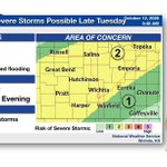
Mother Nature is about to break our extended spell of sunny-and-warm conditions. Severe storms could erupt Tuesday evening, bringing gusty winds, large hail, and heavy rainfall. Scattered storms may continue on Weds and Thurs before a BIG (Canadian air) cool-down...

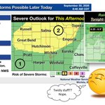
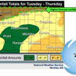
After an upgrade, today's weather model (Weds Weather 2.0) now has a leveled-up severe risk that comes with a chance for brief, weak twisters (yay). Heavy rainfall is still planned, too, but our forecasted totals have fallen a bit...

Continuing showers and t-storms are still possible from now through Thursday night. BU CO's biggest rainfall numbers are scheduled for Thurs, but severe weather chances are highest on Weds (so far). The primary flood concerns are still central and SE KS (also, so far).

While we aren't in hurricane country, we could see some hurricane-country effects as Polo helps push wet and soggy air our way. Rain chances start tomorrow and pick up dramatically late Weds through Thurs. We've been left out of the flood watches... so far.

The Rainfall Distribution System (RDS), not to be confused with the Cat Distribution System (CDS), is avoiding us today. However, chances get better on Fri and Sat. Could see a few strong storms mixed in with our sporadic showers (currently a Marginal severe threat Sat).

As long as Mother Nature didn't hear the "Q" word being used, we should be in for a nice run of much cooler (and calm) air! Highs primarily in the upper-70s all week, and another moisture chance arriving late-week (good news, since we got a little shorted on the last round!).

First more heat (could reach 100 today), then severe storms (possibly popping in central KS this afternoon and then moving our way), and then FINALLY the start of our cool-down (better on Sunday and then lovely by Monday!).

One more steamy day (Sat) before we launch into the cool-down. However, we also may have to ride out some storms first. Mother Nature leveled up our severe weather (wind and hail) threat for Sat evening. Rainfall may continue into Sun, but without the extra-cranky clouds.

The hot and sticky air is going to continue through Saturday.. but that may be the end of the suffering! A front will bring rain Sat night/Sunday, as well as cooler air. 80s forecasted here for Sun and 70s on Mon!! BTW: some Sat night storms could get a little feisty...

And Mother Nature is heating us back up... back to "above normal," but fortunately, not to the same level we were before. We may also see another rainfall chance on Tuesday aft/eve.. which may come with some marginally severe t-storm winds (always strings attached with M.N.).

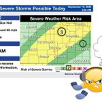
In response to our complaints about stingy moisture, Mother Nature has slapped a severe weather risk day on us (wait... what?). Sometime between late afternoon and late at night, we could see storms with dmg winds, large hail... and hopefully rain (how about JUST the rain?).

After 10+ straight days of 100+ temps and 2 weeks of no rainfall, Mother Nature is offering some forecast fixes. A front should arrive sometime Weds bringing both rainfall (evening/overnight especially) and the beginning of a break from heat. Even more cooling arrives this wkd!

Mother Nature is queuing up some heat and occasional rainfall chances, and guess which one we get? Triple-digit heat will return this weekend and continue through... well, as far as we can see at the moment. But that moisture? Unfortunately, most likely headed somewhere else...

Those "green" Marginal risk days haven't earned us much moisture lately, but we're going to try again tomorrow. Better chances are NW of the Turnpike, but maybe we'll see rain? (And maybe marginally severe stuff?) The heat is down a bit this week, but don't look beyond Friday...

Get geared up for heat again today... and maybe some rocky skies overnight? Heat index will be around 100 degrees here, and there is a small chance for some strong-to-severe stuff tonight. But the wkd is shaping up to be not as miserably sweltering!

Slightly less heat (at least for the next couple of days), but also slightly less moisture in the plans? Highs will be around 90 today and Thurs. Moisture could visit this morning (trying to lure it south), but the extended outlook has primarily dry skies... and more heat coming.

