

Retired from TV after 27 years, but will always be a meteorologist. Wisconsin born and raised. Family is everything. Purpose: make others smile & laugh!
Milwaukee
Joined March 2009
- Tweets20.2K
- Following575
- Followers6.1K
- Likes5.3K


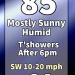


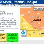


Rain and a few storms are likely Tuesday morning into early afternoon.
The best chance for severe weather is south of I-94 as huge storms roll across northern Illinois.
Some areas near the state line could see 1”. Look at Chicago and areas south with 2-5” of rain on Tuesday.


I hope everyone had a great weekend.
There is still a chance for some heavy rain along the state line overnight from severe storms firing up in northern Illinois.
Monday morning is foggy with lows in the upper 60s.
Highs are near 80 with steamy humidity and a light breeze.

It is humid, and we will see fog develop overnight with lows in the mid 60s. Once the fog burns off mid morning, the rest of the day is sunny and humid with highs in the mid to upper 70s. The wind will be light off the lake.
Enjoy the first day of the Wisconsin State Fair.

8/4 10:20pm
Still expecting rain to develop overnight and then scattered throughout the day. No severe weather is expected and it will not be a washout.
Most of us should see between a half inch to some isolated 1” totals.
It will be cloudy, damp, with highs in the 70s.


Tuesday is warm and humid once again with highs in the mid 80s.
Northern and central WI see rain showers midday along a cold front. That front moves south and brings showers to southern WI by early evening. The best chance for rain is after 10pm and overnight into Wednesday.


It has been a cloudy start to Sunday, but give it an hour and southern WI will be clear like the rest of the state.
Enjoy the afternoon sunshine and highs in the mid to upper 70s.
NE wind at 10-20mph.
#sundayfunday

Scattered downpours later this evening and overnight. No severe weather expected.
Scattered showers Saturday morning and again in the afternoon.
It won’t rain all the time or everywhere, but showers are likely from now until Saturday afternoon. 1-2” of rain is expected.


Storms develop this evening Up North. Those storms track SE overnight and arrive in SE WI after 2am.
Most of Wisconsin is under a level 3 of 5 risk. Best chance for large hail is in the Northwoods. The main risk around the state is for damaging wind


Summer lovers…it’s back!
A heat advisory has been issued for Sunday for most of SE Wisconsin. 90s with dew points in the 70s create heat indices in SE Wisconsin to 100°
Western WI is under an Extreme Heat Warning Sunday afternoon and evening for heat indices up to 110°.

One more day of low dew points and comfortable air before the steam returns for the weekend and early next week.
#Milwaukee #humidity

Just like that…a taste of fall, especially in the Northwoods with lows in the 40s.
The AC is getting a break tonight, and if you don’t have AC, it’s finally great sleeping weather.
#Wisconsin #coolnight

Today is sunny and windy with highs near 80.
The dry air has moved into the region, and Wednesday will be even cooler with highs in the mid 70s.
The humidity remains low through Saturday as temperatures start a warming trend. Sunday is back to July heat and steamy air.

It has been a cloudy and cool start to your Monday, but the heavy rain in SW WI is moving out and taking the clouds with it.
Expect a big warm up and increasing humidity this afternoon to fuel some evening thunderstorms
#Wisconsin #sunshine

A warm front brings a gusty SW to 35 mph on Monday. As a result, temperatures and dew points increase all day. By late afternoon, highs will be in the mid 80s with dew points reaching tropical 70°. This is fuel for late day storms which will likely be severe along the cold front.


We need rain, but not the severe storms that are in Monday’s forecast.
Look for storms to develop after 5pm and into the evening. Damaging winds, large hail, tornadoes, and heavy rain are all possible.
Stay tuned for updates.
#Wisconsin #SevereWeather


It’s the weekend!
This morning has a few clouds as a cold front moves through the area. There is just a slight chance of a morning shower
It is a warm and humid start to the day, but the dew point and temps drop this afternoon.
Sunday is smokey and cooler with highs in the 70s


Tuesday is another hot day with highs in the upper 90s across SE Wisconsin.
Don’t expect clouds to provide shade…the sky is clear.
The westerly breeze is not strong…no relief there.
The little bit of relief comes from some “drier air” moving in during the afternoon.


Noon update:
It has heated up and is very humid across SE WI. Some spots are already 90.
The sun is intense and there isn’t much of a breeze to help. Stay cool


