

Advancing the state-of-the-art and practice of the Civil and Environmental Engineering (CEE) profession and shaping new directions in the broad CEE industry.
Athens, Greece
Joined February 2015
- Tweets163
- Following63
- Followers82
- Likes19
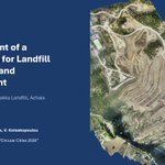
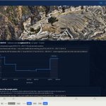

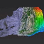


At the 9th HSWMA Conference in Athens we presented a digital twin of the Xerolakka landfill: 7 drone surveys (2019–2025) in one platform. Comparing them all together revealed the real settlement trend. argo-e.com/en/news/argo-e-gr…
#DigitalTwin #Landfill #UAV

Αύριο 2/10, 13:15, Αίθουσα Β: παρουσιάζουμε το Ψηφιακό Δίδυμο του ΧΥΤΑ Ξερόλακκας στο 9ο Συνέδριο ΕΕΔΣΑ. 7 αποτυπώσεις UAV (2019–2025) σε μία πλατφόρμα, με ζωντανή επίδειξη.
#DigitalTwin #ΕΕΔΣΑ #ΚυκλικέςΠόλεις2030
argo-e.com/el/news/argo-e-gr…

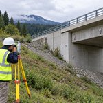
Ground and structures move. The key is knowing how much, how fast, and when action is needed. Explore monitoring methods, baselines and trigger thresholds in our latest article.
🔗 argo-e.com/en/news/monitorin…
#StructuralMonitoring #Geotechnical #Engineering
🤖 Made with AI

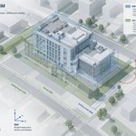
GIS and BIM can exchange files. That does not mean they truly integrate.
The real issue is specification: coordinates, schemas, detail, validation and ownership.
Read more: argo-e.com/en/news/why-gis-a…
#GIS #BIM #DigitalEngineering #Geospatial
🤖 Made with AI

The redesigned ISSMGE website is live. New homepage, new typography for long-form reading, and every web address unchanged — bookmarks, citations and the full archive intact.
New face, same foundations: argo-e.com/en/news/the-new-i…
#ISSMGE #Geotechnical #WebDev #WebDesign

ARGO-E GROUP mapped the rocky slopes at Acrocorinth Castle's entrance by UAV, supporting GEOCON Consulting's rockfall study for an international film production. Thanks to Dr. Charis Saroglou, NTUA.
More: argo-e.com/en/news/reality-m…
#RealityModeling #UAV #Acrocorinth

📲 A brand-new app, a whole new experience. See how we brought ISSMGE's mobile platform to life
argo-e.com/en/news/argo-e-gr…
#SoftwareDevelopement #MobileAppDevelopment #ISSMGE #Engineering

For Project VORIA in Marousi, ARGO-E transformed the road design and traffic study by DROMOS Consulting into 3D models, photorealistic visualizations and traffic simulations.
Reality Modeling & Animations: ARGO-E
🔗 argo-e.com/en/news/project-v…
#RealityModeling #3DVisualization

🚀 ARGO-E GROUP, with UC Berkeley and Yuba Water, launches the Levee Digital Twin Platform for California’s Yuba River Corridor. Explore 2D/3D views, LiDAR, sensor data, and live monitoring for smarter levee management.
argo-e.com/en/news/launch-of…
#Monitoring #DigitalTwins #Levee

LiDAR or Photogrammetry for your next infrastructure project?
🔵 LiDAR → sees through trees, ±2cm, works at night
🟠 Photogrammetry → photorealistic, lower cost
🔀 Hybrid → best of both
Full breakdown 👇
argo-e.com/en/news/lidar-vs-…
#LiDAR #Photogrammetry #Geospatial #UAV

Days of ground surveys → hours of drone flight.
Centimeter-level accuracy. Safer sites. Richer data.
Our latest article breaks down how drone mapping is transforming infrastructure project delivery 👇
argo-e.com/en/news/how-drone…
#DroneMapping #UAV #Infrastructure

Reactive infrastructure management is becoming obsolete. Digital twins offer real-time monitoring, predictive maintenance & scenario modelling across the full asset lifecycle. Our latest article breaks it all down 👇
argo-e.com/en/news/what-is-a…
#DigitalTwin #SmartCity #Infrastructure

🚀Excited to welcome Prof. Eugene O'Brien to ARGO-E for a one-month secondment! Collaborating on digital twins, infrastructure resilience & structural health monitoring.🌍🏗️📡#PORTAL #HorizonEurope #DigitalTwin #InfrastructureResilience #StructuralHealthMonitoring #MSCA #RDS

xciting news! ARGO-E joins PORTAL, a Horizon Europe project building resilient ports with digital twins, simulations & decision tools. We’ll lead on geospatial analytics, risk modelling & AR/VR visualization.
#DigitalTwins #SmartPorts #Innovation
argo-e.com/en/news/argo-e-jo…
🤖 Made with AI

Photorealistic study for a 55.44MW solar project with 110.88MWh storage in Northern Greece.
29 viewpoints, precise 3D modeling and vegetative mitigation scenarios.
Solar + Storage demands visual precision.
#Solar #BESS #PV #RealityModeling #Renewables
argo-e.com/en/news/photoreal…

At ARGO-E, we developed a new legacy website dedicated to Dr. J.P. Giroud, showcasing his pioneering contributions to geosynthetics.
argo-e.com/en/news/argo-e-de…
#JPGiroud #Geosynthetics #WebsiteDevelopment

53 high-resolution visualizations, precise 3D modeling and DSM integration for a landscape-sensitive utility-scale development.
Visual simulation is essential in large-scale solar permitting.
#SolarEnergy #UtilityScale #400MW #RealityModeling #Renewables
argo-e.com/en/news/photoreal…

Proud to co-author a landmark paper on UAV-enabled landfill monitoring in Greece — redefining how we measure waste settlement at scale. Read more:
argo-e.com/en/news/argo-e-co…
#UAV #Geotechnics #Innovation

18 viewpoints, 4 layout scenarios, precise 3D reconstruction & photo matching for realistic stakeholder visualization.
Visual simulation is a strategic permitting tool.
#SolarEnergy #PV #GlareStudy #RealityModeling #Renewables
argo-e.com/en/news/photoreal…

From precise 3D modeling to virtual flight simulations, we transform technical layouts into immersive project presentations.
Solar development needs more than design — it needs visual strategy.
#SolarEnergy #PV #3DVisualization #Renewables #RealityModeling
argo-e.com/en/news/3d-aerial…
