

Forecasting Excellence for your tomorrow. Serving Southern Ontario with the latest weather alerts and information.
Southern Ontario
Joined January 2019
- Tweets5.8K
- Following813
- Followers775
- Likes4K


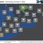

Saturday will be a cooler day across the region, with clouds departing to lead to mainly sunny conditions for much of the day.
There will be the potential for some flurries tomorrow, mainly in Central and Eastern Ontario, however no accumulation is expected.
Frost Advisories are in place for some areas tonight as temperatures are expected to fall near or below the freezing mark for much of the region. However, Frost Advisories have ended for the season for much of Southern Ontario. Ensure plants are covered or brought inside to prevent damage.

Thursday will be a cool day across the region with a mix of sun and cloud. Some rain is expected to begin during the evening.
The rain that begins tomorrow evening is expected to continue into Friday for much of the day. We are expecting breezy conditions through the day as well.
This weekend continues to look like it will feature a cool down, with low temperatures near or below the freezing mark likely.

Wednesday will be a cooler day across the region with a mix of sun and cloud. More clouds than sun are expected in Central Ontario. Some rain is likely in the morning in Southwestern Ontario.
The next few days are expected to be on the cooler side across the region. We continue to monitor the chance for rain and windy conditions on Friday.
Additionally, we are monitoring the potential for temperatures to fall near or below the freezing mark for the upcoming weekend.

Tuesday will bring varying conditions to the region, with single digit temperatures expected in Central Ontario and Humidex values in the 30s in Southwestern Ontario.
Rain and thunderstorms will begin this evening in Central and Eastern Ontario and will continue through the day tomorrow. Nearly all areas will likely see rain and potentially some thunder during the morning hours before clearing.
Rain may be heavy at times, and thunderstorms will be possible at any time due to the warm airmass in place. Some thunderstorms in Central and Eastern Ontario may become severe with strong wind gusts and small hail being the main threats.
Localized flooding will be possible tomorrow, especially for areas that receive multiple rounds of torrential downpours. Ensure you do not drive through flooded roadways.
Temperatures in yellow represent forecasted Humidex values.

**Rain and Thunderstorms Expected Tuesday**
Rounds of rain and thunderstorms are expected through the day on Tuesday, mainly throughout Central and Eastern Ontario.
Rain will begin moving in this evening and will continue through much of the day on Tuesday. Rain will be heavy at times, bringing 30 to 40 millimetres to portions of Central and Eastern Ontario. Localized rainfall amounts will vary and higher amounts are possible depending where torrential downpours setup. Flooding will be possible, and flash flooding may occur where torrential downpours reoccur over the same area.
Much of the area will see some rain and potentially some thunder during the morning hours before clearing out. Thunderstorms will be possible at any time with a warm airmass in place.
Some severe thunderstorms will be possible in Central and Eastern Ontario with wind gusts of 90 km/h and hail 2 to 3 centimetres in diameter being the main threats, therefore a Very Low risk has been placed over these areas. Rainfall totals of up to 60 millimetres are also possible, locally, and there is a low risk for an isolated weak tornado.
Environment Canada has issued a Special Weather Statement for portions of Central and Eastern Ontario, stating that local rainfall amounts of 40 to 60 millimetres are possible beginning tonight and ending Tuesday afternoon or evening. They have mentioned that showers and a risk of thunderstorms are expected, with the risk for severe thunderstorms.
If travelling in heavy rain, ensure you slow down, avoid using cruise, and turn your full lighting system on. Ensure you do not drive through flooded roadways.


10:25 PM ET - Visibility is currently reduced in some areas, with London Airport and Windsor Airport reporting visibility of 5 km.
Fog has developed across portions of the area. Please travel with caution this evening, overnight and tomorrow morning.
#ONwx

Monday will bring a mix of sun and cloud to many areas, with cloudy conditions continuing through much of the day in Central and Eastern Ontario.
The day will likely begin with dense fog across much of the region. Fog may continue for part of the day in areas where cloudy conditions continue. If you have plans to travel for the Thanksgiving holiday, allow extra time and travel with caution.
The upcoming week is likely to bring a series of ups and downs, with warm temperatures likely Tuesday, rain and windy conditions likely Friday, then a cool down next weekend.
Advance Weather would like to wish everyone a very Happy Thanksgiving!
Temperatures in yellow represent forecasted Humidex values.

**Dense Fog May Impact Travel on Thanksgiving Day**
If you have plans to travel for Thanksgiving tomorrow, you will want to allow adequate travel time. Dense fog may impact your drive throughout the day depending where you are headed.
Many areas are likely to see fog during the morning hours. Fog may be patchy in some areas and dense in others.
Cloudy conditions are expected in portions of Central and Eastern Ontario through much of the day tomorrow. Without the sun being visible, the fog may persist through the afternoon and potentially through the evening hours.
Ensure you slow down and your full lighting system is activated if driving in fog.


Wednesday will bring varying conditions across the region, including showers for the GTA and Eastern Ontario, a mix of sun and cloud for Midwestern and Central Ontario, and sunny skies in Deep Southwestern Ontario.
The rest of the week looks relatively quiet aside from the chance for some showers. We are going to keep an eye on a chance of rain on Sunday, however uncertainty remains.

Tuesday will be a slightly warmer day across the region, with no precipitation expected along with sunny skies.
Frost Advisories are in effect for many areas tonight. Portions of Central Ontario are not under a Frost Advisory, however, the advisories have already ended for the season for some areas.
Ensure plants are brought inside or covered up tonight to prevent damage. Many areas will likely see low temperatures near or below 0ºC.
The rest of the week is expected to bring a few chances of showers.

5:17 PM ET - A Frost Advisory is in place for much of Southern #Ontario. Central Ontario is not included as Frost Advisories end there earlier in the month, however frost is still likely.
Ensure plants are covered up or brought inside to prevent damage as temperatures fall near 0ºC tonight.

Some more showers are expected Monday in portions of Central, Eastern and Southwestern Ontario. Otherwise, varying conditions of sun and cloud is expected. It will be a cooler day across the area.
We continue to monitor the risk for frost as temperatures will likely fall close to or below the freezing mark tomorrow night into early Tuesday morning. If you have sensitive plants, be prepared to cover them up.
The upcoming week looks relatively dry. We will keep an eye on a chance for rain around mid-week, but it doesn't look like it will amount to much at this time.

**Widespread Frost Possible Tuesday Morning**
We are monitoring low temperatures tomorrow night into Tuesday morning that may fall close to or below the freezing mark.
If temperatures fall low enough for Frost, this will likely be the first widespread frost of the season.
If you have sensitive plants, be prepared to cover them up to prevent damage. Stay tuned for further updates.

Sunday will bring showers, heavy at times, to much of the region. Sun and clouds are expected in Southwestern Ontario, with the risk for isolated showers.
Frost Advisories are in effect for portions of Eastern Ontario.

3:48 PM ET - Frost Advisory in effect for portions of Eastern Ontario.
Temperatures are expected to fall to near the freezing mark tonight into Sunday morning.
Damage to plants, trees, and crops is possible.
Ensure plants are brought inside or covered up to prevent damage.


Friday will be a cooler day across the region, with a mix of sun and cloud for all areas. No humidity is expected.
Rain and maybe some thunder is likely overnight into tomorrow morning. The rain is expected to clear out of the region by mid to late morning.
The next few days may bring some showers but are expected to be dry for the most part. Looking ahead to next week, we are watching the first chance for some widespread frost.

6:37 PM ET - RADAR UPDATE:
Rain is expected to move across the area tonight, with some periods of heavier rain possible. Some thunder is possible as well.
*Image courtesy of WeatherWise.

The month of October will begin with continued rain showers throughout the day on Thursday, with some breaks in the rain likely.
It will be a more humid day across Southern Ontario with portions of Southwestern Ontario likely to see Humidex values in the low 30s.
Another round of rain and potentially some thunderstorms is expected tomorrow evening and will continue overnight into Friday. Some lingering showers are likely Friday.
Temperatures in yellow represent forecasted Humidex values.

Wednesday will bring showers to much of the region, which will be intermittent through the day. Showers may be heavy at times. A mix of sun and cloud is expected for Eastern Ontario.
Some fog is possible again tomorrow morning across the region. Slow down and drive with caution in areas of poor visibility.
We are also watching the chance for more showers Thursday, and possibly some steadier rain on Friday. Some isolated flooding may be possible by the end of the week.
Tomorrow is the National Day for Truth and Reconciliation, also known as Orange Shirt Day. The day honours the children who never returned home and survivors of residential schools, as well as their families and communities. More information can be found on the Orange Shirt Day website.
