

GIS Developer @hntbcorp | 3D Printing Enthusiast | GIS Geek | App Developer | Husband | Dad | Traveler | Not So Secret Admirer of Natural Wonders
United States
Joined September 2010
- Tweets488
- Following361
- Followers206
- Likes113




Pinned Tweet
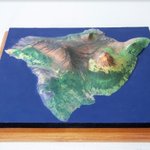
Thanks @shapeways, my second #3DPrint #ReliefMap was a smashing success!
shapeways.com/product/LU8XUW…


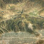
#30DayMapChallenge Day 24 #Elevation Rendering of the Central Wasatch Range outside Salt Lake City, Utah


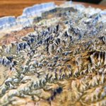
When I get bored I render DEM's using Blender. I have rendered the Grand Canyon before, but this time I played around with a 'perspective' camera view. #Blender3d #b3d


Ian Grasshoff retweeted

Earthquakes with exaggerated depth (and CSS filters of course😁) just had some fun for #30DayMapChallenge. Check it out on Glitch: glowy-earthquakes.glitch.me/


Ian Grasshoff retweeted

#esrijs 4.11 is released 🎉 The @ArcGISJSAPI team has been camping out at the office to finish the #JavaScript API release.
Now it’s here! Check out all the new features, such as placing @glTF3D models in your scene:
developers.arcgis.com/javasc…


LiDAR data is a great way to visual historic locations. Check out Fort Crown Point, New York. #3D, #VR or #AR skfb.ly/6BsEx via @sketchfab
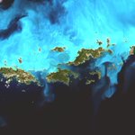
It's not often that you find near cloudless satellite imagery over tropical areas. It must have been a gorgeous day in the Virgin Islands when this #Sentinel2 image was captured. #Copernicus #EarthObservation


Check out this 3D model of Mount St. Helen's before the 1980 eruption. I was able to find false color infrared imagery from 1972. #3Dmodels #Geospatial #GIS #Map @Sketchfab
sketchfab.com/models/fcee45f…


My latest #3DPrinted #Map of the San Francisco Peaks, just north of Flagstaff Arizona.


Explore our moon's terrain with @Mapbox. I built this simple web app to help me learn how to use Mapbox gl js.
#MadeWithMapbox
smartmapps-lunar-map.s3-webs…
Ian Grasshoff retweeted

Landsat data used to be ~$600/scene.
A recent mosaic of mine used > 2300 scenes of data. In the past I'd owe $1.4M. That was for a single map; a day's work.
Technology has far outpaced the notion of paying for scenes. It's simply unimaginable.
nature.com/articles/d41586-0…