

Weather team providing live weather coverage with degreed meteorologists & storm chasers focused in Kentucky. Business inquiries:Zerometerchasers@gmail.com
Joined April 2025
- Tweets7.6K
- Following235
- Followers1.3K
- Likes2.3K




Zero Meter Chasers retweeted

Rinse, cycle and REPEAT! Chilly morning temperatures as you wake up this morning!
We will warm into the lower 70s in the afternoon today. Another PERFECT weather day!
Keeping a close eye on our drought status as we have not seen measurable rain in over SEVEN days! Some drought conditions are showing up in Central Kentucky.
Enjoy this weather while it lasts! Looks like an active pattern is taking shape as we begin November! Ready to fire up the blogs/streams soon! #KYwx


Zero Meter Chasers retweeted

Low level Jet come late Next Monday Evening via EURO AI Ensemble right over I-65 Corridor. Little 🌬️
Watching trends with this signal.

MAIN STORY this Week will be our very Dry & warm weather pattern as a strong ridge of High Pressure keeps us at bay with amazing Weather conditions. Sure we’ll have a few cool mornings but Temps will stay above Normal; late week near 80 for some. Best shot of rain near Halloween.


THE WEEK AHEAD:
A *very warm* stretch of weather will continue across the Lower OH Valley & MidSouth as what we have seen last several days. With it, dry conditions will persist. Trunk or Treats will have perfect conditions. Some may see temps near 80°. Rain Chances by Weekend.

10/22 THURSDAY
High Pressure continues to dominate the region and also into our forecast for today.
Chamber of Commerce weather with pleasant conditions for many in mid-70°s.


PLEASANT, SEASONAL & DRY Weather will continue through this week and even into late week. High Pressure to the North will stay put. Short and Long range guidance and ensembles support this solution. Rain will be limited so Drought will continue to increase. The 70°s will continue
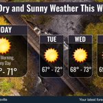
A slow weather week as rain will be limited with our current Weather pattern. High Pressure to our North around the Great Lakes keeps us Dry and Seasonal. Image via @nwslouisville

ON THIS DATE IN 2007:
We usually discuss “Second Severe Season” when it comes to Severe Weather events this time other year (October thru January) in the Lower OH Valley and this was one of the events that stuck out from others. An anomalously warm and moist airmass draped over the the Region where Moisture had dewpoints well into the 60°s along & West of I-65 as it mixed with a deep Positive Titled Midlevel Trof for this time of the year. Showers moved out in the morning as a warm front lifted East allowing KY/IN in the “open warm sector”for the afternoon. We destabilized fast and cells began to pop supercelluar in Western KY/IN by late Afternoon into early Evening.
Tornadoes occurred on both sides of the River where an EF-3 dropped in Clark Co, IN. More tornadoes occurred as an EF-3 struck near Owensboro, and several more touched down in Western KY such as Hopkins, Trigg, and Christian Co’s. The mixing of the fast upper level winds and thermodynamics were ripe by peak heating in this corridor allowing surface winds to “back” out of the Southeast.
Tornadoes occurred not just in the Warm Sector but also farther North toward the Upper Low in Michigan. The SPC draped a Moderate Risk with a 15# TOR threat. In all 35 reports of Tornadoes were accounted for with a total of 413 Severe Weather reports.
-Mike


COLD night on tap across the Commonwealth. The 1st Frost Advisory has been issued. Make sure you bring in your sensitive plants. We’re actually a little ahead of schedule for the 1st Frost; usually during the week of Halloween as we see temps near 36°. Crazy, we had 90s days ago!

As skies cleared late last night, Temperatures dropped into the 40°s for everyone. A PERFECT Fall Day is on tap as Surface High Pressure has built in to the region with an abundance of Sunshine, light breeze and dry conditions with temps cool in the 50°s.

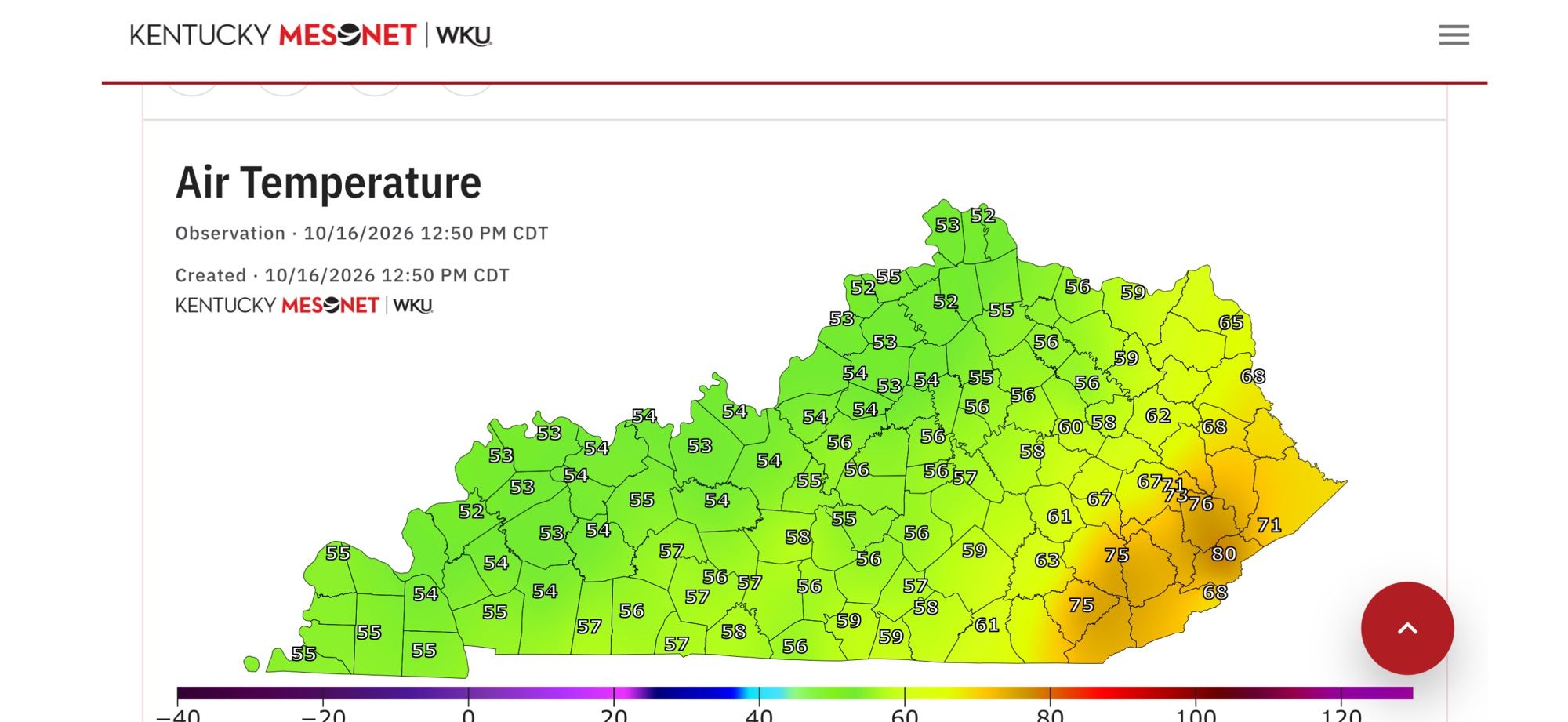
Many of you all are Pumpkin Spice lovers, so not a bad way to embrace the “cool change” to the Temperature swing we have experienced in the last 24hrs via @kymesonet. From near 90 to lower 50°s for a few currently.
Winds will taper off and skies clear late tonight in the 40°s!

1PM CDT-
FALL is finally in the Air… cool, breezy, cloudy and dreary. The Cold Front is pushing through the state and dropping Temperatures well into the 50°s. After a muggy and very warm Thursday, temperatures 24 hours later are almost 30° COLDER along & West of I-65.

FRIDAY:
A Cold Front is forecasted to slide into the Region by early Friday Morning. Light scattered showers will be accompanied with the cooler air but Temperatures will tank through the day. Mid-Upper 60s to start early in the morning but then low to mid-50s as you head home from work. Be Sure to grab that jacket out the door later in the day.
FALL WEATHER is here, especially for the weekend. Overnight Lows will drop into the 40s for Friday once skies clear out.
Bowling Green set a Record!
...RECORD HIGH TEMPERATURE SET AT BOWLING GREEN KY...
A RECORD HIGH TEMPERATURE OF 89 DEGREES WAS SET AT BOWLING GREEN KY TODAY. THIS BREAKS THE OLD RECORD OF 87 DEGREES SET IN 1897.
$$
KDW
Mesoscale Discussion has been issued for southeast Missouri...southern Illinois...southwest Indiana | Watch Prob: 20% | Tornado: UP TO 90 MPH | Wind Gust: UP TO 60 MPH.

Flood Warning for Larue, KY, Marion, KY, and Taylor, KY until 12:00 PM 10/15/26. Flooding of rivers, creeks, streams, and low-lying areas is imminent. Turn around, don’t drown when encountering flooded roads.

Flash Flood Warning for Marion County, KY until 11:45 AM EDT. Heavy rain has caused flash flooding; 0.5-1 inch more may fall. Flash flooding of small creeks, streams, and flooded roads is ongoing. Turn around, don’t drown.

Time Extended - Dense Fog Advisory for Hancock, Breckinridge, Meade +23 more | Visibility: 0.25 MI | Expires Thursday, 10/15/26 at 9 AM.

