

Part of @UtahDPS, we coordinate response to disasters and recovery to Keep Utah Safe. Social media support for local incidents. En español: @EmergenciasUtah
- Tweets8.8K
- Following2.5K
- Followers47.1K
- Likes7.7K


ALT Widespread heavy rainfall is expected to occur across the entirety of the forecast area starting Saturday afternoon/evening as Tropical Storm Rachel transitions to an extratropical system to our southwest and interacts with a strong midlevel trough. Widespread rainfall amounts from 1-2" are expected across much of the forecast area, with localized amounts potentially reaching 3+" across locations such as higher terrain locations across southwest Utah, the Book Cliffs, and locations within and adjacent to the Bear River Range.


ALT An NWS graphic titled "Wet Weather by Early Next Week." Background photography by Wasitt Hemwarapornchai depicts raindrops streaming across a glass panel.Key Forecast Messages:A strong Pacific Northwest storm system is expected to cross the area beginning late Saturday, with impacts to continue through early next week. There is increasing confidence that this system will tap into deep tropical moisture, bringing widespread rain and higher elevation snow to Utah and southwest Wyoming. Widespread precipitation brings a heightened threat of flash flooding to at least central and southern Utah. Those with outdoor plans this weekend should monitor future forecasts and make backup plans if able. Outlook Map Details: An inset map shows the Climate Prediction Center 6–10 Day Precipitation Outlook (October 11–15, 2026, updated 10/05/26), highlighting a 50%–60% probability of above-normal precipitation across Utah and surrounding Intermountain West states.


ALT Smiling couple sitting on a couch giving a high five, promoting awareness of local risks for safety.

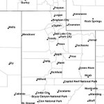
ALT Image showing the area of central and southern Utah included in a Flood Watch through Tuesday.

ALT This graphic displays a severe thunderstorm warning plotted on a map. The warning is in effect until 2:45 PM MDT. The warning includes Burmester UT. This warning is for East central Tooele County in northern Utah. The threats associated with this warning are wind gusts up to 60 MPH and quarter sized hail. There are 1,668 people in the warning along with 0 schools and 0 hospitals.


ALT a graphic that reads "After a wildfire, your flood risk increases." with a depiction of a home on a green hill, with flooding happening around the home due to heavy rain and a burned mountainside from a recent wildfire.


ALT Two people smiling near a camper with message about staying informed through FEMA app during emergencies.


ALT An information graphic from the National Weather Service Salt Lake City titled "Flood Watch" in effect Through Monday Evening. Locations Affected: The southern two-thirds of Utah including recent burn scars. Key Messages: Widespread heavy rainfall may result in flash flooding in normally dry washes, slickrock areas, recent burn scars, and other flood-prone locations. Flooding is also possible in poor drainage and urban areas. Map Details: A regional map highlights the "Flood Watch Hazard Area" in green across the southern two-thirds of Utah. Highlighted locations within the watch area include Provo, Duchesne, Price, Fillmore, Richfield, Beaver, Cedar City, Panguitch, Escalante, Kanab, St. George, Hanksville, and Moab. Impacts & Preparedness: Debris flows off recent burn scars Consider alternate recreation plans Never drive through flooded roadways Have multiple ways to receive warnings.