

Your source for Central Arkansas weather! Daily forecasts, weather updates! Watch the Central ARWX Weather Network on Roku!
Little Rock, AR
Joined May 2026
- Tweets824
- Following21
- Followers65
- Likes3


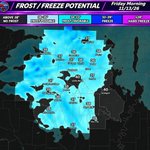


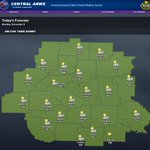


🥶❄️🌧️ FIRST WIDESPREAD FREEZE OF THE SEASON COMING! BUT WAIT... A MUCH MORE ACTIVE WEATHER PATTERN MAY BE DEVELOPING! 👀
CENTRAL ARWX STORM CENTER | MONDAY EVENING, NOVEMBER 9, 2026
Good evening, Central Arkansas!
We've got quite a bit to discuss in tonight's forecast! From a beautiful stretch of fall weather to our first widespread freeze of the season, and now increasing signs of a much more active weather pattern heading toward Thanksgiving!
AND THAT MAY NOT BE THE ONLY THING WE'RE WATCHING! 👀
Let's break it all down!
🌙 TONIGHT'S FORECAST — CLEAR & COOL!
We're expecting another quiet November night across Central Arkansas with mostly clear to partly cloudy skies and cool temperatures.
Most communities will drop into the lower and middle 40s, with some of our cooler valleys falling into the upper 30s.
🌡️ TONIGHT'S FORECAST LOWS:
🥶 Clinton: 40°
🥶 Russellville: 41°
🥶 Conway: 42°
🥶 Benton: 43°
🥶 Hot Springs: 45°
🥶 Little Rock: 45°
🥶 Pine Bluff: 43°
🥶 Searcy: 43°
🥶 Sheridan: 41°
🥶 Stuttgart: 47°
No widespread frost or freezing temperatures are expected tonight.
☀️ THE WEEK AHEAD — ENJOY THE WARMTH WHILE IT LASTS!
We're looking at another beautiful stretch of fall weather through midweek before a much stronger cold front changes things heading toward the weekend!
📅 YOUR CENTRAL ARWX 7-DAY FORECAST
🌤️ TUESDAY, NOVEMBER 10: Mostly cloudy to partly sunny skies with mild temperatures. High 71° | Low 53°.
🌤️ VETERANS DAY WEDNESDAY: Partly cloudy and warm! High 76° | Low 45°. A very slight 10% chance of an isolated shower.
☀️ THURSDAY: Sunny, breezy, and turning cooler behind our next cold front! High 64° | Low 35°.
🥶 FRIDAY: Turning noticeably colder! Sunshine continues, but afternoon highs struggle to reach the middle 50s. High 54° | Low 31°.
❄️ SATURDAY: A FREEZING START TO THE WEEKEND! Sunny skies with highs near 57° after a very cold morning. Overnight low near 34°.
☀️ SUNDAY: Partly cloudy with temperatures slowly recovering. High 59° | Low 39°.
🌤️ MONDAY: Partly cloudy and milder, with highs near 62° and lows around 40°.
🚨🥶 FIRST WIDESPREAD FREEZE OF THE SEASON EXPECTED FRIDAY NIGHT INTO SATURDAY MORNING!
THIS continues to be our biggest short-term weather story!
A strong cold front moving through Arkansas later this week will allow much colder air to settle across the region heading into Saturday morning.
Our latest temperature guidance continues to show widespread lower 30s, with several locations potentially falling BELOW FREEZING!
AND I STILL BELIEVE SOME OF THIS GUIDANCE MAY BE A TOUCH TOO WARM!
If skies clear and winds become light Friday night, temperatures could fall several degrees below current projections.
That could result in freezing temperatures becoming more widespread than the current forecast suggests.
🌱 NOW IS THE TIME TO START THINKING ABOUT PROTECTING SENSITIVE PLANTS!
A widespread frost is looking increasingly likely, and many communities may experience their first freeze of the fall season.
🦌 MODERN GUN DEER SEASON OPENING WEEKEND!
For our Arkansas deer hunters, opening morning Saturday could be COLD!
Temperatures near or below freezing are possible across much of Central Arkansas around sunrise.
The good news? We're currently expecting dry weather with plenty of sunshine throughout the day.
So grab those heavier jackets if you're heading into the woods early Saturday morning!
🌡️ BUT HERE'S SOMETHING IMPORTANT — THIS COLD SHOT LOOKS BRIEF!
While temperatures will drop significantly late this week, the cold air doesn't appear likely to stick around for an extended period.
We're expecting temperatures to gradually moderate Sunday into early next week.
And that temporary warmup could become important as our next weather systems begin to take shape!
🌧️ NOW LET'S TALK ABOUT SOMETHING WE DESPERATELY NEED... RAIN!
We've been discussing the ongoing drought across Arkansas for weeks, and unfortunately, the upcoming seven-day forecast doesn't offer much meaningful rainfall.
But beyond that?
THINGS ARE STARTING TO LOOK A LITTLE MORE INTERESTING! 👀🌧️
Our longer-range forecast guidance is beginning to show increasing opportunities for rainfall during the second half of November.
The latest Climate Prediction Center outlook also highlights portions of Central Arkansas with a Slight Risk of heavy precipitation during the November 16–22 period.
This doesn't guarantee a heavy rainfall event, but it's another indication that we may finally be moving toward a more active weather pattern.
🌧️ LATE NEXT WEEK — OUR NEXT POTENTIAL WEATHER MAKER!
Our extended forecast currently shows scattered shower chances returning around Thursday, November 19.
And we're continuing to monitor additional potential systems beyond that timeframe!
Could this finally bring some much-needed widespread rainfall to Arkansas?
IT'S POSSIBLE, BUT WE STILL HAVE SOME WORK TO DO BEFORE WE CAN GET EXCITED ABOUT SPECIFIC RAINFALL TOTALS!
The exact timing, track, and intensity of these systems remain uncertain.
🦃🥶 AND THEN THERE'S THANKSGIVING WEEK...
Here's where the longer-range forecast starts getting REALLY interesting!
Some guidance is beginning to suggest the possibility of ANOTHER SUBSTANTIAL SHOT OF COLD AIR as we approach Thanksgiving.
And depending on how the larger-scale weather pattern evolves, additional precipitation opportunities may also become possible.
COULD WE BE LOOKING AT AN EVEN BIGGER PATTERN CHANGE AS NOVEMBER COMES TO AN END?! 👀
It's simply too early to know.
We're not making any predictions about winter precipitation, severe weather, or specific Thanksgiving Day conditions at this distance.
But we ARE watching the developing pattern very closely!
📢 FREQUENT UPDATES THROUGHOUT THE WEEK!
With our first widespread freeze potential approaching and increasing signs of a more active extended forecast, we'll have frequent updates as newer guidance becomes available.
📺 WATCH THE ARWX 24/7 NETWORK!
Catch our detailed evening forecast, Futurecast radar, extended weather outlooks, and more on Roku, YouTube, the website, and the Central ARWX App!
📱 Don't forget to add Central ARWX to your phone using our PWA App for forecasts, radar, alerts, and the ARWX 24/7 Network wherever you go!
👇 LET'S HEAR FROM YOU, CENTRAL ARKANSAS!
🥶 Are you ready for our first widespread freeze?
🦌 Who's heading out for opening weekend of modern gun deer season?
🌧️ And how badly does your area need some meaningful rainfall?
Drop your county in the comments!
FROM OUR FIRST FREEZE TO A POTENTIALLY MUCH MORE ACTIVE WEATHER PATTERN, NOVEMBER IS ABOUT TO GET INTERESTING!
Stay tuned, Central Arkansas!
#CentralARWX #ArkansasWeather #FirstFreeze #ColdFront #ArkansasDrought #RainChances #ThanksgivingWeather #ModernGunSeason #Futurecast #CentralArkansas
~Lead Forecaster Derek


1
132
🚨🥶🌧️ **FIRST WIDESPREAD FREEZE, INCREASING RAIN CHANCES, AND A MUCH MORE ACTIVE WEATHER PATTERN?!** 👀🔥
**CENTRAL ARKANSAS, THINGS ARE ABOUT TO GET INTERESTING!**
We've got some BIG changes showing up in the forecast, and tonight we're breaking down EVERYTHING!
❄️🥶 **FIRST WIDESPREAD FREEZE OF THE SEASON?!**
A strong cold front arrives later this week, bringing the potential for freezing temperatures across much of Central Arkansas **SATURDAY MORNING, JUST IN TIME FOR THE OPENING OF MODERN GUN DEER SEASON!** 🦌
We're already seeing temperatures near or below freezing in the latest guidance, and I still believe some locations could end up COLDER than currently projected!
🌧️ **AND HERE COMES THE RAIN?!**
After another extended dry stretch, our latest ECMWF Futurecast is showing increasing opportunities for much-needed rainfall during the second half of November!
⛈️ **A MUCH MORE ACTIVE WEATHER PATTERN IS DEVELOPING!**
Could we finally be transitioning away from our prolonged quiet weather pattern? Multiple potential weather systems are beginning to show up in the extended guidance!
🦃🥶 **THANKSGIVING WEEK... VERY COLD AIR AND MAYBE MORE?!** 👀❄️
We're watching indications that another significant push of colder air could arrive around Thanksgiving week.
**AND THAT MAY NOT BE THE ONLY THING WE NEED TO WATCH!**
It's far too early to determine exactly how everything will unfold, but the longer-range guidance is becoming VERY interesting!
⚠️ Remember, these extended forecasts remain highly uncertain, and the timing, intensity, and precipitation types could change considerably.
📺🔥 **TONIGHT'S FORECAST IS ONE YOU DON'T WANT TO MISS!**
We're talking:
❄️ Our first widespread freeze potential Saturday morning!
🦌 Opening weekend of modern gun deer season!
🌧️ Increasing rainfall opportunities!
⛈️ A potentially much more active weather pattern!
🥶 Another possible surge of very cold air near Thanksgiving!
👀 **AND COULD THERE BE EVEN MORE DEVELOPING?!**
**TUNE IN TONIGHT FOR THE FULL BREAKDOWN!**
Watch the **ARWX 24/7 Network on Roku, YouTube, the website, and the app!**
**FROM FREEZING TEMPERATURES TO RAIN AND POSSIBLY MORE... NOVEMBER IS STARTING TO GET INTERESTING, CENTRAL ARKANSAS!** 🔥
#CentralARWX #ArkansasWeather #FirstFreeze #DeerSeason2026 #RainChances #PatternChange #ThanksgivingWeather #Futurecast #CentralArkansas
~Lead Forecaster Derek
🤖 Made with AI


41
🌧️🚨 COULD MUCH-NEEDED RAIN FINALLY BE HEADING BACK TO ARKANSAS?! CPC HIGHLIGHTS CENTRAL ARKANSAS! 👀
CENTRAL ARWX STORM CENTER | MONDAY, NOVEMBER 9, 2026
Well, Central Arkansas, THIS is something we’ve been waiting to see! 👀🌧️
After another extended stretch of dry weather, the Climate Prediction Center (CPC) is highlighting much of Central Arkansas in its latest Day 8–14 Heavy Precipitation Outlook!
And considering our ongoing drought concerns, this is certainly a development worth watching!
🌧️ WHAT DOES THE OUTLOOK SHOW?
The latest CPC outlook places much of our 22-county coverage area within a SLIGHT RISK for heavy precipitation during the November 16–22 timeframe.
That includes communities around:
📍 Little Rock and Benton
📍 Conway and Russellville
📍 Hot Springs and Arkadelphia
📍 Pine Bluff and Stuttgart
📍 Searcy and Heber Springs
The highlighted area indicates an increased potential for a heavy precipitation event during this period.
⚠️ BUT LET’S BE CLEAR ABOUT SOMETHING!
A Slight Risk does NOT mean heavy rainfall is guaranteed, nor does it mean rain will occur throughout the entire seven-day period.
This is a longer-range outlook highlighting the potential for a heavy precipitation event, not a forecast of specific rainfall totals or exact timing.
🌦️ WHY IS THIS IMPORTANT?
We’ve been discussing the possibility of a more active weather pattern developing as we approach Thanksgiving.
Our longer-range guidance has also been hinting at additional weather systems moving through the region during the second half of November.
Now, with CPC highlighting the potential for heavier precipitation, we have another reason to monitor this period closely!
🌧️ COULD THIS BRING DROUGHT RELIEF?
Potentially! Widespread beneficial rainfall would certainly be welcome across Arkansas.
However, whether this developing pattern produces meaningful drought improvement will depend on how much rain falls, where it falls, and whether multiple systems develop.
And remember, heavy rainfall over a short period isn’t always as beneficial as a more prolonged, steady soaking rain.
👀 WHAT WE’RE WATCHING NEXT
We’ll be monitoring:
🌧️ Whether precipitation chances continue increasing
⛈️ The strength and timing of potential weather systems
📅 Whether the more active pattern continues toward Thanksgiving
💧 The potential for meaningful drought relief
THIS IS NOT A GUARANTEE OF HEAVY RAIN, BUT IT’S DEFINITELY AN ENCOURAGING SIGNAL THAT OUR WEATHER PATTERN MAY FINALLY BE CHANGING!
📺 MORE COMING UP ON CENTRAL ARWX!
We’ll continue tracking the latest CPC outlooks, long-range Futurecast guidance, and potential rainfall opportunities throughout the week!
Watch the ARWX 24/7 Network on Roku, YouTube, the website, and the app!
📱 Add Central ARWX to your phone with our PWA App for forecasts, radar, alerts, and the ARWX 24/7 Network wherever you go!
👇 LET’S HEAR FROM YOU!
🌧️ How badly do you need rainfall in your area?
💧 Are your ponds, lakes, or creeks running low?
Drop your county in the comments!
#CentralARWX #ArkansasWeather #HeavyRainPotential #CPCOutlook #ArkansasDrought #RainfallOutlook #CentralArkansas #ThanksgivingWeather
~Lead Forecaster Derek

29
🦌🥶 **DEER HUNTERS, GET READY! A FREEZING START TO OPENING DAY OF MODERN GUN SEASON?!** ❄️🌲
**CENTRAL ARWX STORM CENTER | FIRST LOOK AT SATURDAY, NOVEMBER 14, 2026**
Calling all Arkansas deer hunters! 🦌
We've got our **FIRST LOOK at the opening day hunting forecast**, and Mother Nature may be delivering some PERFECT fall hunting weather just in time for modern gun season!
A strong cold front arriving late this week is expected to bring significantly colder temperatures across Arkansas, with the potential for our **FIRST WIDESPREAD FREEZE OF THE SEASON SATURDAY MORNING!**
🌅 **7 AM — OPENING MORNING**
🥶 Temperature: **32°F**
☀️ Conditions: Cold and sunny
💨 Northwest wind: 4 mph
**YOU'RE GOING TO WANT THOSE EXTRA LAYERS!**
Temperatures could be at or below freezing across much of Central Arkansas as hunters head into the woods.
Some rural areas, valleys, and sheltered locations may be even colder than our current forecast suggests!
☀️ **12 PM — LUNCHTIME**
🌡️ Temperature: **54°F**
☀️ Conditions: Sunny
💨 Northwest wind: 7 mph
By midday, temperatures should recover nicely into the 50s, making for a much more comfortable afternoon in the woods.
🌄 **4 PM — LATE AFTERNOON HUNT**
🌡️ Temperature: **59°F**
☀️ Conditions: Sunny
💨 Northwest wind: 5 mph
We're expecting a beautiful fall afternoon with comfortable temperatures, plenty of sunshine, and relatively light winds!
🦌 **OVERALL OPENING DAY OUTLOOK**
✅ Cold, potentially freezing morning temperatures
✅ Plenty of sunshine throughout the day
✅ Light northwest winds
✅ Dry conditions currently favored
✅ Afternoon temperatures warming into the upper 50s
❄️ **ONE IMPORTANT THING TO WATCH!**
I continue to believe our current temperature guidance may be running a touch too warm for Saturday morning.
If conditions favor strong overnight cooling, we could see temperatures falling below current projections in several locations.
That means Saturday's 32° forecast could still trend colder!
📢 **THIS IS ONLY OUR FIRST LOOK!**
We're still several days away from opening morning, and forecast details will continue to change.
**Central ARWX Storm Center will have frequent updates throughout the week**, including our latest temperature projections, wind conditions, and opening weekend hunting forecast!
📺 **WATCH THE ARWX 24/7 NETWORK** on Roku, YouTube, the website, and the app for the latest forecasts and weather updates!
👇 **ARKANSAS DEER HUNTERS, LET'S HEAR FROM YOU!**
🦌 Who's heading into the woods Saturday morning?
🌲 What county will you be hunting in?
🥶 And do you prefer those cold, frosty opening mornings or warmer weather?
**Good luck to all our Arkansas hunters this weekend! Stay safe, stay warm, and enjoy opening day!** 🦌🍂
#CentralARWX #ArkansasWeather #ArkansasDeerSeason #ModernGunSeason #OpeningDay #DeerHunting #HuntingForecast #FirstFreeze #CentralArkansas
~Lead Forecaster Derek

28
🥶❄️ FIRST WIDESPREAD FREEZE OF THE SEASON COMING SATURDAY MORNING?! I THINK WE MAY BE COLDER THAN THE MODELS ARE SHOWING! 🦌
CENTRAL ARWX STORM CENTER | MONDAY, NOVEMBER 9, 2026
Central Arkansas, we're continuing to closely monitor a significant shot of colder air expected to arrive late this week, and I'm becoming increasingly concerned about the potential for our FIRST WIDESPREAD FREEZE OF THE FALL SEASON!
And the timing? Just in time for the opening of modern gun deer season Saturday morning! 🦌🥶
🌡️ LATEST FUTURECAST — 6 AM SATURDAY, NOVEMBER 14
Our latest temperature guidance continues to show widespread lower to middle 30s across Central Arkansas, with several communities already projected to reach freezing!
❄️ SATURDAY MORNING FORECAST TEMPERATURES:
🥶 Beebe: 32°
🥶 Malvern: 32°
🥶 Arkadelphia: 32°
🥶 Fordyce: 32°
🥶 Greenbrier: 33°
🥶 Searcy: 33°
🥶 Vilonia: 33°
🥶 Lonoke: 33°
🥶 Sheridan: 33°
🥶 Benton: 34°
🥶 Conway: 34°
🥶 Russellville: 34°
🥶 Heber Springs: 34°
🥶 Pine Bluff: 35°
🥶 Hot Springs: 36°
🥶 Little Rock: 37°
🚨 HERE'S WHERE MY FORECAST THINKING DIFFERS FROM THE GUIDANCE!
I personally believe the current temperature guidance is running a TOUCH TOO WARM!
While our latest Futurecast shows many locations hovering between 32° and 36°, I believe there's a reasonable possibility that temperatures could end up several degrees colder than currently projected.
If skies clear, winds become light, and conditions favor strong overnight cooling, temperatures could fall below current model projections.
MY CURRENT THINKING? MOST OF CENTRAL ARKANSAS COULD EXPERIENCE ITS FIRST FREEZE OF THE SEASON SATURDAY MORNING! ❄️
That includes locations currently showing temperatures just above freezing.
Of course, we'll need to closely monitor how this system evolves throughout the week. Cloud cover, wind speeds, and the strength of the incoming cold air will all play important roles in determining just how cold we get.
🌱 WHAT DOES THIS MEAN FOR PLANTS AND VEGETATION?
With widespread frost looking increasingly possible and freezing temperatures potentially expanding across the region, now is a good time to begin making preparations.
Sensitive plants and remaining warm-season vegetation could be affected, especially if temperatures fall to or below 32° for an extended period.
🦌 OPENING MORNING OF MODERN GUN DEER SEASON!
For those planning to head into the woods early Saturday, prepare for a VERY chilly morning!
Depending on your location, temperatures could be near or below freezing around sunrise.
The good news? Current guidance favors dry weather for opening morning!
📢 FREQUENT UPDATES COMING THROUGHOUT THE WEEK!
We're going to be watching this VERY closely as newer forecast guidance becomes available.
Expect frequent updates from Central ARWX Storm Center throughout the week as we fine-tune:
❄️ How widespread freezing temperatures may become
🌡️ Just how cold Saturday morning could get
🥶 Locations most likely to experience their first freeze
🦌 The latest opening-weekend deer hunting forecast
I wouldn't be surprised to see those forecast temperatures trend colder as we get closer to Saturday!
📺 STAY CONNECTED WITH CENTRAL ARWX!
Watch the ARWX 24/7 Network on Roku, YouTube, the website, and the app!
We'll have additional details in our evening forecast, along with the latest look at our extended weather pattern and potential rainfall opportunities closer to Thanksgiving!
👇 LET'S HEAR FROM YOU!
🥶 Do you think we'll see our first widespread freeze Saturday morning?
🦌 Who's heading into the woods for opening weekend?
Drop your city or county below!
Stay tuned, Central Arkansas! We've got a lot to monitor this week!
#CentralARWX #ArkansasWeather #FirstFreeze #FreezePotential #FrostAdvisory #ColdFront #DeerSeason2026 #ModernGunSeason #CentralArkansas #Futurecast
~Lead Forecaster Derek

52
☀️🌫️ GOOD MORNING, CENTRAL ARKANSAS! A CHILLY, FOGGY START BUT A BEAUTIFUL MONDAY AHEAD! 🍂
CENTRAL ARWX STORM CENTER | Monday, November 9, 2026
Good morning, Central Arkansas! We're kicking off another workweek with some chilly temperatures and areas of morning fog, but don't let that fool you! Another beautiful fall afternoon is on the way!
🌡️ CURRENT CONDITIONS — 5:45 AM
Temperatures are generally sitting in the middle 30s to lower 40s across our coverage area this morning.
🥶 Little Rock: 39°
🥶 Benton: 38°
🥶 Conway: 41°
🥶 Hot Springs: 41°
🥶 Pine Bluff: 39°
🥶 Russellville: 41°
🥶 Searcy: 40°
🥶 Malvern: 36°
🥶 Beebe: 36°
🥶 Heber Springs: 44°
🌫️ WATCH FOR PATCHY MORNING FOG!
Areas of fog could reduce visibility during the morning commute, especially in valleys, low-lying areas, and near bodies of water.
Take it easy heading to work or school this morning!
☀️ TODAY'S FORECAST — FOG THEN SUNSHINE!
Once the morning fog burns off, we're expecting plenty of sunshine and another gorgeous November afternoon!
Temperatures will warm nicely into the upper 60s and lower 70s, with dry conditions expected throughout the region.
🌡️ TODAY'S FORECAST HIGHS:
☀️ Little Rock: 71°
☀️ Benton: 72°
☀️ Conway: 72°
☀️ Hot Springs: 72°
☀️ Pine Bluff: 72°
☀️ Russellville: 70°
☀️ Searcy: 71°
☀️ Heber Springs: 72°
☀️ Clinton: 72°
☀️ Arkadelphia: 72°
No significant rainfall or severe weather is expected today!
🍂🥶 LOOKING AHEAD — ENJOY THE WARMTH WHILE IT LASTS!
We're expecting more beautiful fall weather through the first half of the week, with temperatures potentially climbing into the middle and upper 70s by Wednesday!
BUT BIG CHANGES ARE STILL ON THE WAY! 👀
A stronger cold front is expected to arrive later this week, sending temperatures tumbling heading into the weekend!
❄️ Our latest guidance continues to suggest the potential for widespread frost and freezing temperatures Saturday morning, just in time for the opening weekend of modern gun deer season!
🌧️ And we're also watching some interesting long-range developments that could bring increasing rain opportunities closer to Thanksgiving.
We'll have a MUCH closer look at the cold front, freeze potential, and developing rainfall opportunities in tonight's full forecast!
📺 WATCH THE ARWX 24/7 NETWORK!
Catch our latest forecasts, radar, alerts, and weather updates on Roku, YouTube, the website, and the app!
Our full evening forecast will also be available on the Central ARWX Weather Network, YouTube, website, and app.
📱 Add Central ARWX to your phone with our PWA App to stay connected wherever you go!
👇 LET'S HEAR FROM YOU!
🌫️ Are you dealing with fog this morning?
☀️ Are you enjoying this beautiful fall weather, or are you ready for the colder temperatures this weekend?
Drop your city or county in the comments!
Have a fantastic Monday, Central Arkansas! ☀️🍂
#CentralARWX #ArkansasWeather #MondayForecast #MorningWeather #CentralArkansas #FallWeather #ColdFront #FreezePotential
~Lead Forecaster Derek


36
Who is ready for that first freeze? Well you better get ready! Derek has more in tonight's forecast! youtu.be/o_d2CjvRtxI #arwx
23
🚨🥶 BIG COLD BLAST AHEAD?! AND IS OUR NEXT WEATHER MAKER FINALLY SHOWING UP?! 🌧️👀
CENTRAL ARWX STORM CENTER | TONIGHT'S FORECAST TEASER
Central Arkansas, we're watching some BIG changes developing in the extended forecast, and tonight we've got plenty to talk about!
🥶 WIDESPREAD FROST & FREEZE POTENTIAL! Our latest guidance is showing temperatures potentially falling into the LOWER 30s across much of Central Arkansas next weekend! Could this be our first widespread freeze of the season?
❄️ A STRONGER COLD FRONT IS COMING! After another beautiful stretch of fall weather, temperatures look to take a significant tumble heading into the weekend!
🌧️ AND WAIT… IS THAT RAIN FINALLY SHOWING UP?! 👀
Our long-range Futurecast is beginning to hint at another weather system bringing rain back into Arkansas around November 21!
It's still nearly two weeks away, so confidence in the timing and rainfall amounts remains low. But it's certainly something worth watching!
🔥 TONIGHT'S BIG QUESTIONS:
Will freezing temperatures become widespread next weekend? How cold could we get? And could the longer-range pattern finally deliver another round of much-needed rainfall?
📺 WE'RE BREAKING IT ALL DOWN IN TONIGHT'S FULL FORECAST!
Watch the ARWX 24/7 Network on Roku, YouTube, the website, and the app!
👀 Don't miss this one, Central Arkansas! The extended forecast is getting INTERESTING!
#CentralARWX #ArkansasWeather #ColdBlast #FreezePotential #Futurecast #ArkansasRain #CentralArkansas #WeatherUpdate
~Lead Forecaster Derek


30
☀️🍂 GOOD MORNING, CENTRAL ARKANSAS! A BEAUTIFUL SUNDAY AHEAD!
CENTRAL ARWX STORM CENTER | Sunday, November 8, 2026
Good morning, everyone! We're waking up to a chilly start across Central Arkansas, but we've got a beautiful fall afternoon ahead!
🌡️ CURRENT CONDITIONS
Temperatures as of 8:45 AM are generally running in the middle to upper 40s across the region.
🥶 Little Rock: 45°
🥶 Pine Bluff: 45°
🥶 Conway: 47°
🥶 Benton: 48°
🥶 Hot Springs: 48°
🥶 Russellville: 47°
🥶 Searcy: 46°
☀️ TODAY'S FORECAST — MOSTLY SUNNY!
We're expecting plenty of sunshine throughout the afternoon, with just a few passing clouds across parts of Central Arkansas.
Afternoon highs will climb into the middle and upper 60s, making for a fantastic November Sunday!
🌡️ FORECAST HIGHS:
☀️ Little Rock: 68°
☀️ Benton: 69°
☀️ Conway: 67°
☀️ Hot Springs: 69°
☀️ Pine Bluff: 68°
☀️ Russellville: 66°
☀️ Clinton: 69°
☀️ Searcy: 66°
☀️ Mount Ida: 69°
No significant rainfall or severe weather is expected today!
📅 LOOKING AHEAD — BIG TEMPERATURE CHANGES COMING!
We're expecting another nice stretch of fall weather early this week, with afternoon highs returning to the lower and middle 70s.
However, we're keeping a close eye on a stronger cold front arriving late in the week!
🥶 Temperatures could fall considerably heading into next weekend, with increasing potential for widespread frost and even freezing temperatures in some locations.
🌧️ Unfortunately, widespread beneficial rainfall continues to look limited, meaning our ongoing drought remains a concern.
We'll have a MUCH more detailed breakdown of the upcoming cold front, frost potential, and extended outlook in this evening's forecast!
📺 WATCH THE CENTRAL ARWX WEATHER NETWORK 24/7!
Catch our latest forecasts, weather updates, radar, and more on Roku, YouTube, our website, and the Central ARWX App!
Our full evening forecast is available on the Central ARWX Weather Network, YouTube, the website, and the app.
📱 Don't forget to add Central ARWX to your phone with our PWA App for weather updates wherever you go!
Enjoy this beautiful Sunday, Central Arkansas! 🍂☀️
#CentralARWX #ArkansasWeather #SundayForecast #FallWeather #ColdFront #CentralArkansas
~Lead Forecaster Derek


43
🥶❄️ FROST ADVISORY TONIGHT! BUT AN EVEN BIGGER SHOT OF COLD AIR MAY BE ON THE WAY!
CENTRAL ARWX STORM CENTER | Saturday Evening, November 7, 2026
Good evening, Central Arkansas!
We've got several things to talk about in tonight's forecast, including our first significant frost concerns of the season, a beautiful stretch of fall weather, and a potentially MUCH STRONGER cold front heading our way next weekend!
And we're also keeping a close eye on the weather pattern developing as we approach Thanksgiving! 👀
Let's break it all down!
🌙🥶 TONIGHT'S FORECAST — COLD WITH PATCHY FROST!
Temperatures will tumble into the middle and upper 30s across much of Central Arkansas overnight, with partly cloudy to mostly clear skies.
A FROST ADVISORY goes into effect at MIDNIGHT for portions of northern and north-central Arkansas, including areas around Clinton, Heber Springs, Searcy, and Beebe.
Even outside the advisory area, some patchy frost cannot be ruled out, especially in rural communities and low-lying locations.
🌡️ TONIGHT'S FORECAST LOWS:
🥶 Mount Ida: 34°
🥶 Clinton: 35°
🥶 Sheridan: 35°
🥶 Lonoke: 36°
🥶 Pine Bluff: 36°
🥶 Arkadelphia: 36°
🥶 Benton: 37°
🥶 Searcy: 37°
🥶 Heber Springs: 37°
🥶 Conway: 38°
🥶 Russellville: 39°
🥶 Hot Springs: 39°
🥶 Little Rock: 39°
⚠️ IMPORTANT REMINDER: Frost can develop even when temperatures remain above freezing! If you've got sensitive plants outdoors, take precautions before heading to bed tonight.
☀️ ANOTHER BEAUTIFUL FALL WEEK AHEAD!
Once we get past our chilly Sunday morning, we're looking at another fantastic stretch of November weather!
Temperatures will gradually climb back into the 70s early in the week, with plenty of sunshine and limited rainfall opportunities.
Here's how things are shaping up:
☀️ Sunday: Partly cloudy and pleasant, near 68°.
☀️ Monday: Sunny and warmer, around 72°.
🌤️ Tuesday: Partly cloudy with highs near 74°.
🌦️ Veterans Day Wednesday: A slight chance of isolated showers, but most locations should remain dry. Highs near 75°.
☀️ Thursday: Sunshine returns as cooler air arrives, highs around 64°.
🥶 Friday: Sunny but noticeably cooler, highs near 57°.
❄️ Saturday: Even colder, with highs near 55° and overnight temperatures potentially dropping into the lower 30s!
🌧️ THE DROUGHT PROBLEM CONTINUES!
Unfortunately, we're not seeing much meaningful rainfall in the upcoming forecast.
Wednesday offers a slight opportunity for isolated showers, but widespread drought relief is not anticipated.
While we certainly needed last week's rainfall, it's going to take additional significant rainfall events to make lasting improvements.
And that brings us to our next big weather story!
🥶🚨 A MUCH STRONGER COLD FRONT NEXT WEEKEND?
We're watching increasing signals for another significant push of colder air arriving late next week into next weekend!
This could potentially be one of our colder air masses of the fall season so far.
Current guidance suggests:
❄️ Afternoon highs falling into the 50s.
🥶 Overnight temperatures approaching the lower 30s in some locations.
🌡️ Increasing potential for more widespread frost, with some locations possibly reaching freezing.
💨 Another noticeable change in temperatures behind the cold front.
BUT HERE'S THE CATCH!
Despite the stronger cold front, current guidance continues to favor relatively dry conditions.
That means another opportunity for colder temperatures without the beneficial widespread rainfall we desperately need.
We'll continue monitoring how strong this cold front becomes and whether freezing temperatures become more widespread.
👀🦃 WHAT ABOUT THE WEEK BEFORE THANKSGIVING?
Here's something we're beginning to watch a little more closely!
Some longer-range guidance is hinting at additional changes in the weather pattern during the latter part of November, particularly around the late-week/weekend period before Thanksgiving.
We're still too far out to determine exactly what this means for Arkansas, and confidence remains limited.
However, we'll be monitoring whether the pattern becomes more active, potentially bringing additional cold fronts or opportunities for precipitation.
Nothing significant is guaranteed at this point, but it's a period worth watching as we get closer!
📺 TONIGHT'S FORECAST — WATCH CENTRAL ARWX!
We've got much more in our full evening forecast, including a closer look at the latest Futurecast temperatures, the Frost Advisory, the seven-day outlook, and the potentially stronger cold air next weekend!
WATCH THE CENTRAL ARWX WEATHER NETWORK 24/7!
📺 Roku: Watch the Central ARWX Weather Network.
▶️ YouTube: Watch the Central ARWX Weather Network, including our latest forecasts.
🌐 Website: Stream the Central ARWX Weather Network and access forecasts, radar, and weather alerts.
📱 Central ARWX App: Take forecasts, radar, alerts, and our 24/7 Network wherever you go!
Our evening forecast airs at the top of every even hour on the 24/7 Network and is also available on YouTube, the website, and the app.
📱 Don't forget! Add Central ARWX to your phone using our PWA App!
👇 LET'S HEAR FROM YOU!
🥶 Are you ready for the colder temperatures?
❄️ Do you think we'll see our first widespread freeze next weekend?
🌧️ Or are you just ready for some more much-needed rainfall?
Drop your city or county in the comments!
Stay warm tonight, Central Arkansas! We'll continue tracking the colder weather and any significant changes in the extended forecast!
#CentralARWX #ArkansasWeather #FrostAdvisory #FrostPotential #ColdFront #CentralArkansas #FallWeather #WeatherForecast #Drought #ThanksgivingWeather
~Lead Forecaster Derek


1
82
here is an indepth look at the week ahead! youtu.be/4AhusYqLbe4 #arwx

1
23
🥶❄️ FROST ADVISORY ISSUED! CENTRAL ARKANSAS PREPARES FOR A CHILLY SUNDAY MORNING!
CENTRAL ARWX STORM CENTER | Saturday Evening, November 7, 2026
Well, Central Arkansas, the cold air is moving in, and we're getting closer to our first widespread frost potential of the season!
The National Weather Service has issued a FROST ADVISORY beginning at MIDNIGHT TONIGHT for portions of northern and north-central Arkansas, including areas near Heber Springs, Searcy, and Beebe!
While the advisory doesn't cover our entire 22-county region, frost remains possible in other locations, especially across rural communities and low-lying areas.
❄️ LATEST SUNDAY MORNING FUTURECAST — 6 AM
Our updated temperature guidance continues to show a chilly start to Sunday, with temperatures falling into the upper 30s and lower 40s.
🌡️ FORECAST TEMPERATURES:
🥶 Beebe: 36°
🥶 Greenbrier: 37°
🥶 Vilonia: 37°
🥶 Lonoke: 37°
🥶 Arkadelphia: 37°
🥶 Fordyce: 37°
🥶 Conway: 38°
🥶 Searcy: 38°
🥶 Malvern: 38°
🥶 Sheridan: 38°
🥶 Pine Bluff: 38°
🥶 Heber Springs: 39°
🥶 Benton: 39°
🥶 Hot Springs: 40°
🥶 Little Rock: 41°
🥶 Russellville: 41°
⚠️ FROST CAN DEVELOP ABOVE FREEZING!
Even with air temperatures between 35° and 40°, exposed surfaces can become cold enough for frost to develop, particularly when skies are clear and winds are light.
🌱 PROTECT THOSE SENSITIVE PLANTS TONIGHT!
If you have tender vegetation, flowers, or outdoor potted plants, consider bringing them inside or covering them before heading to bed.
A widespread freeze is not currently expected, but some sheltered locations could experience colder temperatures than those shown on our Futurecast map.
☀️ SUNDAY'S WEATHER LOOKS BEAUTIFUL!
After our chilly morning, we're expecting another nice November afternoon with plenty of sunshine and temperatures gradually warming into the upper 50s and lower 60s.
But we're not finished talking about cold weather just yet!
👀🥶 COULD EVEN COLDER AIR ARRIVE NEXT WEEKEND?
We're beginning to watch signals in the longer-range forecast guidance suggesting another push of colder air could arrive across Arkansas next weekend!
It's still early, and there's plenty of uncertainty regarding the timing and intensity of that potential cold air mass.
However, depending on how the pattern develops, we could be looking at another round of frost or even colder overnight temperatures.
We'll be taking a much closer look at that possibility in tonight's extended forecast!
📺 MORE COMING UP TONIGHT ON CENTRAL ARWX!
Tonight's forecast will feature:
❄️ The latest Frost Advisory and Sunday morning temperatures
🌡️ Our updated Futurecast and frost potential
☀️ The week-ahead forecast
🥶 The possibility of even colder air arriving next weekend
🌧️ Our next opportunities for rainfall as drought conditions continue
Watch the ARWX 24/7 Network on Roku, YouTube, the website, and the app!
Our evening forecast airs at the top of every even hour on the 24/7 Network and is also available on YouTube, the website, and the app.
📱 Add Central ARWX to your phone with our PWA App for forecasts, radar, alerts, and the ARWX 24/7 Network everywhere you go!
👇 LET'S HEAR FROM YOU!
🥶 What's the coldest temperature you've recorded at your house so far this fall?
❄️ Are you expecting frost tonight?
Let us know your city or county in the comments!
Stay warm, Central Arkansas! We'll have much more coming up in tonight's forecast!
#CentralARWX #ArkansasWeather #FrostAdvisory #FrostPotential #ColdFront #CentralArkansas #WeekendWeather #Futurecast
~Lead Forecaster Derek

75
🥶❄️ FROST POTENTIAL STILL ON THE TABLE, BUT THE LATEST FUTURECAST IS SHOWING SOME CHANGES!
CENTRAL ARWX STORM CENTER | Saturday, November 7, 2026
Well, Central Arkansas, we're getting closer to our coldest morning of the weekend, and we've got a NEW update to our frost potential!
Our latest Futurecast model for 7 AM Sunday morning, November 8, is now showing temperatures generally ranging from the upper 30s to lower 40s across our coverage area.
That's a little warmer than some of our previous model runs, but we're NOT completely ruling out frost just yet! 👀
🌡️ LATEST SUNDAY MORNING FUTURECAST TEMPERATURES
🥶 Malvern: 37°
🥶 Sheridan: 37°
🥶 Arkadelphia: 37°
🥶 Fordyce: 37°
🥶 Greenbrier: 38°
🥶 Vilonia: 38°
🥶 Beebe: 38°
🥶 Lonoke: 38°
🥶 Morrilton: 39°
🥶 Benton: 39°
🥶 Pine Bluff: 39°
🥶 Searcy: 39°
🥶 Little Rock: 40°
🥶 Hot Springs: 40°
🥶 Stuttgart: 40°
🥶 Russellville: 41°
🥶 Heber Springs: 41°
❄️ SO WHAT DOES THIS MEAN FOR FROST?
The latest guidance has backed off somewhat on the colder temperatures we were seeing earlier.
However, we're still monitoring the possibility of PATCHY FROST, particularly across southern and southwestern portions of our coverage area.
Locations around Malvern, Sheridan, Arkadelphia, and Fordyce could have some of the better opportunities for frost development.
⚠️ REMEMBER — FROST CAN DEVELOP ABOVE 32°!
Even with air temperatures in the middle and upper 30s, exposed surfaces can cool enough for frost to form, especially in rural communities and sheltered valleys.
🌱 SHOULD YOU PROTECT YOUR PLANTS?
If you have frost-sensitive plants outdoors, especially in colder rural locations, taking a few precautions tonight would still be a good idea.
A widespread freeze is NOT indicated by this latest guidance.
👀 WHAT WE'RE WATCHING TONIGHT
A few things could make a difference in how cold we get:
🌙 Clear skies allowing temperatures to fall more efficiently.
💨 Light or calm winds favoring additional cooling.
🌡️ Local temperature differences, particularly across valleys and rural areas.
Small changes in any of these factors could determine whether frost develops in your neighborhood.
☀️ WHAT ABOUT THE DAYS AHEAD?
The good news is that our overall weather pattern remains quiet!
We'll continue seeing plenty of sunshine and generally dry conditions, with afternoon temperatures gradually recovering into the upper 60s and lower 70s early next week.
Unfortunately, that also means limited opportunities for additional drought relief in the short term.
📺 MORE COMING UP IN OUR EVENING FORECAST!
We'll take another look at the latest temperature trends, frost potential, and our extended forecast.
Watch the ARWX 24/7 Network on Roku, YouTube, the website, and the app!
Our evening forecast airs at the top of every even hour on the 24/7 Network and is also available on YouTube, the website, and the app.
📱 Add Central ARWX to your phone with our PWA App to access forecasts, radar, alerts, and the ARWX 24/7 Network everywhere you go!
👇 LET'S HEAR FROM YOU!
🥶 What's the coldest temperature you've recorded at your house so far this fall?
❄️ Do you think we'll see frost at your location tomorrow morning?
Drop your city or county below!
We'll continue watching the latest guidance as our chilly Sunday morning approaches!
#CentralARWX #ArkansasWeather #FrostPotential #SundayForecast #CentralArkansas #ColdWeather #Futurecast #WeatherUpdate
~Lead Forecaster Derek

86
☀️🥶 GOOD MORNING, CENTRAL ARKANSAS! A COOL SATURDAY AHEAD, BUT AN EVEN COLDER NIGHT IS COMING!
CENTRAL ARWX STORM CENTER | Saturday, November 7, 2026
Happy Saturday, Central Arkansas!
We're waking up to a chilly November morning across the region, with temperatures in the 40s just about everywhere!
If you're heading out for some weekend activities, grab that jacket! We're looking at a beautiful fall day overall, but temperatures will be noticeably cooler than what we've experienced earlier this week.
🌡️ CURRENT CONDITIONS — 8:00 AM
Here's where temperatures are sitting across Central Arkansas this morning:
🌡️ Little Rock: 47°
🌡️ Conway: 47°
🌡️ Benton: 48°
🌡️ Hot Springs: 47°
🌡️ Pine Bluff: 48°
🌡️ Russellville: 47°
🌡️ Searcy: 47°
🌡️ Sheridan: 48°
🌡️ Heber Springs: 49°
Definitely some chilly weather to start the weekend!
☀️ TODAY'S FORECAST — PARTLY CLOUDY & COOL!
We're expecting a mixture of sunshine and clouds across Central Arkansas today, with dry conditions continuing throughout the region.
Afternoon temperatures will climb into the lower and middle 60s, making for a very pleasant but cooler November afternoon.
🌤️ TODAY'S FORECAST HIGHS:
☀️ Little Rock: 63°
☀️ Conway: 64°
☀️ Benton: 64°
☀️ Hot Springs: 64°
☀️ Pine Bluff: 63°
☀️ Russellville: 63°
☀️ Searcy: 61°
☀️ Sheridan: 63°
☀️ Arkadelphia: 65°
☀️ Mount Ida: 66°
✅ No widespread rain expected!
✅ No severe weather concerns!
✅ Great weather for outdoor activities!
Whether you're heading to a football game, spending time with family, or just enjoying your Saturday, the weather should cooperate!
🥶❄️ BUT HERE'S THE BIG STORY — FROST POTENTIAL TONIGHT!
We're continuing to watch the potential for frost developing across portions of Central Arkansas late tonight into EARLY SUNDAY MORNING!
With temperatures expected to fall into the 30s, some areas could see favorable conditions for frost, especially in rural communities and low-lying locations.
🌱 If you have sensitive plants outdoors, now is a good time to get them protected before temperatures drop tonight!
Remember, frost can develop even when the air temperature remains a few degrees above freezing.
👀 LOOKING AHEAD — WHAT'S NEXT?
Our extended forecast continues to favor a stretch of dry fall weather, with chilly mornings and gradually moderating afternoon temperatures as we head into next week.
The ongoing drought remains a concern, and we'll continue watching for our next meaningful opportunity for rainfall.
📺 MORE COMING UP IN TONIGHT'S FULL EVENING FORECAST!
We'll take a closer look at the latest Futurecast temperatures, Sunday morning frost potential, and what the upcoming week has in store!
WATCH THE ARWX 24/7 NETWORK!
📺 Roku
▶️ YouTube
🌐 Central ARWX Website
📱 Central ARWX App
Our evening forecast airs at the top of every even hour on the 24/7 Network and is also available on YouTube, the website, and the app.
📱 Add Central ARWX to your phone with our PWA App to access forecasts, radar, alerts, and the ARWX 24/7 Network everywhere you go!
👇 LET'S HEAR FROM YOU, CENTRAL ARKANSAS!
🥶 How chilly was it at your house this morning?
🏈 And who's enjoying some football today?
Drop your city or county below!
☀️ Have a fantastic Saturday, Central Arkansas! Stay warm and enjoy the beautiful fall weather!
#CentralARWX #ArkansasWeather #SaturdayForecast #CentralArkansas #FrostPotential #FallWeather #MorningForecast #WeatherUpdate
~Lead Forecaster Derek


1
57
🏈🌙 FRIDAY NIGHT LIGHTS ARE LOOKING FANTASTIC ACROSS CENTRAL ARKANSAS!
CENTRAL ARWX STORM CENTER | Friday, November 6, 2026
It's FRIDAY NIGHT FOOTBALL time, Central Arkansas! 🏈🔥
If you're heading out to support your favorite high school football team tonight, we've got some GREAT news!
Mother Nature is cooperating, and we're looking at nearly PERFECT football weather across the region!
Clear skies, light winds, and cool fall temperatures will make for a beautiful evening under the stadium lights!
🏈 FRIDAY NIGHT LIGHTS FORECAST
🌙 KICKOFF — 7 PM
Clear skies
🌡️ Temperature: 57°
💨 North winds around 5 MPH
🏈 HALFTIME — 8 PM
Clear skies
🌡️ Temperature: 55°
💨 North-northeast winds around 5 MPH
🏁 POSTGAME — 9 PM
Mostly clear skies
🌡️ Temperature: 53°
💨 North-northeast winds around 5 MPH
🧥 BRING THAT JACKET!
While conditions will be excellent for football, temperatures will gradually fall through the 50s as the evening progresses.
If you're sitting in the stands for a couple of hours, you'll definitely appreciate having a jacket or sweatshirt handy!
✅ No rain expected!
✅ No severe weather concerns!
✅ Light winds!
✅ Great weather for players, coaches, cheerleaders, bands, and fans!
🥶 LOOKING AHEAD TO THE WEEKEND!
Enjoy tonight's comfortable conditions because colder air continues settling into Arkansas this weekend!
Saturday will be noticeably cooler, with highs in the 50s, and we're still tracking the potential for FROST EARLY SUNDAY MORNING!
📺 STAY CONNECTED WITH CENTRAL ARWX!
Watch the ARWX 24/7 Network on Roku, YouTube, the website, and the app!
Our evening forecast airs at the top of every even hour on the 24/7 Network and is also available on YouTube, the website, and the app.
📱 Add Central ARWX to your phone with our PWA App for forecasts, radar, alerts, and the ARWX 24/7 Network everywhere you go!
👇 IT'S TIME TO SHOW SOME SCHOOL SPIRIT! 🏈🔥
WHO ARE YOU CHEERING FOR TONIGHT?
Drop your school, mascot, or team colors in the comments! Let's see which Central Arkansas communities are representing tonight!
Good luck to all our area teams, and have a SAFE and FUN Friday night under the lights!
#CentralARWX #FridayNightLights #ArkansasHighSchoolFootball #ArkansasWeather #FootballForecast #CentralArkansas #GameDayWeather
~Lead Forecaster Derek

63
🥶❄️ FROST POTENTIAL CONTINUES TO INCREASE! CENTRAL ARKANSAS, GET READY FOR A COLD SUNDAY MORNING!
CENTRAL ARWX STORM CENTER | Friday, November 6, 2026
We've been tracking this weekend's cold air for several days now, and our latest Futurecast model continues to show a growing potential for WIDESPREAD FROST ACROSS CENTRAL ARKANSAS EARLY SUNDAY MORNING! 👀🥶
After enjoying temperatures near 70° this afternoon, things are about to change in a BIG way!
A colder air mass will settle across the region this weekend, sending temperatures into the 30s by early Sunday morning.
❄️ SUNDAY MORNING FROST POTENTIAL — 6 AM
Our latest high-resolution Futurecast guidance is showing temperatures falling into the middle and upper 30s across much of our 22-county coverage area!
🌡️ PROJECTED TEMPERATURES:
❄️ Beebe: 34°
❄️ Arkadelphia: 34°
❄️ Vilonia: 35°
❄️ Lonoke: 35°
❄️ Malvern: 35°
❄️ Sheridan: 35°
❄️ Fordyce: 35°
❄️ Searcy: 36°
❄️ Greenbrier: 36°
❄️ Pine Bluff: 36°
❄️ Benton: 37°
❄️ Heber Springs: 37°
❄️ Stuttgart: 37°
❄️ Russellville: 38°
❄️ Little Rock: 39°
❄️ Hot Springs: 39°
⚠️ WHAT DOES THIS MEAN FOR OUR AREA?
The latest model guidance suggests that conditions could become favorable for patchy to potentially widespread frost Sunday morning.
The greatest concern will be across rural communities, sheltered valleys, and low-lying locations where temperatures may fall several degrees colder than nearby urban areas.
REMEMBER: Frost does NOT require air temperatures to reach 32°!
Frost can develop on exposed surfaces even when temperatures a few feet above the ground remain in the middle or upper 30s.
🌱 TIME TO PROTECT THOSE SENSITIVE PLANTS!
If you've still got flowers, gardens, or other frost-sensitive vegetation outdoors, now is the time to begin making preparations!
✅ Bring potted plants indoors when possible.
✅ Cover sensitive plants before temperatures fall Saturday night.
✅ Keep an eye on updated forecasts, especially if you live in rural or low-lying locations.
🥶 WHAT ABOUT A FREEZE?
At this time, our guidance favors frost rather than a widespread freeze across Central Arkansas.
However, isolated locations could approach freezing if skies remain clear, winds become calm, and temperatures fall more efficiently than currently projected.
We're also continuing to monitor the potential for another chilly morning early Monday.
☀️ THE GOOD NEWS?
We have a beautiful stretch of mostly sunny and dry fall weather ahead!
Saturday will be noticeably cooler, with afternoon highs generally in the 50s, followed by another cool day Sunday.
Temperatures should gradually recover early next week, with highs returning to the upper 60s and lower 70s.
📡 WE'RE WATCHING THIS CLOSELY!
We'll continue comparing the latest model runs and monitoring the potential for frost advisories as we approach the weekend.
Remember, these are Futurecast model projections, and actual temperatures will depend on cloud cover, wind speeds, and local conditions.
📺 MORE COMING UP IN OUR EVENING FORECAST!
We'll break down the weekend cold air, the frost threat, and what the extended forecast looks like heading into Veterans Day week!
Watch the ARWX 24/7 Network on Roku, YouTube, the website, and the app!
Our evening forecast airs at the top of every even hour on the 24/7 Network and is also available on YouTube, the website, and the app.
📱 Add Central ARWX to your phone with our PWA App to access forecasts, radar, alerts, and the ARWX 24/7 Network everywhere you go!
👇 LET'S HEAR FROM YOU!
🥶 Have you already experienced frost this fall, or will this potentially be your first frosty morning?
🌱 Are you planning to cover your plants this weekend?
Drop your city or county in the comments!
#CentralARWX #ArkansasWeather #FrostPotential #ColdWeather #SundayForecast #CentralArkansas #FallWeather #WeatherAware
~Lead Forecaster Derek

94
☀️🥶 GOOD MORNING, CENTRAL ARKANSAS! BEAUTIFUL FRIDAY AHEAD, BUT MUCH COLDER WEATHER IS ON THE WAY!
CENTRAL ARWX STORM CENTER | Friday, November 6, 2026
Happy Friday, Central Arkansas!
We're wrapping up the workweek with another BEAUTIFUL fall day across the region! Sunshine will dominate our forecast today, but we've got some chilly changes heading our way this weekend! 👀🥶
🌡️ CURRENT CONDITIONS — 5:45 AM
We're waking up to temperatures mainly in the upper 40s and lower to middle 50s across Central Arkansas.
🌡️ Little Rock: 55°
🌡️ Conway: 52°
🌡️ Benton: 54°
🌡️ Hot Springs: 54°
🌡️ Pine Bluff: 54°
🌡️ Russellville: 52°
🌡️ Searcy: 51°
🌡️ Sheridan: 54°
☀️ TODAY'S FORECAST — MOSTLY SUNNY!
If you've got outdoor plans today, the weather is looking FANTASTIC!
Expect plenty of sunshine, dry conditions, and comfortable afternoon temperatures in the middle 60s to lower 70s.
🌤️ FORECAST HIGHS:
☀️ Little Rock: 68°
☀️ Conway: 68°
☀️ Benton: 69°
☀️ Hot Springs: 70°
☀️ Pine Bluff: 68°
☀️ Russellville: 69°
☀️ Searcy: 67°
☀️ Sheridan: 69°
☀️ Mount Ida: 71°
No widespread rainfall or severe weather is expected today. Just a beautiful November Friday!
🥶❄️ WEEKEND OUTLOOK — HERE COMES THE COLD!
Our next big weather story will be the noticeably colder temperatures arriving this weekend!
Saturday afternoon highs could struggle to get out of the 50s, and temperatures are expected to fall into the 30s overnight.
⚠️ FROST IS BECOMING INCREASINGLY LIKELY SUNDAY MORNING!
Some locations could fall into the lower and middle 30s, especially in rural communities and sheltered valleys.
We're also watching the potential for additional frost Monday morning.
🌱 If you've still got sensitive plants outdoors, now is a good time to prepare!
Beyond the weekend, sunshine continues with temperatures gradually warming back into the upper 60s and lower 70s next week.
📺 MORE COMING UP IN TONIGHT'S FULL EVENING FORECAST!
We'll take a detailed look at the latest Futurecast temperatures, frost potential, our extended dry pattern, and the ongoing drought situation.
📡 WATCH THE ARWX 24/7 NETWORK!
Watch the ARWX 24/7 Network on Roku, YouTube, the website, and the app!
Our evening forecast airs at the top of every even hour on the 24/7 Network and is also available on YouTube, the website, and the app.
📱 Add Central ARWX to your phone with our PWA App to access forecasts, radar, alerts, and the ARWX 24/7 Network everywhere you go!
👇 LET'S HEAR FROM YOU!
What's the temperature at your house this morning, and are you ready for the colder weather this weekend? 🥶
☀️ Have a fantastic Friday, Central Arkansas!
#CentralARWX #ArkansasWeather #MorningForecast #FridayForecast #FrostPotential #FallWeather #CentralArkansas
~Lead Forecaster Derek


71
🥶❄️ HERE COMES THE COLD AIR, CENTRAL ARKANSAS! FROST LIKELY THIS WEEKEND AS TEMPERATURES TAKE A TUMBLE!
CENTRAL ARWX STORM CENTER | Thursday Evening, November 5, 2026
Good evening, Central Arkansas!
After another beautiful fall afternoon, we're getting ready for a BIG change in our temperatures heading into the weekend!
We've got plenty of sunshine in the forecast, but don't let that fool you. Some of our coldest temperatures of the season could be just around the corner!
And yes, FROST IS BECOMING INCREASINGLY LIKELY FOR PARTS OF CENTRAL ARKANSAS! 👀🥶
🌙 TONIGHT'S FORECAST — CLEAR & COOL!
We're looking at a quiet evening across Central Arkansas, with mostly clear skies, a few passing clouds, and temperatures gradually falling into the 40s.
🌡️ FORECAST LOWS:
• Little Rock: 50°
• Conway: 49°
• Benton: 47°
• Hot Springs: 49°
• Pine Bluff: 46°
• Russellville: 47°
• Clinton: 43°
• Sheridan: 44°
• Searcy: 50°
No widespread rainfall or severe weather is expected tonight!
☀️ FRIDAY — BEAUTIFUL, BUT COOLER!
Friday will bring another beautiful fall day with plenty of sunshine!
However, we'll definitely notice a difference in temperatures compared to earlier this week.
🌡️ High: 67°
🌙 Low: 42°
💨 Winds: NNE 5–10 MPH
Get outside and enjoy the sunshine, because even colder weather is coming!
🥶 SATURDAY & SUNDAY — OUR BIG WEATHER STORY!
A cooler air mass will settle across Arkansas this weekend, bringing afternoon highs down into the upper 50s and lower 60s!
📅 SATURDAY: Mostly sunny with a high near 57°.
📅 SUNDAY: Sunny with a high near 60°.
But the bigger concern will be what happens overnight Saturday into Sunday morning!
❄️ FROST POTENTIAL INCREASING — SUNDAY MORNING!
Our latest high-resolution Futurecast model is showing temperatures falling into the middle and upper 30s across much of Central Arkansas early Sunday morning.
🌡️ SUNDAY 6 AM FUTURECAST TEMPERATURES:
❄️ Sheridan: 34°
❄️ Arkadelphia: 34°
❄️ Lonoke: 35°
❄️ Beebe: 35°
❄️ Fordyce: 35°
❄️ Benton: 36°
❄️ Searcy: 36°
❄️ Pine Bluff: 36°
❄️ Morrilton: 37°
❄️ Heber Springs: 37°
❄️ Stuttgart: 37°
❄️ Little Rock: 38°
❄️ Russellville: 38°
⚠️ WHAT DOES THIS MEAN?
Conditions could become favorable for frost across a large portion of our coverage area, particularly in rural communities, sheltered valleys, and locations where temperatures fall into the lower and middle 30s.
Remember, frost can develop even when the air temperature remains above freezing!
🌱 IF YOU HAVE SENSITIVE PLANTS OUTDOORS, START PREPARING NOW!
While a widespread hard freeze is NOT currently indicated, some localized colder locations could approach the freezing mark.
Frost potential may also linger into Monday morning, especially in colder rural locations.
Actual frost development will depend on cloud cover, wind speeds, and how efficiently temperatures cool overnight.
☀️ LOOKING AHEAD — SUNSHINE RETURNS IN A BIG WAY!
Once we get beyond the chilly weekend, temperatures will gradually rebound!
📅 MONDAY: Sunny — 68° / 41°
📅 TUESDAY: Sunny — 71° / 43°
🇺🇸 VETERANS DAY WEDNESDAY: Sunny — 71° / 45°
📅 THURSDAY: Sunny — 69° / 43°
Our extended outlook remains overwhelmingly dry, with plenty of sunshine and temperatures eventually returning to the upper 60s and lower 70s.
🌧️ AND THAT BRINGS US BACK TO THE DROUGHT!
Unfortunately, while Tuesday's rainfall was certainly welcome, the extended dry forecast means drought recovery could remain slow.
We still need additional widespread rainfall events to make meaningful progress against our ongoing drought conditions.
We'll continue monitoring the pattern for our next opportunity for precipitation.
📺 WATCH THE ARWX 24/7 WEATHER NETWORK!
Want the full breakdown of the weekend cold air, frost potential, and our extended outlook?
Watch the ARWX 24/7 Network on Roku, YouTube, the website, and the app!
Our evening forecast airs at the top of every even hour on the 24/7 Network and is also available on YouTube, the website, and the app.
📱 TAKE CENTRAL ARWX EVERYWHERE!
Add Central ARWX to your phone with our PWA App to access forecasts, radar, weather alerts, and the ARWX 24/7 Network everywhere you go!
👇 LET'S HEAR FROM CENTRAL ARKANSAS!
🥶 Are you ready for our first widespre


74
🌧️🌱 SOME ENCOURAGING NEWS FOR CENTRAL ARKANSAS! COULD NOVEMBER FINALLY BRING SOME MUCH-NEEDED DROUGHT RELIEF?
CENTRAL ARWX STORM CENTER | Thursday, November 5, 2026
After months of dealing with dry conditions, worsening drought, and elevated wildfire danger, we're finally beginning to see some encouraging signals in the longer-range outlook!
The latest NOAA Climate Prediction Center (CPC) November precipitation and drought outlooks are showing the potential for improvement across Central Arkansas!
But there's a catch — we're going to need more than just one good rainfall event to get out of this drought!
🌧️ NOVEMBER PRECIPITATION OUTLOOK — ABOVE-NORMAL RAINFALL FAVORED!
The latest CPC monthly precipitation outlook places ALL 22 counties in our Central ARWX coverage area within an area favoring above-normal precipitation.
💧 The outlook indicates a 33–40% probability of above-normal precipitation across the region.
That's an encouraging signal, although it doesn't guarantee a wet month or specify how much rain we'll receive.
After Tuesday's widespread rainfall, this is certainly something we want to see as we look toward the remainder of November!
🌱 NOW LET'S TALK ABOUT THE DROUGHT!
The latest monthly drought outlook is also showing encouraging signs!
🟢 NORTHERN ARKANSAS: Portions of northern Central Arkansas, including areas around Clinton and near Heber Springs, are within a zone where drought removal is considered likely during November.
🌧️ CENTRAL AND SOUTHERN ARKANSAS: Areas including Little Rock, Conway, Benton, Hot Springs, Pine Bluff, and surrounding communities are generally expected to see drought conditions persist, but with some improvement.
⚠️ HERE'S THE IMPORTANT PART!
Even with the potential for above-normal rainfall this month, widespread drought elimination is NOT currently anticipated across most of our coverage area.
We still need additional rainfall events to replenish soil moisture and provide longer-lasting relief.
🔥 WHAT ABOUT WILDFIRE DANGER AND BURN BANS?
Tuesday's rainfall has already helped improve short-term wildfire conditions across portions of Arkansas, with several burn bans being lifted.
However, a few rainy days don't automatically eliminate the longer-term drought or wildfire concerns.
Additional rainfall over the coming weeks would certainly be welcome!
👀 SO WHAT ARE WE WATCHING NEXT?
Our focus now turns toward the next opportunities for meaningful rainfall during November.
While the short-term forecast features a stretch of generally dry weather and much colder temperatures this weekend, the monthly outlook provides some hope that additional precipitation opportunities may develop later in the month.
And with temperatures cooling as we head deeper into fall, we'll also be monitoring any changes in the larger weather pattern.
📺 MORE COMING UP IN OUR EVENING FORECAST!
We'll continue discussing the drought, our next rainfall opportunities, and the growing frost potential this weekend!
Watch the ARWX 24/7 Network on Roku, YouTube, the website, and the app!
Our evening forecast airs at the top of every even hour on the 24/7 Network and is also available on YouTube, the website, and the app.
📱 Add Central ARWX to your phone with our PWA App to access forecasts, radar, alerts, and the ARWX 24/7 Network everywhere you go!
👇 LET'S HEAR FROM YOU!
Did Tuesday's rainfall make a noticeable difference around your home, or is the ground still extremely dry where you live?
Drop your city or county below!
🌧️ Hopefully November can bring us the additional rainfall we desperately need!
#CentralARWX #ArkansasWeather #DroughtOutlook #RainfallOutlook #NovemberWeather #DroughtRelief #CentralArkansas #WeatherUpdate
~Lead Forecaster Derek


49