

Part of @ONS, we're producers of geographic info for use with statistics. Guidance: https://xitter.cf/t.co/TysUXMhQcf Contact us: https://xitter.cf/t.co/Pr55o2wxzg
Titchfield, Fareham
Joined December 2013
- Tweets2K
- Following148
- Followers7.3K
- Likes215



**NEW RELEASE**
Local Planning Authorities (January 2026) Boundaries for United Kingdom
Available from the Open Geography Portal geoportal.statistics.gov.uk/…

**NEW RELEASES**
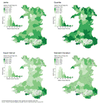
Rural Urban Classification Fire and Rescue Authorities for England and Wales
Rural Urban Classification Integrated Care Boards for England and Wales
Download from Open Geography Portal geoportal.statistics.gov.uk/…
**NEW RELEASES**
Rural Urban Classification International Territorial Levels 2 for England and Wales
Rural Urban Classification International Territorial Levels 3 for England and Wales
Download from Open Geography Portal:geoportal.statistics.gov.uk/…
**NEW RELEASES**
Rural Urban Classification Police Force Areas for England and Wales
Rural Urban Classification Senedd Constituencies for Wales
Available from Open Geography Portal geoportal.statistics.gov.uk/…
**NEW RELEASE**
ONS UPRN Directory (September 2026) (Epoch 128) UK
Download from the Open Geography portal:geoportal.statistics.gov.uk/…
**NEW RELEASE**
National Statistics UPRN Lookup (September 2026) (Epoch 128) UK
Download from the Open Geography portal: geoportal.statistics.gov.uk/…
**NEW RELEASE**
County Electoral Divisions (May 2026) Boundaries for England
Available from the Open Geography portal:geoportal.statistics.gov.uk/…
**NEW RELEASE**
National Statistics Postcode Lookup (August 2026) for the United Kingdom
Download from the Open Geography portal: geoportal.statistics.gov.uk/…
**NEW RELEASE**
ONS Postcode Directory (August 2026) for the United Kingdom
Download from the Open Geography portal: geoportal.statistics.gov.uk/…
**NEW RELEASE**
NHS Postcode Directory (August 2026) for the United Kingdom
Download from the Open Geography portal: geoportal.statistics.gov.uk/…
**NEW RELEASE**
National Statistics UPRN Lookup (June 2026) for the United Kingdom
Download from the Open Geography portal:geoportal.statistics.gov.uk/…
**NEW RELEASE**
Wards (May 2026) Boundaries for United Kingdom
Download from the Open Geography portal:geoportal.statistics.gov.uk/…
**NEW RELEASE**
Parishes and Non-Civil Parished Areas (May 2026) Boundaries for England and Wales
Download from the Open Geography portal: geoportal.statistics.gov.uk/…
**NEW RELEASE**
Cancer Alliances (April 2026) Boundaries for England
Download from the Open Geography portal:geoportal.statistics.gov.uk/…
**NEW RELEASES**
Code History Database (June 2026) for the UK
Register of Geographic Codes (June 2026) for the UK
Download from the Open Geography portal:geoportal.statistics.gov.uk/…
**NEW RELEASE**
National Statistics Postcode Lookup (May 2026) for the United Kingdom
Download from the Open Geography portal:geoportal.statistics.gov.uk/
**NEW RELEASE**
ONS Postcode Directory (May 2026) for the United Kingdom
Download from the Open Geography portal:geoportal.statistics.gov.uk/
**NEW RELEASE**
Countries (December 2025) boundaries for UK
Download from the Open Geography portal
geoportal.statistics.gov.uk/
**NEW RELEASE**
Counties and Unitary Authorities (December 2025) Boundaries for the United Kingdom. Download from the Open Geography portal - geoportal.statistics.gov.uk/…
**NEW RELEASES**
Scottish Parliamentary Constituencies (May 2026) Boundaries for Scotland
Scottish Parliamentary Regions (May 2026) Boundaries for for Scotland
Available to download from the Open Geography portal:geoportal.statistics.gov.uk/…