

📹 26,456 Live Shots TWC 1992-2024 FOX 2024- https://xitter.cf/t.co/QGdxFrqcyd https://xitter.cf/t.co/VzUH1f86uG
Atlanta, GA
Joined March 2009
- Tweets7.8K
- Following190
- Followers2.3M
- Likes1.7K






Pinned Tweet
25,000 LIVE SHOTS!
I've been lucky enough to cover weather in 46 states and 6 countries, including 94 hurricanes and tropical storms.
Thanks for watching along the way.....the adventure continues!
Mike Seidel retweeted

UPDATE: NC12 is still closed from Marc Basnight Bridge to Rodanthe, and about 800 feet of pavement has now been damaged by forces from the offshore nor'easter. Please stay safe. Avoid travel on NC12 on Pea Island. For travel updates, check DriveNC.gov.


This is Pea Island on Highway 12 around 5 PM. An hour later it closed due to overwash. Touch and go for the next couple of days with each high tide. The mandatory evacuation for visitors continues on Hatteras/Ocracoke Islands as all ferry service remains suspended.
@NCDOT_NC12
Another Nor'Easter is trying to wash over Highway 12, but the dune held during the Sun PM high tide. Meanwhile homes are threatened in Rodanthe, as Buxton, which lost 20 houses to the ocean, has a new super-wide beach. We're back live Monday from the Outer Banks on @foxweather
We've got you covered on @foxweather as Hurricane Isaias landfalls on the Gulf Coast Friday night. Plus, we're simulcasting on @FoxNews midnight Friday - 6 AM ET Saturday.


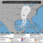
In its first advisory @NHC_Atlantic is forecasting the new Tropical Depression to intensify quickly into Tropical Storm.....and then HURRICANE Isaias by Thursday. First cone has it in the northern Gulf as a Cat. 2 Friday afternoon. The latest on @foxweather

The last high tide of concern has passed! The water is returning to where it should be, in the canals and bays around Freeport, NY.....and other spots along the South Shore of Long Island. We're live on @foxweather. – at Freeport, NY
The Nor'easter has moved to the Jersey Shore as weakening gets underway. What's left will get kicked out to the northeast later Monday. Coastal flood warnings end by 8 PM ET as the winds subside throughout the day. We're live on @foxweather & @FoxNews in the flood zone. – at Freeport, NY
Nor'Easter coverage continues on @foxweather & @FoxNews as coastal flooding, beach erosion, 50 MPH gusts and heavy rain continue into Sunday. – at Greenport, NY
A brilliant sunset over Long Island Sound as we go with extended coverage through the weekend of the Nor'Easter and Hurricane Nolo on @foxweather
Download the app and watch for free anywhere! – at Greenport, NY


Seconds before our 6 AM ET/midnight HT live shot, a wave got us as the storm surge from Hurricane Lowell crossed the beach, seawall, the road and 2 parking lots. That's what happens when you put your back at the ocean for even a few seconds! – at Koloa, HI
As Hurricane Lowell makes it's closest approach to Kauai @foxweather has live coverage starting with @thekatiebyrne at 10 PM HT/4 AM ET & I'll hit the air at midnight HT/6 AM ET. A Hurricane and High Surf Warnings are up along with a Flood Watch. – at Kekaha, HI
A tropical storm warning is up on Kauai as live coverage continues from Koloa on @foxweather & @FoxNews.
Hurricane Lowell makes it's closest approach Monday night and we'll show you the impacts.


Sunrise over Poipu Beach on Kauai as we watch Category 4 Hurricane Lowell make it's turn toward Hawaii. Plus, a morning swim with the 🐢.
Live coverage continues on @foxweather
Rainbow Falls is roaring following 15-20" of rain so far from Hurricane Lala. It's an 80' drop. Live coverage continues all night and through Sunday on @foxweather – at Hilo, HI
Tropical Storm Lala is looking healthier this afternoon as @NHC_Atlantic forecasts a minimal hurricane as it approaches on Sat. It would be only the 3rd landfalling #hurricane in Hawaii in 77 years!
(Dot/Iniki)
We're live on @foxweather from Hilo with @thekatiebyrne in Honolulu. – at Hilo, HI

Check out this storm that blew-up over southern Ocean County, NJ this afternoon and kept back building until sunset. Stafford Township 5.38" & Surf City 4.36" of rain! And that nasty smoke which will hang around through Fri. Air quality alerts all/parts of 20 states


Mike Seidel retweeted

Potential Tropical Cyclone #One Advisory 1 (10 AM CDT, Tue Jun 16): Very Heavy Rainfall and Dangerous Flash Flooding Expected from Potential Tropical Cyclone One. hurricanes.gov
Mike Seidel retweeted

Quick edit showing some of the intense moments today while documenting 8 tornadoes in northern Illinois into Indiana. Massive shoutout to @skydrama for nailing the forecast in the warm sector. Hands down the craziest tornado outbreak I've ever documented.
Full video will be released in the near future on the @thestormreel YouTube page.
#ilwx #inwx #tornado #outbreak