

Emlid makes RTK receivers Reach for survey and mapping. Reach comes with an app for iOS and Android for data collection. Tag @emlid to get featured.
Worldwide
Joined February 2014
- Tweets1.4K
- Following121
- Followers2.3K
- Likes1.4K



Different crews, different habits, different results?
Fyfe’s surveyors share the same projects, settings, and code libraries in Emlid, so every crew works to the same standard on every job.
Here’s how they built it: blog.emlid.com/customer-stor…

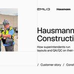
Not enough surveyors to go around? At Hausmann Construction, superintendents now handle their own layout, stakeout, and grade checks on site with Emlid.
Here's how they set it up: blog.emlid.com/customer-stor…

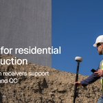
Check pads, grades, and utilities on every lot with the Emlid GNSS rover with no wait for a surveyor.
We explained how it works for each stage of a residential build: blog.emlid.com/GNSS-for-resi…

AR stakeout on the Reach RS4 Pro shows the point right on the ground under your pole. See how it works, from the engineer who built it: blog.emlid.com/ar-stakeout-r…

Emlid is heading to INTERGEO 2026 in Munich, Sept 15–17. Come by booth B6D053 to test the Reach RS4 Pro, catch live workflow demos, and hear CEO Igor Vereninov on the main stage.
Book a demo: share-eu1.hsforms.com/2FjLiF…


Not all utility data is created equal. ASCE 38 gives you four Quality Levels, from record research to physical exposure.
Here's how RTK GNSS fits into each one → blog.emlid.com/ASCE-38-x

If your utility as-built survey keeps getting kicked back, it’s likely a missing datum, late capture, or incomplete attributes.
Nail these four requirements and get the approval the first time: blog.emlid.com/utility-trenc…

Do you really need a base for your next project? Swipe to find the best correction source for your workflow. Emlid Corrections: urban & multi-site projects with internet access. Reach base: remote sites, even without internet. State CORS: Local, urban areas with internet coverage


Centimeter accuracy—right out of the box. Emlid Corrections is here: activate in Emlid Flow and get 1–2 cm in seconds. No base station, no NTRIP setup. Powered by @pointonenav network. First year free, for your current and future fleet. Check coverage emlid.com/corrections-x
A set of anchor bolts sat 6 inches off—caught before the pour, not after. All due to CORE Construction putting Reach receivers in superintendents' hands to check layouts themselves.
Read how: blog.emlid.com/core-construc…

Level the pole at every point, or lean it toward the target and keep walking. The Reach receivers with IMU tilt compensation make the second one just as accurate.
Explore how it works in the field: blog.emlid.com/imu-in-survey…

A layout point can move between the surveyor's visit and the next check. That gap is where rework hides.
Here's how Dellbrook closed it with Emlid Reach + Emlid Flow: blog.emlid.com/customer-stor…

Most earthworks overruns are preventable.
Our new guide shows how to keep the whole workflow on one data chain, from the first terrain survey to the final as-built, so cut/fill, grade checks, and QA stay connected: blog.emlid.com/earthworks-pl…

A European geophysics and geotechnical firm switched to Emlid Reach across 26 offices without losing its team.
Here's exactly how they did it, and how you can do it too: blog.emlid.com/switching-gns…

One rule for utility as-builts: collect everything before the trench closes.
Reach RS4 + Emlid Flow → points, attributes, and photos in a single project. Synced to the office automatically.
Get the full guide: blog.emlid.com/as-built-x

Three places construction teams lose money without noticing:
1. Rework from layout errors.
2. Crews and machines sitting idle waiting for a surveyor.
3. Quantities invoiced from estimates that get disputed.
We broke down how to fix this with GNSS tools: youtube.com/watch?v=Z8FyPJrj…
Patriot Environmental maps frack ponds with photogrammetry and bathymetry.
To get surface and subsurface in one survey, they use Reach receivers, a DJI drone with a sonar, and Starlink to connect both over NTRIP.
Swipe to see how it works.


See you at Hillhead 2026, UK! From June 23–25, come meet the Emlid team at Stand RD16.
Get hands-on with our latest RTK GNSS receivers with AR stakeout workflows. Book a real-life demo: meetings-eu1.hubspot.com/jno…

With Reach and Emlid Flow, anyone on your site can verify grades in real time. Walk your pad with a Reach rover, open the app, see cut/fill instantly. See how it works in real life → blog.emlid.com/cut-and-fill-…

GPR tells you what's underground; Emlid Reach tells you where exactly it is. Stream centimeter-level RTK data directly to your GPR cart for precise, excavation-ready CAD & GIS maps.
See how the workflow works: emlid.com/reach-for-gpr-x
